Phoenix to Winnipeg is 1,364 miles (2,196 km), a flight of about 3 hours 30 minutes.
The right side wins overall because while left has a slight edge at Phoenix departure, the right side captures the more dramatic and varied scenery along the full route — including the Colorado Plateau terrain in northern Arizona and southern Utah visible in the early cruise, and the superior Winnipeg arrival view of the Red River and city layout. On a long northbound flight, right also gives better views of the Rocky Mountain foothills as the route passes east of the Rockies over Montana and into the Canadian prairies.
Flight Path
The route tracks northeast from Phoenix, crossing the Navajo Nation and the Colorado Plateau with its canyon systems visible in northern Arizona. Over Utah and Colorado the route passes east of the Wasatch and Rocky Mountain ranges, with the high plains of Wyoming and Montana following. The Missouri River drainage basin crosses the mid-route. Southern Saskatchewan's flat wheat-belt prairie dominates the final hour before descending into the Red River Valley of Manitoba — one of the flattest landscapes on Earth, with the ancient lakebed of glacial Lake Agassiz forming the perfectly level terrain around Winnipeg.
Great circle distance and headings ›

.jpg?width=600)
.jpg?width=600)
Phase by phase
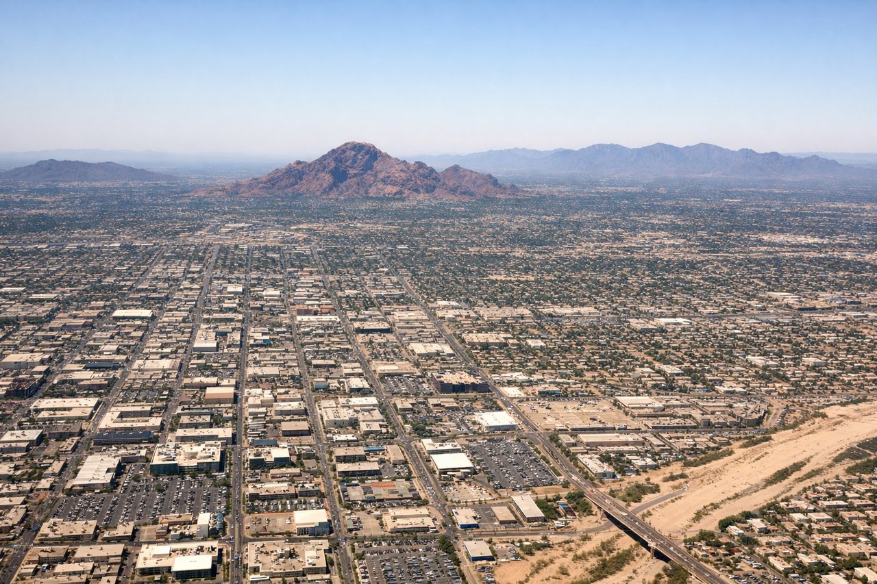
Takeoff from PHX
LEFTPHX primarily departs east on runway 26 or west on runway 8. Departing east (runway 26R/26L), a left/south-facing seat gives you the South Mountain Park massif and the Estrella Mountains as the aircraft climbs and turns north. Departing west, left side still captures the downtown Phoenix grid and the Salt River valley before the turn northward.
Landing at YWG
RIGHTWinnipeg International (YWG) predominantly lands on runway 36 (northbound) or runway 13/31. On the common runway 36 approach from the south, the right/east side gives a clear view of the Red River winding through the city and the downtown Winnipeg skyline including the distinctive Manitoba Legislative Building dome and the Forks historic site at the river confluence.
Landmarks on this routeAll landmarks →
Will your flight be in sunlight?
Pick a date and time in the Sun Map to watch the sun move across your whole flight.
About This Route
Which side of the plane should I sit on flying from Phoenix Sky Harbor International (PHX) to Winnipeg International (YWG)?
Sit on the Right side of the plane for the best views on flights from Phoenix to Winnipeg. The right side wins overall because while left has a slight edge at Phoenix departure, the right side captures the more dramatic and varied scenery along the full route — including the Colorado Plateau terrain in northern Arizona and southern Utah visible in the early cruise, and the superior Winnipeg arrival view of the Red River and city layout. On a long northbound flight, right also gives better views of the Rocky Mountain foothills as the route passes east of the Rockies over Montana and into the Canadian prairies.
What can I see during takeoff from Phoenix Sky Harbor International in Phoenix?
During takeoff from Phoenix Sky Harbor International (PHX), sit on the Left side for the best views. PHX primarily departs east on runway 26 or west on runway 8. Departing east (runway 26R/26L), a left/south-facing seat gives you the South Mountain Park massif and the Estrella Mountains as the aircraft climbs and turns north. Departing west, left side still captures the downtown Phoenix grid and the Salt River valley before the turn northward. Notable sights include: South Mountain Park (largest municipal park in the US, clearly visible as a dark rocky ridge), Estrella Mountains to the southwest, the Salt River bed running east-west below, downtown Phoenix grid with Chase Field visible.
What can I see when landing at Winnipeg International in Winnipeg?
When landing at Winnipeg International (YWG), sit on the Right side for the best views. Winnipeg International (YWG) predominantly lands on runway 36 (northbound) or runway 13/31. On the common runway 36 approach from the south, the right/east side gives a clear view of the Red River winding through the city and the downtown Winnipeg skyline including the distinctive Manitoba Legislative Building dome and the Forks historic site at the river confluence. Notable sights include: Red River snaking through central Winnipeg, the Forks (confluence of Red and Assiniboine Rivers), downtown Winnipeg skyline with the Manitoba Legislative Building, flat agricultural patchwork of the Red River Valley stretching to the horizon.
How long is the flight from Phoenix to Winnipeg?
The flight from Phoenix Sky Harbor International (PHX) to Winnipeg International (YWG) takes about 3 hours 30 minutes. The shortest flight path between them is 1,364 miles (2,196 km); winds and air traffic control usually add a few percent.
What does the Phoenix to Winnipeg flight path pass over?
The route tracks northeast from Phoenix, crossing the Navajo Nation and the Colorado Plateau with its canyon systems visible in northern Arizona. Over Utah and Colorado the route passes east of the Wasatch and Rocky Mountain ranges, with the high plains of Wyoming and Montana following. The Missouri River drainage basin crosses the mid-route. Southern Saskatchewan's flat wheat-belt prairie dominates the final hour before descending into the Red River Valley of Manitoba — one of the flattest landscapes on Earth, with the ancient lakebed of glacial Lake Agassiz forming the perfectly level terrain around Winnipeg.