Calgary to St. John's is 2,686 miles (4,323 km), a flight of about 4 hours 35 minutes.
The right side captures a brief but genuine glimpse of the Rocky Mountains during departure and, more significantly, the dramatic cliff-and-harbour approach into St. John's, while the left side offers only flat prairie and boreal forest for most of the flight.
Flight Path
Northern Ontario boreal forest and lake country, then the Gulf of St. Lawrence and western Newfoundland highlands as the route approaches the Avalon Peninsula
Great circle distance and headings ›Phase by phase
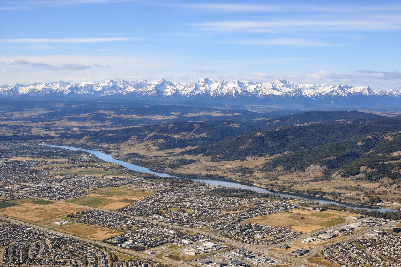
Takeoff from YYC
RIGHTDeparting YYC on runway 35 the aircraft climbs north then banks east toward the prairies; during that turn the Rocky Mountain front range and foothills west of Calgary swing into view on the right side before fading behind. The left side mostly shows the flat city grid and plains stretching north.
Landing at YYT
RIGHTOn approach into YYT from the west, the flight path crosses the barren, lake-dotted Avalon Peninsula highlands before descending toward the coast; the final turn onto runway 28 or 10 reveals the dramatic cliffs, Signal Hill, and the narrow harbour entrance to St. John's on the right side of the aircraft.
Will your flight be in sunlight?
Pick a date and time in the Sun Map to watch the sun move across your whole flight.
About This Route
Which side of the plane should I sit on flying from Calgary International (YYC) to St Johns International (YYT)?
Sit on the Right side of the plane for the best views on flights from Calgary to St. John's. The right side captures a brief but genuine glimpse of the Rocky Mountains during departure and, more significantly, the dramatic cliff-and-harbour approach into St. John's, while the left side offers only flat prairie and boreal forest for most of the flight.
What can I see during takeoff from Calgary International in Calgary?
During takeoff from Calgary International (YYC), sit on the Right side for the best views. Departing YYC on runway 35 the aircraft climbs north then banks east toward the prairies; during that turn the Rocky Mountain front range and foothills west of Calgary swing into view on the right side before fading behind. The left side mostly shows the flat city grid and plains stretching north. Notable sights include: Rocky Mountain front range, Bow River valley, Calgary foothills, Kananaskis peaks in the distance.
What can I see when landing at St Johns International in St. John's?
When landing at St Johns International (YYT), sit on the Right side for the best views. On approach into YYT from the west, the flight path crosses the barren, lake-dotted Avalon Peninsula highlands before descending toward the coast; the final turn onto runway 28 or 10 reveals the dramatic cliffs, Signal Hill, and the narrow harbour entrance to St. John's on the right side of the aircraft. Notable sights include: Signal Hill, The Narrows harbour entrance, Atlantic coastal cliffs, Avalon Peninsula barrens and lakes.
How long is the flight from Calgary to St. John's?
The flight from Calgary International (YYC) to St Johns International (YYT) takes about 4 hours 35 minutes. The shortest flight path between them is 2,686 miles (4,323 km); winds and air traffic control usually add a few percent.
What does the Calgary to St. John's flight path pass over?
Northern Ontario boreal forest and lake country, then the Gulf of St. Lawrence and western Newfoundland highlands as the route approaches the Avalon Peninsula