Charlottetown to Toronto is 825 miles (1,328 km), a flight of about 2 hours 20 minutes.
The left side captures the more distinctive coastal and urban scenery — PEI's shoreline and the Confederation Bridge at departure, and the Toronto skyline with Lake Ontario at arrival — while the right side offers mostly featureless inland terrain for both phases.
Flight Path
Cruise passes over the Gulf of Maine borderlands, New Brunswick's forested interior, and the St. Lawrence Lowlands of southern Quebec and eastern Ontario before descending toward the Great Lakes basin.
Great circle distance and headings ›.jpeg?width=600)

Phase by phase
Takeoff from YYG
LEFTDeparting YYG on runway 10, the aircraft climbs east over Hillsborough Bay before banking southwest toward Toronto, giving left-side passengers a good look at PEI's south shore, the Confederation Bridge, and the Northumberland Strait. The right side mostly shows open water and flat farmland with little definition.
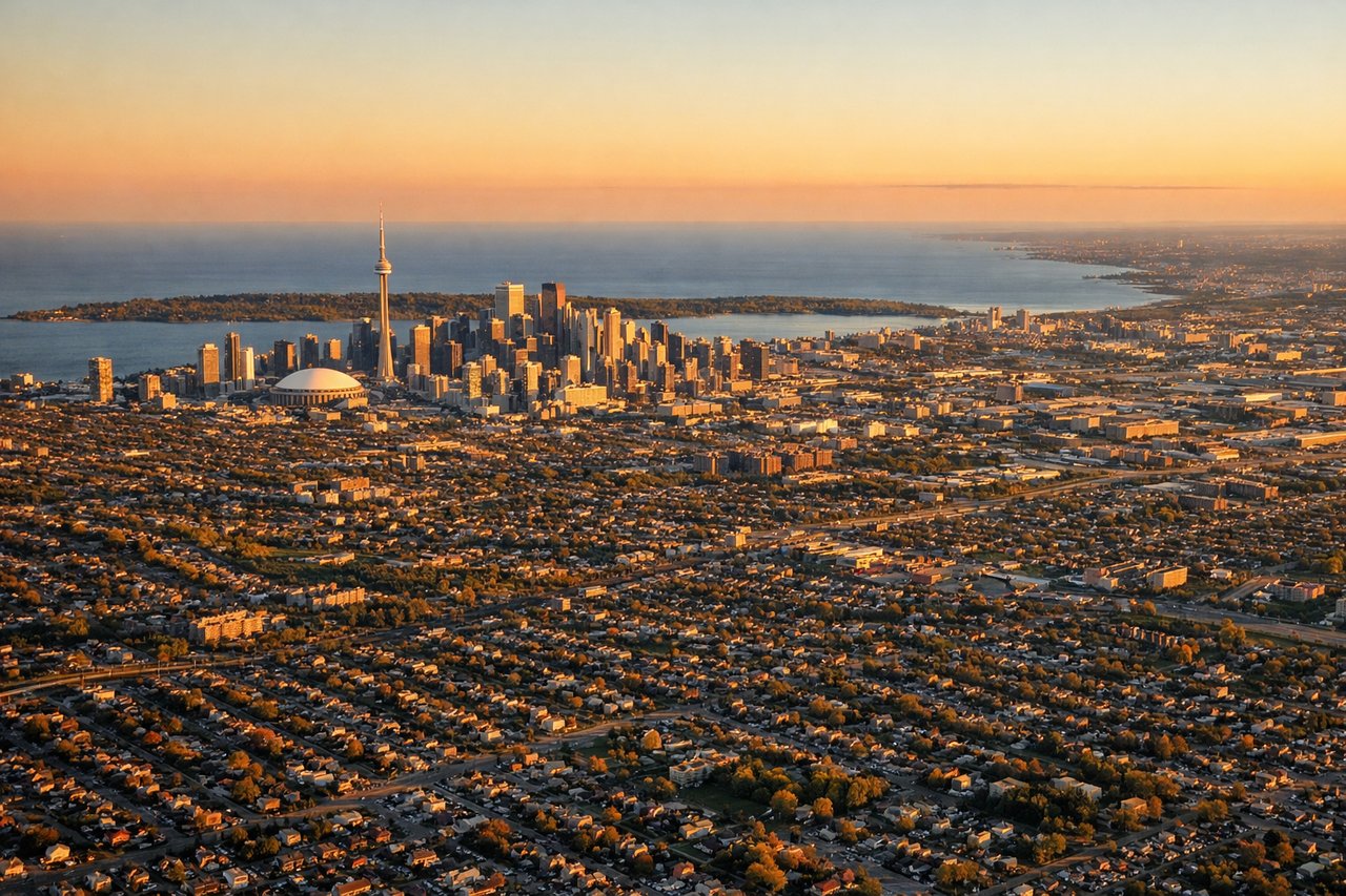
Landing at YYZ
LEFTArrivals into YYZ typically descend from the east and swing south over Lake Ontario before turning onto final for the 24 or 33 runways, putting the Toronto skyline and lakefront on the left side. The right side during this turn mostly faces inland suburban sprawl with fewer distinct features.
Landmarks on this routeAll landmarks →
Will your flight be in sunlight?
Pick a date and time in the Sun Map to watch the sun move across your whole flight.
About This Route
Which side of the plane should I sit on flying from Charlottetown (YYG) to Lester B Pearson International (YYZ)?
Sit on the Left side of the plane for the best views on flights from Charlottetown to Toronto. The left side captures the more distinctive coastal and urban scenery — PEI's shoreline and the Confederation Bridge at departure, and the Toronto skyline with Lake Ontario at arrival — while the right side offers mostly featureless inland terrain for both phases.
What can I see during takeoff from Charlottetown in Charlottetown?
During takeoff from Charlottetown (YYG), sit on the Left side for the best views. Departing YYG on runway 10, the aircraft climbs east over Hillsborough Bay before banking southwest toward Toronto, giving left-side passengers a good look at PEI's south shore, the Confederation Bridge, and the Northumberland Strait. The right side mostly shows open water and flat farmland with little definition. Notable sights include: Confederation Bridge, Hillsborough Bay, Northumberland Strait, Charlottetown Harbour.
What can I see when landing at Lester B Pearson International in Toronto?
When landing at Lester B Pearson International (YYZ), sit on the Left side for the best views. Arrivals into YYZ typically descend from the east and swing south over Lake Ontario before turning onto final for the 24 or 33 runways, putting the Toronto skyline and lakefront on the left side. The right side during this turn mostly faces inland suburban sprawl with fewer distinct features. Notable sights include: Lake Ontario shoreline, CN Tower and downtown Toronto skyline, Toronto Islands, Humber River mouth.
How long is the flight from Charlottetown to Toronto?
The flight from Charlottetown (YYG) to Lester B Pearson International (YYZ) takes about 2 hours 20 minutes. The shortest flight path between them is 825 miles (1,328 km); winds and air traffic control usually add a few percent.
What does the Charlottetown to Toronto flight path pass over?
Cruise passes over the Gulf of Maine borderlands, New Brunswick's forested interior, and the St. Lawrence Lowlands of southern Quebec and eastern Ontario before descending toward the Great Lakes basin.