Toronto to Charlottetown is 825 miles (1,328 km), a flight of about 1 hour 45 minutes.
The left side wins overall. While the right side has a slight edge at takeoff for Lake Ontario views, the left side captures the Gulf of St. Lawrence coastline of Quebec and New Brunswick as the flight tracks northeast, and delivers the superior landing view of Charlottetown Harbour and the Northumberland Strait.
Flight Path
The flight tracks northeast over the St. Lawrence River valley near Quebec City, then crosses into New Brunswick over the Appalachian highlands near Fredericton, before crossing the Northumberland Strait to PEI. The St. Lawrence is visible as a massive dark blue waterway, and the rolling forested hills of New Brunswick are prominent in the middle portion of the flight.
Great circle distance and headings ›
.jpeg?width=600)
Phase by phase
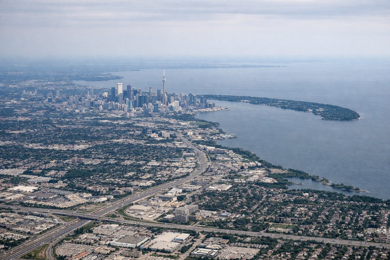
Takeoff from YYZ
RIGHTYYZ departures heading east typically use runways 05 or 06L/R, putting the right side facing north toward Lake Simcoe and the Oak Ridges Moraine. As the aircraft climbs and banks eastward, the right side gets a clear view of the Toronto urban grid and Lake Ontario's northern shore receding behind you.
Landing at YYG
LEFTCharlottetown Airport runway 10 is the primary arrival heading from the west, meaning the aircraft approaches from the west-southwest over the red-soiled farmland of PEI. The left side faces north toward Charlottetown Harbour and the Northumberland Strait, giving a clear view of the city, the Confederation Bridge in the far distance to the southwest, and the distinctive red clay coastline.
Landmarks on this routeAll landmarks →
Will your flight be in sunlight?
Pick a date and time in the Sun Map to watch the sun move across your whole flight.
About This Route
Which side of the plane should I sit on flying from Lester B Pearson International (YYZ) to Charlottetown (YYG)?
Sit on the Left side of the plane for the best views on flights from Toronto to Charlottetown. The left side wins overall. While the right side has a slight edge at takeoff for Lake Ontario views, the left side captures the Gulf of St. Lawrence coastline of Quebec and New Brunswick as the flight tracks northeast, and delivers the superior landing view of Charlottetown Harbour and the Northumberland Strait.
What can I see during takeoff from Lester B Pearson International in Toronto?
During takeoff from Lester B Pearson International (YYZ), sit on the Right side for the best views. YYZ departures heading east typically use runways 05 or 06L/R, putting the right side facing north toward Lake Simcoe and the Oak Ridges Moraine. As the aircraft climbs and banks eastward, the right side gets a clear view of the Toronto urban grid and Lake Ontario's northern shore receding behind you. Notable sights include: Lake Ontario shoreline, Toronto downtown skyline, Lake Simcoe to the north, Oak Ridges Moraine.
What can I see when landing at Charlottetown in Charlottetown?
When landing at Charlottetown (YYG), sit on the Left side for the best views. Charlottetown Airport runway 10 is the primary arrival heading from the west, meaning the aircraft approaches from the west-southwest over the red-soiled farmland of PEI. The left side faces north toward Charlottetown Harbour and the Northumberland Strait, giving a clear view of the city, the Confederation Bridge in the far distance to the southwest, and the distinctive red clay coastline. Notable sights include: Charlottetown Harbour, Northumberland Strait, PEI red clay farmland, Confederation Bridge (distant, southwest).
How long is the flight from Toronto to Charlottetown?
The flight from Lester B Pearson International (YYZ) to Charlottetown (YYG) takes about 1 hour 45 minutes. The shortest flight path between them is 825 miles (1,328 km); winds and air traffic control usually add a few percent.
What does the Toronto to Charlottetown flight path pass over?
The flight tracks northeast over the St. Lawrence River valley near Quebec City, then crosses into New Brunswick over the Appalachian highlands near Fredericton, before crossing the Northumberland Strait to PEI. The St. Lawrence is visible as a massive dark blue waterway, and the rolling forested hills of New Brunswick are prominent in the middle portion of the flight.