Both sides score equally low (1.5) because this 7-hour flight crosses monotonous terrain for the majority of the journey. The YYZ departure offers brief urban and water scenery (Lake Ontario, Toronto skyline), while the AKX arrival shows only flat steppe and a modest river valley. The cruise phase over central Canada and the western steppe dominates the flight and is uniformly flat and featureless from both sides. Left wins marginally because the Toronto takeoff provides more visual interest than the Aktyubinsk landing.
Flown YYZ to AKX? Did we get it right?
Flight Path
Toronto to Aktyubinsk is 5,447 miles (8,766 km), a flight of about 10 hours 40 minutes.
The flight path crosses the Canadian Shield (rocky, forested terrain with lakes), the Canadian prairies (flat grassland), and eventually the western steppe of Kazakhstan. Notable geographic features along the route include: the Great Lakes region (visible during early climb), the Canadian Shield's lake-dotted landscape (first 2 hours), the flat prairie provinces of Manitoba and Saskatchewan (hours 2-4), the Rocky Mountains far to the south (not on direct route), and the vast Kazakh steppe (hours 5-7). No dramatic mountains, coastlines, or major rivers cross the direct flight path. The terrain is predominantly flat to gently rolling throughout the cruise phase.
Great circle distance and headings ›

Phase by phase
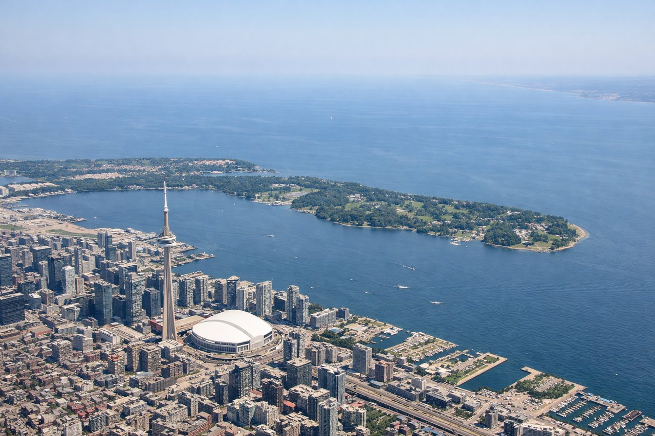
Takeoff from YYZ
LEFTToronto's urban sprawl and Lake Ontario shoreline are visible on the left (north) side during northeast-runway departures. The right side shows suburban development and inland terrain with no water features.
Landing at AKX
RIGHTAktyubinsk sits on the Ilek River in flat steppe terrain. The right (south) side during approach offers views of the river valley and the city itself. The left side shows undifferentiated steppe grassland with minimal visual interest.
Will your flight be in sunlight?
Pick a date and time in the Sun Map to watch the sun move across your whole flight.
About This Route
Which side of the plane should I sit on flying from Lester B Pearson International (YYZ) to Aktyubinsk (AKX)?
Sit on the Left side of the plane for the best views on flights from Toronto to Aktyubinsk. Both sides score equally low (1.5) because this 7-hour flight crosses monotonous terrain for the majority of the journey. The YYZ departure offers brief urban and water scenery (Lake Ontario, Toronto skyline), while the AKX arrival shows only flat steppe and a modest river valley. The cruise phase over central Canada and the western steppe dominates the flight and is uniformly flat and featureless from both sides. Left wins marginally because the Toronto takeoff provides more visual interest than the Aktyubinsk landing.
What can I see during takeoff from Lester B Pearson International in Toronto?
During takeoff from Lester B Pearson International (YYZ), sit on the Left side for the best views. Toronto's urban sprawl and Lake Ontario shoreline are visible on the left (north) side during northeast-runway departures. The right side shows suburban development and inland terrain with no water features. Notable sights include: Lake Ontario northern shoreline, Toronto downtown core skyline, Scarborough Bluffs (if visible during climb), Greater Toronto Area sprawl.
What can I see when landing at Aktyubinsk in Aktyubinsk?
When landing at Aktyubinsk (AKX), sit on the Right side for the best views. Aktyubinsk sits on the Ilek River in flat steppe terrain. The right (south) side during approach offers views of the river valley and the city itself. The left side shows undifferentiated steppe grassland with minimal visual interest. Notable sights include: Ilek River valley, Aktyubinsk city grid, surrounding steppe grassland, industrial areas on city outskirts.
How long is the flight from Toronto to Aktyubinsk?
The flight from Lester B Pearson International (YYZ) to Aktyubinsk (AKX) takes about 10 hours 40 minutes. The shortest flight path between them is 5,447 miles (8,766 km); winds and air traffic control usually add a few percent.
What does the Toronto to Aktyubinsk flight path pass over?
The flight path crosses the Canadian Shield (rocky, forested terrain with lakes), the Canadian prairies (flat grassland), and eventually the western steppe of Kazakhstan. Notable geographic features along the route include: the Great Lakes region (visible during early climb), the Canadian Shield's lake-dotted landscape (first 2 hours), the flat prairie provinces of Manitoba and Saskatchewan (hours 2-4), the Rocky Mountains far to the south (not on direct route), and the vast Kazakh steppe (hours 5-7). No dramatic mountains, coastlines, or major rivers cross the direct flight path. The terrain is predominantly flat to gently rolling throughout the cruise phase.