While takeoff favors the left for Lake Ontario views, the landing approach on the right side over Berlin's river system and lakes provides more visually distinctive urban and water features. The right side captures Berlin's defining geographical character during descent, making it the stronger choice for the full journey.
Flown YYZ to BER? Did we get it right?
Flight Path
Toronto to Berlin is 4,041 miles (6,503 km), a flight of about 7 hours 20 minutes.
The flight crosses the Atlantic Ocean with no visible landmarks for approximately 4 hours. Over the eastern Atlantic (west of Ireland), the ocean surface and occasional cloud formations dominate. As the aircraft approaches European airspace, the Irish coast becomes visible around the 5-hour mark, followed by the United Kingdom landmass. The flight path typically crosses Wales or southern England, where the Welsh mountains (Snowdonia) and English Midlands are visible. Crossing into continental Europe, the North Sea and Dutch/German coastline appear, followed by the flat North German Plain leading to Berlin.
Great circle distance and headings ›

Phase by phase
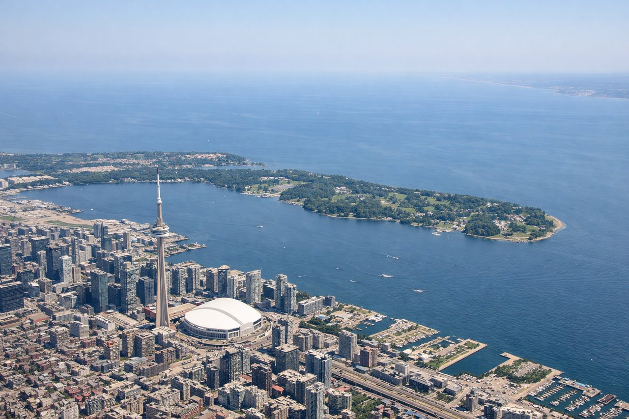
Takeoff from YYZ
LEFTLeft side offers views of Lake Ontario immediately after departure, with the Toronto waterfront and downtown skyline visible during climb-out. Right side faces inland toward the Greater Toronto Area sprawl with fewer distinctive landmarks.

Landing at BER
RIGHTRight side provides views of the Spree River winding through Berlin's city center and the distinctive lakes (Müggelsee, Tegeler See) that ring the metropolitan area during descent. Left side faces toward the industrial outskirts and Brandenburg countryside with fewer urban landmarks.
Will your flight be in sunlight?
Pick a date and time in the Sun Map to watch the sun move across your whole flight.
About This Route
Which side of the plane should I sit on flying from Lester B Pearson International (YYZ) to Berlin Brandenburg (BER)?
Sit on the Right side of the plane for the best views on flights from Toronto to Berlin. While takeoff favors the left for Lake Ontario views, the landing approach on the right side over Berlin's river system and lakes provides more visually distinctive urban and water features. The right side captures Berlin's defining geographical character during descent, making it the stronger choice for the full journey.
What can I see during takeoff from Lester B Pearson International in Toronto?
During takeoff from Lester B Pearson International (YYZ), sit on the Left side for the best views. Left side offers views of Lake Ontario immediately after departure, with the Toronto waterfront and downtown skyline visible during climb-out. Right side faces inland toward the Greater Toronto Area sprawl with fewer distinctive landmarks. Notable sights include: Lake Ontario, Toronto Islands, Scarborough Bluffs, downtown Toronto skyline.
What can I see when landing at Berlin Brandenburg in Berlin?
When landing at Berlin Brandenburg (BER), sit on the Right side for the best views. Right side provides views of the Spree River winding through Berlin's city center and the distinctive lakes (Müggelsee, Tegeler See) that ring the metropolitan area during descent. Left side faces toward the industrial outskirts and Brandenburg countryside with fewer urban landmarks. Notable sights include: Spree River through Berlin center, Müggelsee lake, Tegeler See, Berlin's urban grid and Tiergarten park.
How long is the flight from Toronto to Berlin?
The flight from Lester B Pearson International (YYZ) to Berlin Brandenburg (BER) takes about 7 hours 20 minutes. The shortest flight path between them is 4,041 miles (6,503 km); winds and air traffic control usually add a few percent.
What does the Toronto to Berlin flight path pass over?
The flight crosses the Atlantic Ocean with no visible landmarks for approximately 4 hours. Over the eastern Atlantic (west of Ireland), the ocean surface and occasional cloud formations dominate. As the aircraft approaches European airspace, the Irish coast becomes visible around the 5-hour mark, followed by the United Kingdom landmass. The flight path typically crosses Wales or southern England, where the Welsh mountains (Snowdonia) and English Midlands are visible. Crossing into continental Europe, the North Sea and Dutch/German coastline appear, followed by the flat North German Plain leading to Berlin.