While takeoff offers Lake Ontario views, the landing approach provides more sustained and dramatic scenery—the Meuse River valley, Belgian countryside, and Brussels itself are visually richer than the Toronto departure. Left-side seats capture the best of the approach sequence.
Flown YYZ to BRU? Did we get it right?
Flight Path
Toronto to Brussels is 3,756 miles (6,044 km), a flight of about 7 hours 15 minutes.
The flight path crosses the Atlantic Ocean for roughly 4.5 hours with no visible landmarks. Over the Atlantic, you may see the southern tip of Greenland (distant, far north) if flying a northern great-circle route, but this is not guaranteed. Upon approaching Europe, the flight passes over the Irish coast (County Cork or County Waterford area), then over the Irish Sea and Wales, then England, the English Channel, and finally descends over northern France and Belgium. The most notable mid-flight geographic feature is the Irish coastline (if visible during daylight), appearing as a jagged, rocky shoreline with green inland terrain. The English Channel crossing offers views of the English coast and French coast as distinct landmasses. The descent into Brussels crosses the flat agricultural plains of northern France and Belgium—no mountains, but the geometric field patterns and river valleys become increasingly detailed as altitude decreases.
Great circle distance and headings ›Phase by phase
Takeoff from YYZ
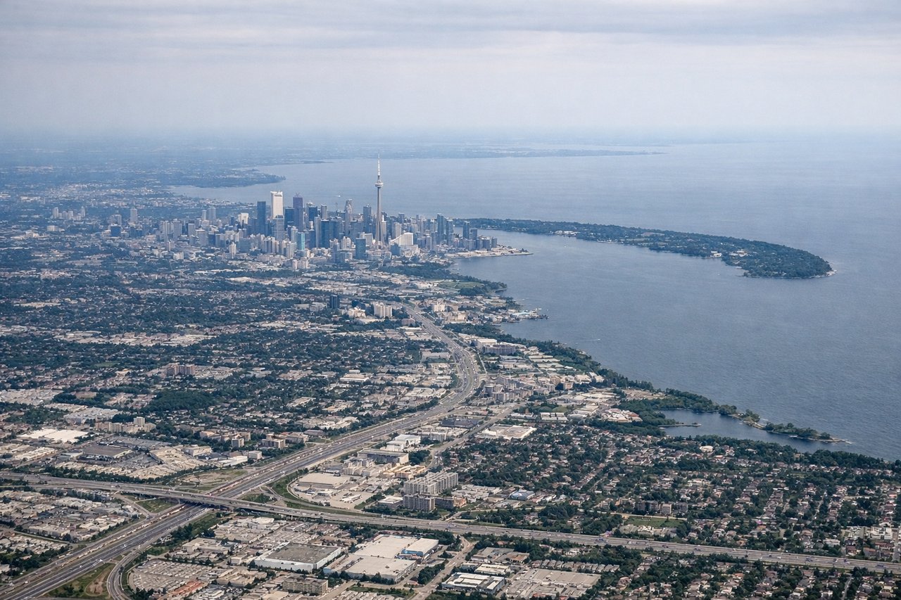
RIGHTRight-side seats offer views of Lake Ontario immediately after departure, with the Toronto waterfront and downtown skyline visible during initial climb. The aircraft typically departs westbound or northwestbound, making the right side the scenic choice for the first 10-15 minutes.
Landing at BRU
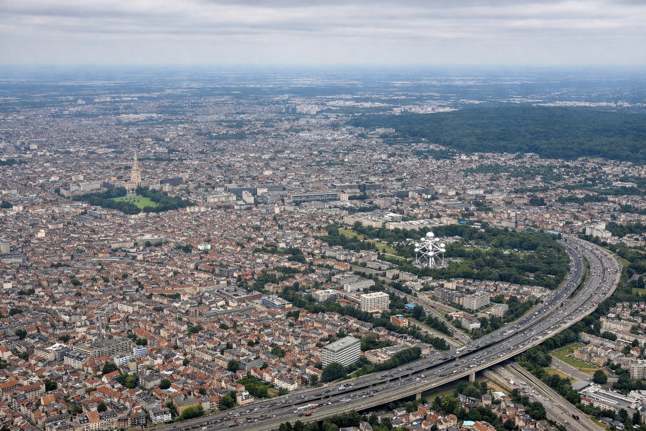
LEFTLeft-side seats provide excellent views during the approach to Brussels. Aircraft typically descend over the Meuse River valley and Belgian countryside, and the left side captures the river, agricultural patchwork, and the city of Brussels itself as you descend toward the airport northeast of the city.
Will your flight be in sunlight?
Pick a date and time in the Sun Map to watch the sun move across your whole flight.
About This Route
Which side of the plane should I sit on flying from Lester B Pearson International (YYZ) to Brussels Natl (BRU)?
Sit on the Left side of the plane for the best views on flights from Toronto to Brussels. While takeoff offers Lake Ontario views, the landing approach provides more sustained and dramatic scenery—the Meuse River valley, Belgian countryside, and Brussels itself are visually richer than the Toronto departure. Left-side seats capture the best of the approach sequence.
What can I see during takeoff from Lester B Pearson International in Toronto?
During takeoff from Lester B Pearson International (YYZ), sit on the Right side for the best views. Right-side seats offer views of Lake Ontario immediately after departure, with the Toronto waterfront and downtown skyline visible during initial climb. The aircraft typically departs westbound or northwestbound, making the right side the scenic choice for the first 10-15 minutes. Notable sights include: Lake Ontario (south and southeast), Toronto downtown core and CN Tower (south-southwest), Scarborough Bluffs (southeast), Greater Toronto Area urban sprawl (west and north).
What can I see when landing at Brussels Natl in Brussels?
When landing at Brussels Natl (BRU), sit on the Left side for the best views. Left-side seats provide excellent views during the approach to Brussels. Aircraft typically descend over the Meuse River valley and Belgian countryside, and the left side captures the river, agricultural patchwork, and the city of Brussels itself as you descend toward the airport northeast of the city. Notable sights include: Meuse River (visible as a winding ribbon through farmland), Belgian agricultural landscape (geometric field patterns), Brussels city center (urban cluster visible 10-15 miles southwest), Zaventem Airport area (industrial and airport infrastructure).
How long is the flight from Toronto to Brussels?
The flight from Lester B Pearson International (YYZ) to Brussels Natl (BRU) takes about 7 hours 15 minutes. The shortest flight path between them is 3,756 miles (6,044 km); winds and air traffic control usually add a few percent.
What does the Toronto to Brussels flight path pass over?
The flight path crosses the Atlantic Ocean for roughly 4.5 hours with no visible landmarks. Over the Atlantic, you may see the southern tip of Greenland (distant, far north) if flying a northern great-circle route, but this is not guaranteed. Upon approaching Europe, the flight passes over the Irish coast (County Cork or County Waterford area), then over the Irish Sea and Wales, then England, the English Channel, and finally descends over northern France and Belgium. The most notable mid-flight geographic feature is the Irish coastline (if visible during daylight), appearing as a jagged, rocky shoreline with green inland terrain. The English Channel crossing offers views of the English coast and French coast as distinct landmasses. The descent into Brussels crosses the flat agricultural plains of northern France and Belgium—no mountains, but the geometric field patterns and river valleys become increasingly detailed as altitude decreases.