Both sides score equally low (1.5 each) because this 4,500+ mile flight crosses predominantly flat, featureless terrain—the Canadian Shield, boreal forest, and Arctic tundra offer minimal dramatic scenery. However, the right side edges ahead slightly due to the Arctic Ocean pack ice and coastal features visible during the final approach to Barrow, which provide more visual interest than the inland tundra on the left. Neither side qualifies as scenic by typical standards; this route prioritizes destination experience over en-route views.
Flown YYZ to BRW? Did we get it right?
Flight Path
Toronto to Barrow is 3,117 miles (5,016 km), a flight of about 4 hours 50 minutes.
Hudson Bay (partial crossing or skirting depending on exact routing), Mackenzie River delta region, Beaufort Sea ice, Canadian Arctic Archipelago islands (Tuktut Nogait region), transition from boreal forest to Arctic tundra around 65°N latitude
Great circle distance and headings ›Phase by phase
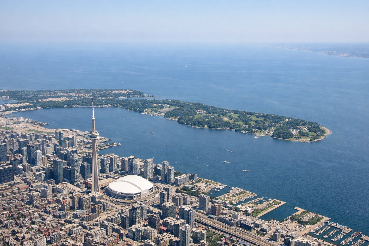
Takeoff from YYZ
LEFTLeft side (north/northwest) offers brief views of Lake Ontario's northern shoreline and the Greater Toronto Area urban sprawl during initial climb before the aircraft turns northwest toward the Arctic. Right side faces inland toward flat Ontario farmland with no distinctive features.
Landing at BRW
RIGHTRight side (north/northeast) during descent into Barrow offers views of the Arctic Ocean pack ice, coastal tundra, and the Chukchi Sea ice formations as the aircraft approaches from the south. Left side faces inland tundra with minimal visual distinction—flat, featureless terrain with scattered lakes and no mountains or dramatic features.
Will your flight be in sunlight?
Pick a date and time in the Sun Map to watch the sun move across your whole flight.
About This Route
Which side of the plane should I sit on flying from Lester B Pearson International (YYZ) to Wiley Post Will Rogers Mem (BRW)?
Sit on the Right side of the plane for the best views on flights from Toronto to Barrow. Both sides score equally low (1.5 each) because this 4,500+ mile flight crosses predominantly flat, featureless terrain—the Canadian Shield, boreal forest, and Arctic tundra offer minimal dramatic scenery. However, the right side edges ahead slightly due to the Arctic Ocean pack ice and coastal features visible during the final approach to Barrow, which provide more visual interest than the inland tundra on the left. Neither side qualifies as scenic by typical standards; this route prioritizes destination experience over en-route views.
What can I see during takeoff from Lester B Pearson International in Toronto?
During takeoff from Lester B Pearson International (YYZ), sit on the Left side for the best views. Left side (north/northwest) offers brief views of Lake Ontario's northern shoreline and the Greater Toronto Area urban sprawl during initial climb before the aircraft turns northwest toward the Arctic. Right side faces inland toward flat Ontario farmland with no distinctive features. Notable sights include: Lake Ontario northern shore, Toronto downtown skyline (CN Tower visible on clear days), Scarborough Bluffs, Greater Toronto Area suburban grid.
What can I see when landing at Wiley Post Will Rogers Mem in Barrow?
When landing at Wiley Post Will Rogers Mem (BRW), sit on the Right side for the best views. Right side (north/northeast) during descent into Barrow offers views of the Arctic Ocean pack ice, coastal tundra, and the Chukchi Sea ice formations as the aircraft approaches from the south. Left side faces inland tundra with minimal visual distinction—flat, featureless terrain with scattered lakes and no mountains or dramatic features. Notable sights include: Arctic Ocean pack ice formations, Barrow coastal tundra, Chukchi Sea ice edge, Point Barrow headland.
How long is the flight from Toronto to Barrow?
The flight from Lester B Pearson International (YYZ) to Wiley Post Will Rogers Mem (BRW) takes about 4 hours 50 minutes. The shortest flight path between them is 3,117 miles (5,016 km); winds and air traffic control usually add a few percent.
What does the Toronto to Barrow flight path pass over?
Hudson Bay (partial crossing or skirting depending on exact routing), Mackenzie River delta region, Beaufort Sea ice, Canadian Arctic Archipelago islands (Tuktut Nogait region), transition from boreal forest to Arctic tundra around 65°N latitude