While takeoff favors the left, the landing approach over the Ganges delta is visually more dramatic and distinctive. The delta's braided channels and river meanders are far more striking than suburban Toronto, making right seats the better overall choice for this route.
Flown YYZ to DAC? Did we get it right?
Flight Path
Toronto to Dhaka is 7,729 miles (12,439 km), a flight of about 16 hours 30 minutes.
This route typically crosses the Atlantic toward Europe or the Middle East, then proceeds over the Mediterranean, Middle East airspace (possibly over Iran, Afghanistan, or Pakistan depending on routing), and the Hindu Kush and Himalayan foothills before descending into the Ganges delta. Notable midpoint features include the Alps (if routed via Europe), the Caucasus Mountains, the Iranian plateau, the Hindu Kush range, and the Indus River valley. The flight crosses multiple time zones and typically includes a fuel stop or continues as an ultra-long-haul routing.
Great circle distance and headings ›


Phase by phase
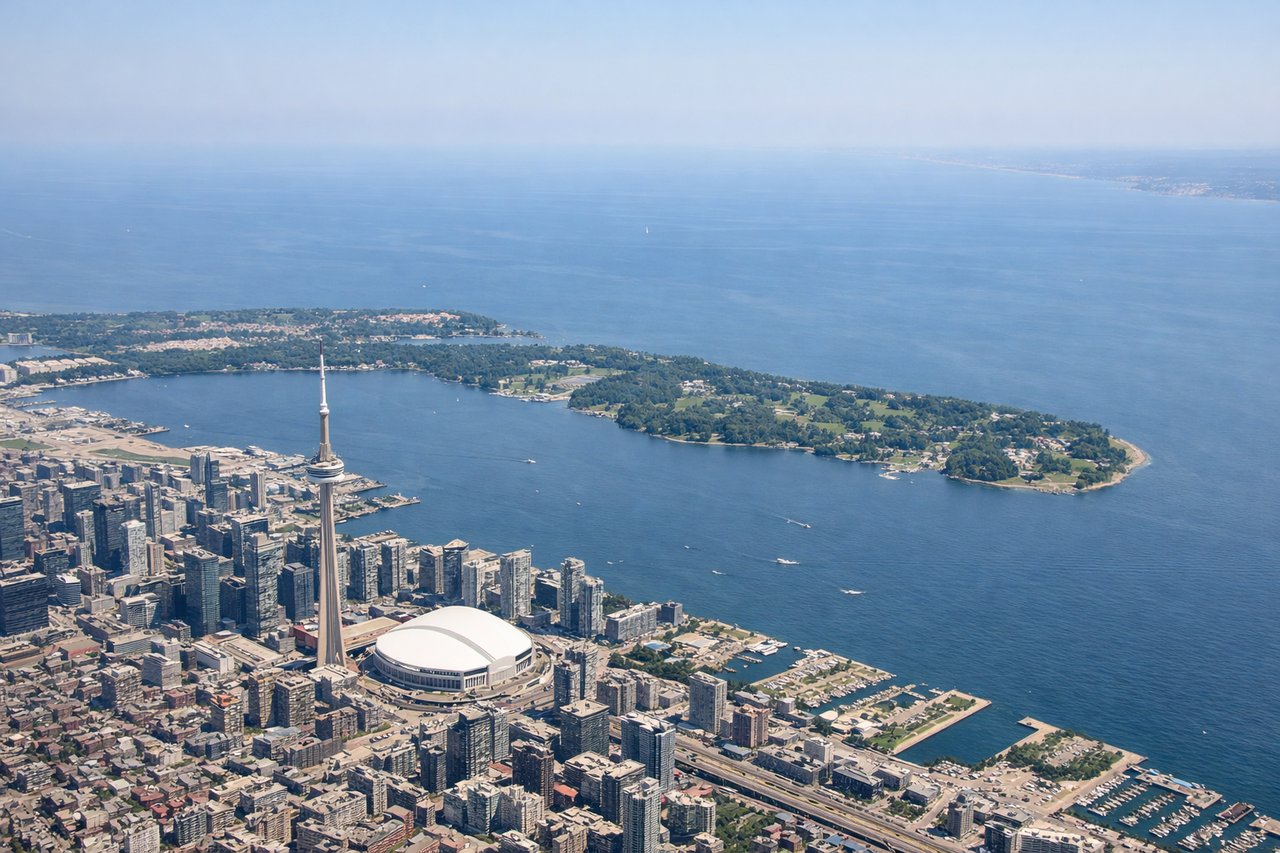
Takeoff from YYZ
LEFTLeft seats offer views of Lake Ontario and the Greater Toronto Area sprawl during the initial climb-out. Most departures from YYZ head east or northeast over the lake before turning toward the Atlantic routing, giving left-side passengers a clear view of the shoreline and urban landscape receding below.
Landing at DAC
RIGHTRight seats provide views during the descent approach into Dhaka. Aircraft typically descend over the Ganges River delta region from the southwest, and right-side passengers see the braided river channels, wetlands, and the Padma River's distinctive meanders before the final approach over the city.
Will your flight be in sunlight?
Pick a date and time in the Sun Map to watch the sun move across your whole flight.
About This Route
Which side of the plane should I sit on flying from Lester B Pearson International (YYZ) to Hazrat Shahjalal International Airport (DAC)?
Sit on the Right side of the plane for the best views on flights from Toronto to Dhaka. While takeoff favors the left, the landing approach over the Ganges delta is visually more dramatic and distinctive. The delta's braided channels and river meanders are far more striking than suburban Toronto, making right seats the better overall choice for this route.
What can I see during takeoff from Lester B Pearson International in Toronto?
During takeoff from Lester B Pearson International (YYZ), sit on the Left side for the best views. Left seats offer views of Lake Ontario and the Greater Toronto Area sprawl during the initial climb-out. Most departures from YYZ head east or northeast over the lake before turning toward the Atlantic routing, giving left-side passengers a clear view of the shoreline and urban landscape receding below. Notable sights include: Lake Ontario (immediate foreground), Toronto downtown skyline and CN Tower (visible to the east), Scarborough Bluffs (eastern shoreline), Hamilton and the western lakeshore (distant left).
What can I see when landing at Hazrat Shahjalal International Airport in Dhaka?
When landing at Hazrat Shahjalal International Airport (DAC), sit on the Right side for the best views. Right seats provide views during the descent approach into Dhaka. Aircraft typically descend over the Ganges River delta region from the southwest, and right-side passengers see the braided river channels, wetlands, and the Padma River's distinctive meanders before the final approach over the city. Notable sights include: Ganges River delta and braided channels (dominant feature), Padma River meanders (southern approach), Dhaka city sprawl and the Buriganga River (final descent), agricultural fields and fish ponds (surrounding delta).
How long is the flight from Toronto to Dhaka?
The flight from Lester B Pearson International (YYZ) to Hazrat Shahjalal International Airport (DAC) takes about 16 hours 30 minutes. The shortest flight path between them is 7,729 miles (12,439 km); winds and air traffic control usually add a few percent.
What does the Toronto to Dhaka flight path pass over?
This route typically crosses the Atlantic toward Europe or the Middle East, then proceeds over the Mediterranean, Middle East airspace (possibly over Iran, Afghanistan, or Pakistan depending on routing), and the Hindu Kush and Himalayan foothills before descending into the Ganges delta. Notable midpoint features include the Alps (if routed via Europe), the Caucasus Mountains, the Iranian plateau, the Hindu Kush range, and the Indus River valley. The flight crosses multiple time zones and typically includes a fuel stop or continues as an ultra-long-haul routing.