Toronto to Keffallinia is 4,903 miles (7,890 km), a flight of about 9 hours 30 minutes.
Left side wins at both ends of the flight. The Toronto departure gives you the city skyline and Lake Ontario, and the Kefallinia arrival gives you Mount Ainos and the Greek coastline. Over the Atlantic and central Europe the views are comparable on both sides, so the departure and arrival experiences tip it firmly left.
Flight Path
The route crosses the North Atlantic south of Greenland, then passes over Ireland and southern England, crosses the English Channel, tracks over northern France and the Alps (Mont Blanc area may be visible in clear conditions), then descends over northern Italy, the Adriatic Sea, and the western coast of Greece before reaching the Ionian Islands.
Great circle distance and headings ›
.jpeg?width=600)

_Panoramica_del_centro_della_citt%C3%A0_dal_lago.jpg?width=600)


Phase by phase
Takeoff from YYZ
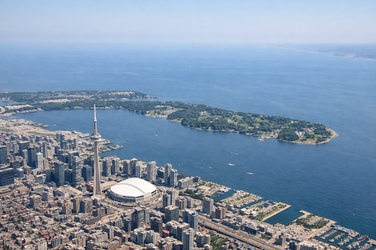
LEFTYYZ departures on the dominant runway 23 head southwest, putting Lake Ontario and the Toronto downtown skyline on the left side. You get a clear view of the CN Tower, the waterfront, and the lake stretching east toward Hamilton Bay.
Landing at EFL
LEFTKefallinia Airport sits on the northeast tip of the island. Arrivals typically come in from the north or northwest over the Ionian Sea, and the left side gives you the best view of the island's mountainous interior including Mount Ainos, plus the Gulf of Patras and the Greek mainland coast.
Landmarks on this routeAll landmarks →
Will your flight be in sunlight?
Pick a date and time in the Sun Map to watch the sun move across your whole flight.
About This Route
Which side of the plane should I sit on flying from Lester B Pearson International (YYZ) to Kefallinia (EFL)?
Sit on the Left side of the plane for the best views on flights from Toronto to Keffallinia. Left side wins at both ends of the flight. The Toronto departure gives you the city skyline and Lake Ontario, and the Kefallinia arrival gives you Mount Ainos and the Greek coastline. Over the Atlantic and central Europe the views are comparable on both sides, so the departure and arrival experiences tip it firmly left.
What can I see during takeoff from Lester B Pearson International in Toronto?
During takeoff from Lester B Pearson International (YYZ), sit on the Left side for the best views. YYZ departures on the dominant runway 23 head southwest, putting Lake Ontario and the Toronto downtown skyline on the left side. You get a clear view of the CN Tower, the waterfront, and the lake stretching east toward Hamilton Bay. Notable sights include: CN Tower and downtown Toronto skyline, Lake Ontario shoreline, Hamilton Harbour to the west, Scarborough Bluffs visible along the lake's north shore.
What can I see when landing at Kefallinia in Keffallinia?
When landing at Kefallinia (EFL), sit on the Left side for the best views. Kefallinia Airport sits on the northeast tip of the island. Arrivals typically come in from the north or northwest over the Ionian Sea, and the left side gives you the best view of the island's mountainous interior including Mount Ainos, plus the Gulf of Patras and the Greek mainland coast. Notable sights include: Mount Ainos (1,628m, highest peak on Kefallinia), Gulf of Patras and the Peloponnese coast, Argostoli Bay and the island's western coastline, the Ionian Sea stretching south.
How long is the flight from Toronto to Keffallinia?
The flight from Lester B Pearson International (YYZ) to Kefallinia (EFL) takes about 9 hours 30 minutes. The shortest flight path between them is 4,903 miles (7,890 km); winds and air traffic control usually add a few percent.
What does the Toronto to Keffallinia flight path pass over?
The route crosses the North Atlantic south of Greenland, then passes over Ireland and southern England, crosses the English Channel, tracks over northern France and the Alps (Mont Blanc area may be visible in clear conditions), then descends over northern Italy, the Adriatic Sea, and the western coast of Greece before reaching the Ionian Islands.