Toronto to Holguin is 1,593 miles (2,564 km), a flight of about 3 hours 45 minutes.
The left side delivers the dramatic Toronto skyline and Lake Ontario on departure, then tracks the flight path over Cuba's northern coast where you may glimpse the Cuban shoreline and interior. While the right side wins on landing approach, the takeoff views from the left are more spectacular and memorable overall.
Flight Path
The flight crosses Lake Ontario, then tracks south over upstate New York or Pennsylvania, across the Appalachian ridges, over the Carolinas or Georgia, then the Straits of Florida before crossing Cuba's northern coast near Camaguey province and tracking east toward Holguin over Cuba's interior plains and the Sierra Cristal foothills.
Great circle distance and headings ›
.jpeg?width=600)
Phase by phase
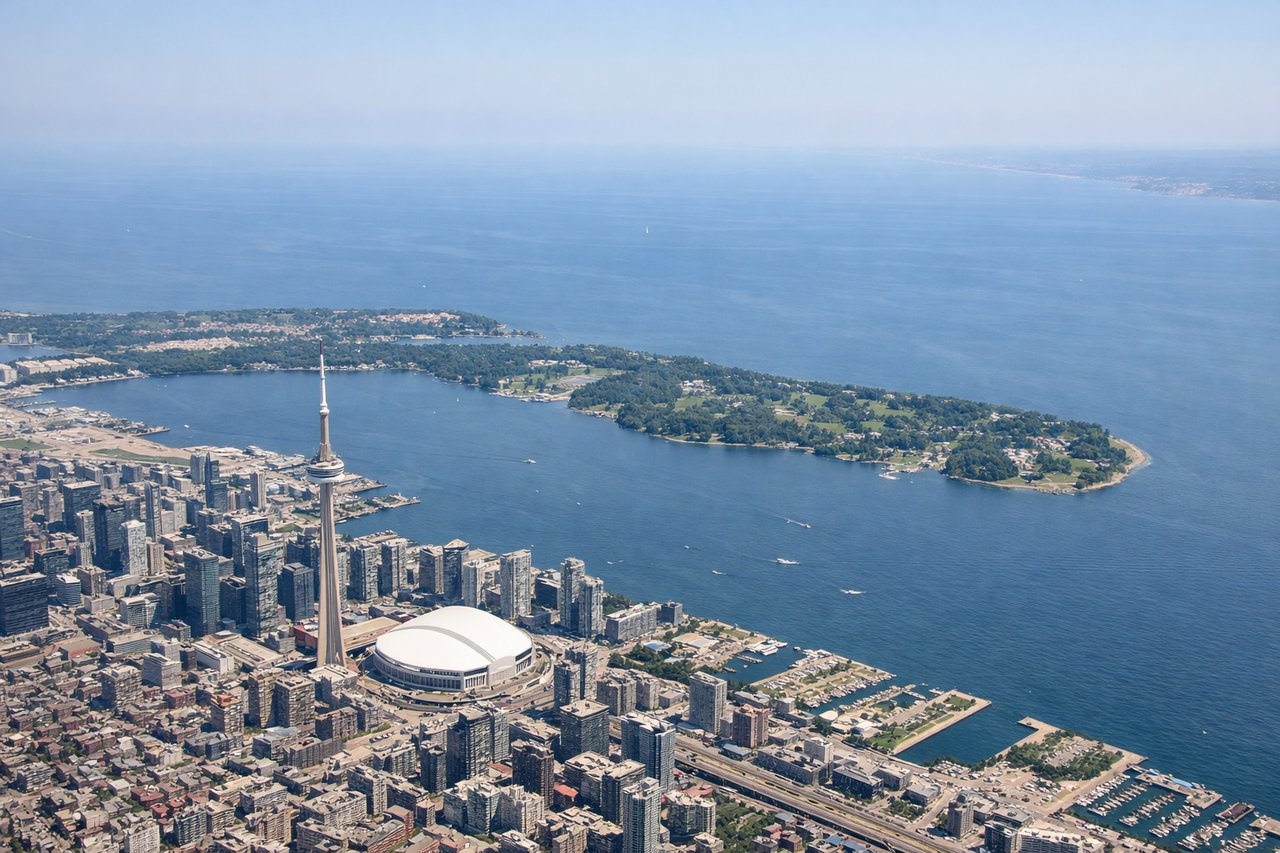
Takeoff from YYZ
LEFTYYZ typically departs southbound or eastbound on runways 05/06L/06R or 23/24L/24R. On a southbound departure toward Cuba, the left side gives you downtown Toronto's skyline including the CN Tower, Lake Ontario, and the Toronto Islands. The right side faces northwest toward suburban sprawl with little of interest.
Landing at HOG
RIGHTHOG's runway 05/23 means arrivals typically come in from the northeast over the Sierra de Nipe and Sierra Cristal mountain ranges. The right side on approach gives views of the rugged Sierra Cristal highlands and the coastal lowlands around Holguin city. The left side faces mostly open Caribbean water on final.
Landmarks on this routeAll landmarks →
Will your flight be in sunlight?
Pick a date and time in the Sun Map to watch the sun move across your whole flight.
About This Route
Which side of the plane should I sit on flying from Lester B Pearson International (YYZ) to Frank Pais (HOG)?
Sit on the Left side of the plane for the best views on flights from Toronto to Holguin. The left side delivers the dramatic Toronto skyline and Lake Ontario on departure, then tracks the flight path over Cuba's northern coast where you may glimpse the Cuban shoreline and interior. While the right side wins on landing approach, the takeoff views from the left are more spectacular and memorable overall.
What can I see during takeoff from Lester B Pearson International in Toronto?
During takeoff from Lester B Pearson International (YYZ), sit on the Left side for the best views. YYZ typically departs southbound or eastbound on runways 05/06L/06R or 23/24L/24R. On a southbound departure toward Cuba, the left side gives you downtown Toronto's skyline including the CN Tower, Lake Ontario, and the Toronto Islands. The right side faces northwest toward suburban sprawl with little of interest. Notable sights include: CN Tower and downtown Toronto skyline, Toronto Islands and Billy Bishop Airport, Lake Ontario shoreline, Port Credit and Mississauga waterfront.
What can I see when landing at Frank Pais in Holguin?
When landing at Frank Pais (HOG), sit on the Right side for the best views. HOG's runway 05/23 means arrivals typically come in from the northeast over the Sierra de Nipe and Sierra Cristal mountain ranges. The right side on approach gives views of the rugged Sierra Cristal highlands and the coastal lowlands around Holguin city. The left side faces mostly open Caribbean water on final. Notable sights include: Sierra Cristal mountain range, Sierra de Nipe highlands, Holguin city and its red-roofed urban grid, coastal lowlands and sugar cane fields of eastern Cuba.
How long is the flight from Toronto to Holguin?
The flight from Lester B Pearson International (YYZ) to Frank Pais (HOG) takes about 3 hours 45 minutes. The shortest flight path between them is 1,593 miles (2,564 km); winds and air traffic control usually add a few percent.
What does the Toronto to Holguin flight path pass over?
The flight crosses Lake Ontario, then tracks south over upstate New York or Pennsylvania, across the Appalachian ridges, over the Carolinas or Georgia, then the Straits of Florida before crossing Cuba's northern coast near Camaguey province and tracking east toward Holguin over Cuba's interior plains and the Sierra Cristal foothills.