The right side scores higher (3.5 vs 2.5) due to superior landing scenery: the Caribbean's turquoise waters, visible reef structures, and the dramatic Blue Mountains provide more visual variety and geographic interest than the left side's similar ocean crossing. Takeoff from Toronto is comparable on both sides, but the right-side approach to Kingston's coastal and mountainous terrain outweighs any advantage the left side might offer during the cruise phase over open ocean.
Flown YYZ to KIN? Did we get it right?
Flight Path
Toronto to Kingston is 1,786 miles (2,875 km), a flight of about 3 hours 45 minutes.
Open Atlantic Ocean and Caribbean Sea with no major landmarks; the flight path crosses the Bahamas region (visible as scattered low islands and shallow banks during cruise at altitude, though individual islands are small and difficult to distinguish at 35,000 feet); the Turks and Caicos Islands lie south of the direct route; the flight descends over the Caribbean approaching Jamaica's north coast, with the island's mountainous spine (Blue Mountains) becoming visible 50-80 miles out
Great circle distance and headings ›

Phase by phase
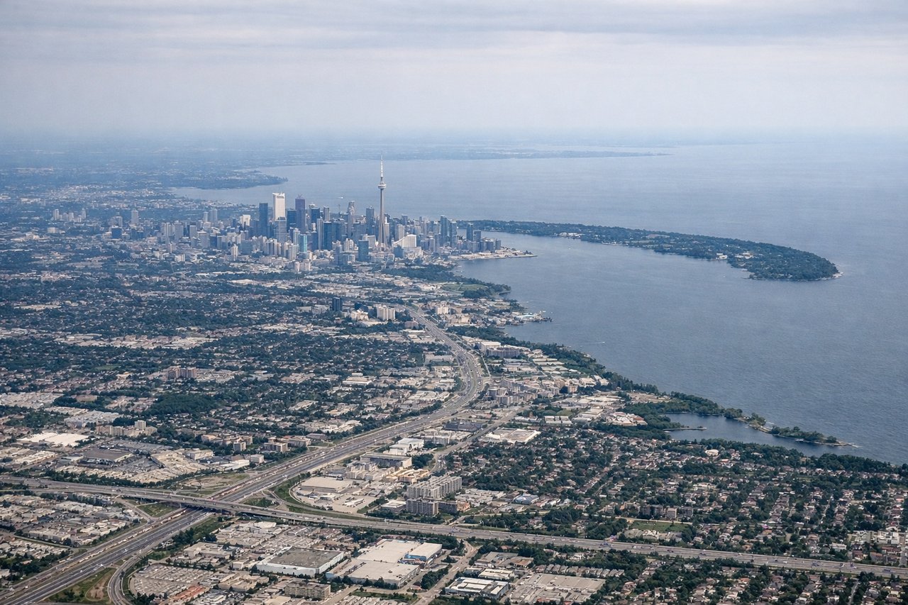
Takeoff from YYZ
RIGHTRight-side departures from YYZ typically use runways 05 or 06, which orient northeast and allow climbs over Lake Ontario's eastern shoreline and the Greater Toronto Area's urban sprawl. Left-side departures westbound over land offer less dramatic scenery initially.
Landing at KIN
RIGHTRight-side approaches to Kingston typically descend over the Caribbean Sea and the Jamaican coastline, offering views of turquoise waters, coral reef formations, and the Blue Mountains inland. Left-side approaches cross similar water but with less dramatic coastal and mountain relief visible during final descent.
Will your flight be in sunlight?
Pick a date and time in the Sun Map to watch the sun move across your whole flight.
About This Route
Which side of the plane should I sit on flying from Lester B Pearson International (YYZ) to Norman Manley International (KIN)?
Sit on the Right side of the plane for the best views on flights from Toronto to Kingston. The right side scores higher (3.5 vs 2.5) due to superior landing scenery: the Caribbean's turquoise waters, visible reef structures, and the dramatic Blue Mountains provide more visual variety and geographic interest than the left side's similar ocean crossing. Takeoff from Toronto is comparable on both sides, but the right-side approach to Kingston's coastal and mountainous terrain outweighs any advantage the left side might offer during the cruise phase over open ocean.
What can I see during takeoff from Lester B Pearson International in Toronto?
During takeoff from Lester B Pearson International (YYZ), sit on the Right side for the best views. Right-side departures from YYZ typically use runways 05 or 06, which orient northeast and allow climbs over Lake Ontario's eastern shoreline and the Greater Toronto Area's urban sprawl. Left-side departures westbound over land offer less dramatic scenery initially. Notable sights include: Lake Ontario shoreline, Toronto downtown skyline and CN Tower, Scarborough Bluffs (clay cliffs along the lake's eastern edge), suburban sprawl of the Greater Toronto Area.
What can I see when landing at Norman Manley International in Kingston?
When landing at Norman Manley International (KIN), sit on the Right side for the best views. Right-side approaches to Kingston typically descend over the Caribbean Sea and the Jamaican coastline, offering views of turquoise waters, coral reef formations, and the Blue Mountains inland. Left-side approaches cross similar water but with less dramatic coastal and mountain relief visible during final descent. Notable sights include: Caribbean Sea with visible reef structures and color gradation from deep blue to turquoise, Jamaican north coast with Port Royal and Kingston Harbor, Blue Mountains rising inland from the coast, Norman Manley International Airport runway and surrounding coastal plains.
How long is the flight from Toronto to Kingston?
The flight from Lester B Pearson International (YYZ) to Norman Manley International (KIN) takes about 3 hours 45 minutes. The shortest flight path between them is 1,786 miles (2,875 km); winds and air traffic control usually add a few percent.
What does the Toronto to Kingston flight path pass over?
Open Atlantic Ocean and Caribbean Sea with no major landmarks; the flight path crosses the Bahamas region (visible as scattered low islands and shallow banks during cruise at altitude, though individual islands are small and difficult to distinguish at 35,000 feet); the Turks and Caicos Islands lie south of the direct route; the flight descends over the Caribbean approaching Jamaica's north coast, with the island's mountainous spine (Blue Mountains) becoming visible 50-80 miles out