The right side wins both the Toronto departure, with its skyline and lakefront view, and the Madrid arrival, with the Guadarrama mountains framing the descent. The left side has little to offer beyond flat farmland and open ocean for most of the flight.
Flown YYZ to MAD? Did we get it right?
Flight Path
Toronto to Madrid is 3,764 miles (6,058 km), a flight of about 8 hours 10 minutes.
The route crosses the Gulf of St. Lawrence, Newfoundland's coastline, and then several hours of open North Atlantic before making landfall near the Bay of Biscay and northern Spain.
Great circle distance and headings ›

Phase by phase
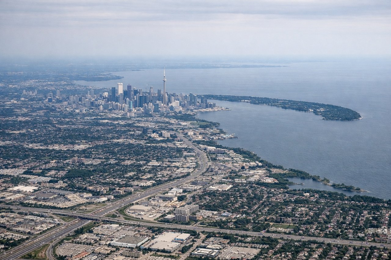
Takeoff from YYZ
RIGHTDeparting Pearson on a typical northeast-bound climb, the right side offers a good look back at downtown Toronto's skyline and the shoreline of Lake Ontario before the aircraft turns east over Ontario farmland. The left side mostly shows suburban sprawl with little variation.
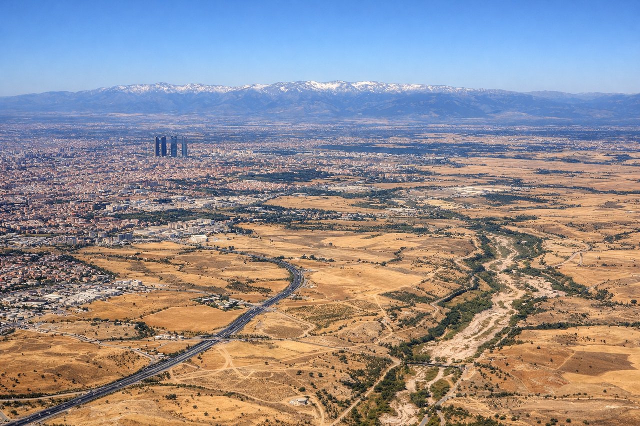
Landing at MAD
RIGHTOn approach into Madrid from the north, the aircraft descends with the Sierra de Guadarrama mountains visible off the right side before the final turn south toward Barajas. The city's northern districts and the airport's terminal complex also come into view on this side during the last few minutes.
Will your flight be in sunlight?
Pick a date and time in the Sun Map to watch the sun move across your whole flight.
About This Route
Which side of the plane should I sit on flying from Lester B Pearson International (YYZ) to Barajas (MAD)?
Sit on the Right side of the plane for the best views on flights from Toronto to Madrid. The right side wins both the Toronto departure, with its skyline and lakefront view, and the Madrid arrival, with the Guadarrama mountains framing the descent. The left side has little to offer beyond flat farmland and open ocean for most of the flight.
What can I see during takeoff from Lester B Pearson International in Toronto?
During takeoff from Lester B Pearson International (YYZ), sit on the Right side for the best views. Departing Pearson on a typical northeast-bound climb, the right side offers a good look back at downtown Toronto's skyline and the shoreline of Lake Ontario before the aircraft turns east over Ontario farmland. The left side mostly shows suburban sprawl with little variation. Notable sights include: Toronto skyline (CN Tower), Lake Ontario shoreline, Toronto Islands.
What can I see when landing at Barajas in Madrid?
When landing at Barajas (MAD), sit on the Right side for the best views. On approach into Madrid from the north, the aircraft descends with the Sierra de Guadarrama mountains visible off the right side before the final turn south toward Barajas. The city's northern districts and the airport's terminal complex also come into view on this side during the last few minutes. Notable sights include: Sierra de Guadarrama, Madrid's northern skyline, Jarama river valley.
How long is the flight from Toronto to Madrid?
The flight from Lester B Pearson International (YYZ) to Barajas (MAD) takes about 8 hours 10 minutes. The shortest flight path between them is 3,764 miles (6,058 km); winds and air traffic control usually add a few percent.
What does the Toronto to Madrid flight path pass over?
The route crosses the Gulf of St. Lawrence, Newfoundland's coastline, and then several hours of open North Atlantic before making landfall near the Bay of Biscay and northern Spain.