The right side scores higher (3.5 vs 2.5) because the eastbound approach to Nairobi crosses dramatic East African plateau terrain and the Rift Valley escarpment, offering sustained topographic interest. While Toronto's takeoff provides urban and lakeside scenery, the bulk of the flight crosses featureless Atlantic and Saharan terrain on both sides. The landing approach into Nairobi—with its elevated plateau, visible national park, and escarpment backdrop—delivers the flight's most visually distinctive segment, making the right side the superior choice overall.
Flown YYZ to NBO? Did we get it right?
Flight Path
Toronto to Nairobi is 7,588 miles (12,212 km), a flight of about 14 hours 20 minutes.
North Atlantic (6+ hours of open ocean with minimal visual interest), Azores archipelago (if visible during mid-Atlantic cruise, though typically at altitude where islands appear as small specks), Sahara Desert (vast tan expanse with minimal relief), Mediterranean coast of North Africa (Morocco/Algeria coastline if routed southerly), Red Sea (if southern routing used), Ethiopian Highlands (if visible on approach to East Africa—mountainous terrain with volcanic features)
Great circle distance and headings ›


Phase by phase
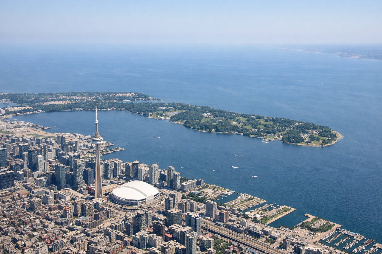
Takeoff from YYZ
LEFTToronto's urban sprawl and Lake Ontario shoreline provide immediate visual interest during climb-out. The left side captures the Greater Toronto Area's grid pattern and the lake's northern shore receding southward.
Landing at NBO
RIGHTNairobi's approach from the east crosses the East African plateau with the Rift Valley escarpment visible, and the city's sprawling urban landscape provides strong visual definition. The right side captures the dramatic topography and Nairobi's position on elevated terrain.
Will your flight be in sunlight?
Pick a date and time in the Sun Map to watch the sun move across your whole flight.
About This Route
Which side of the plane should I sit on flying from Lester B Pearson International (YYZ) to Jomo Kenyatta International (NBO)?
Sit on the Right side of the plane for the best views on flights from Toronto to Nairobi. The right side scores higher (3.5 vs 2.5) because the eastbound approach to Nairobi crosses dramatic East African plateau terrain and the Rift Valley escarpment, offering sustained topographic interest. While Toronto's takeoff provides urban and lakeside scenery, the bulk of the flight crosses featureless Atlantic and Saharan terrain on both sides. The landing approach into Nairobi—with its elevated plateau, visible national park, and escarpment backdrop—delivers the flight's most visually distinctive segment, making the right side the superior choice overall.
What can I see during takeoff from Lester B Pearson International in Toronto?
During takeoff from Lester B Pearson International (YYZ), sit on the Left side for the best views. Toronto's urban sprawl and Lake Ontario shoreline provide immediate visual interest during climb-out. The left side captures the Greater Toronto Area's grid pattern and the lake's northern shore receding southward. Notable sights include: Lake Ontario (immediate south), Toronto downtown core and CN Tower (visible in mid-distance), Scarborough Bluffs (eastern shoreline feature).
What can I see when landing at Jomo Kenyatta International in Nairobi?
When landing at Jomo Kenyatta International (NBO), sit on the Right side for the best views. Nairobi's approach from the east crosses the East African plateau with the Rift Valley escarpment visible, and the city's sprawling urban landscape provides strong visual definition. The right side captures the dramatic topography and Nairobi's position on elevated terrain. Notable sights include: Nairobi city sprawl and Nairobi National Park (visible as green reserve south of city), East African plateau terrain, Rift Valley escarpment (distant western horizon).
How long is the flight from Toronto to Nairobi?
The flight from Lester B Pearson International (YYZ) to Jomo Kenyatta International (NBO) takes about 14 hours 20 minutes. The shortest flight path between them is 7,588 miles (12,212 km); winds and air traffic control usually add a few percent.
What does the Toronto to Nairobi flight path pass over?
North Atlantic (6+ hours of open ocean with minimal visual interest), Azores archipelago (if visible during mid-Atlantic cruise, though typically at altitude where islands appear as small specks), Sahara Desert (vast tan expanse with minimal relief), Mediterranean coast of North Africa (Morocco/Algeria coastline if routed southerly), Red Sea (if southern routing used), Ethiopian Highlands (if visible on approach to East Africa—mountainous terrain with volcanic features)