The right side misses the Toronto departure views but captures the most dramatic feature of the entire flight — Pittsburgh's iconic three-river confluence and downtown on approach. The landing view from the right is genuinely one of the more striking urban arrivals in the northeastern US.
Flown YYZ to PIT? Did we get it right?
Flight Path
Toronto to Pittsburgh is 222 miles (358 km), a flight of about 1 hour 5 minutes.
The flight crosses Lake Erie's eastern end or the Pennsylvania-New York border region, passing over the flat agricultural plains of Erie County, Pennsylvania. The terrain transitions from the Ontario lowlands across the Lake Erie shoreline near Erie, PA, then climbs into the rolling forested ridges of the Allegheny Plateau as you descend toward Pittsburgh. No dramatic mountain ranges — this is plateau and river valley country.
Great circle distance and headings ›Phase by phase
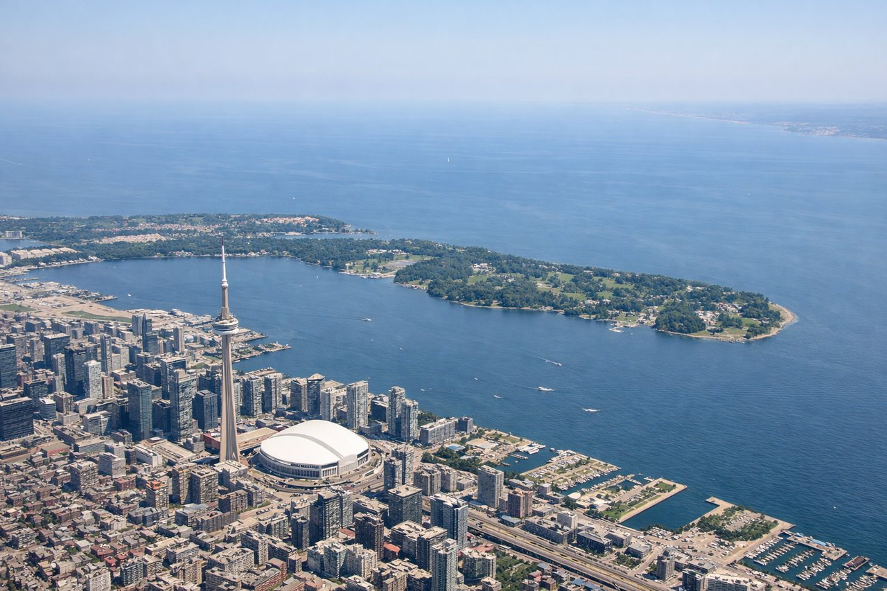
Takeoff from YYZ
LEFTYYZ's most common departure runway is 23 (heading southwest), which puts the left side facing southeast toward downtown Toronto and Lake Ontario. You get a clear view of the Toronto skyline including the CN Tower, and the broad expanse of Lake Ontario stretching to the horizon.
Landing at PIT
RIGHTPittsburgh International sits west of the city, and aircraft typically approach from the west or northwest on runway 28R/28L, meaning the final approach tracks eastward. The right side faces north toward the Ohio River valley and eventually the dramatic confluence of the Allegheny, Monongahela, and Ohio Rivers at Pittsburgh's Point, with the downtown skyline visible in the distance.
Will your flight be in sunlight?
Pick a date and time in the Sun Map to watch the sun move across your whole flight.
About This Route
Which side of the plane should I sit on flying from Lester B Pearson International (YYZ) to Pittsburgh International (PIT)?
Sit on the Right side of the plane for the best views on flights from Toronto to Pittsburgh. The right side misses the Toronto departure views but captures the most dramatic feature of the entire flight — Pittsburgh's iconic three-river confluence and downtown on approach. The landing view from the right is genuinely one of the more striking urban arrivals in the northeastern US.
What can I see during takeoff from Lester B Pearson International in Toronto?
During takeoff from Lester B Pearson International (YYZ), sit on the Left side for the best views. YYZ's most common departure runway is 23 (heading southwest), which puts the left side facing southeast toward downtown Toronto and Lake Ontario. You get a clear view of the Toronto skyline including the CN Tower, and the broad expanse of Lake Ontario stretching to the horizon. Notable sights include: CN Tower and downtown Toronto skyline, Lake Ontario shoreline, Toronto Islands, Humber Bay.
What can I see when landing at Pittsburgh International in Pittsburgh?
When landing at Pittsburgh International (PIT), sit on the Right side for the best views. Pittsburgh International sits west of the city, and aircraft typically approach from the west or northwest on runway 28R/28L, meaning the final approach tracks eastward. The right side faces north toward the Ohio River valley and eventually the dramatic confluence of the Allegheny, Monongahela, and Ohio Rivers at Pittsburgh's Point, with the downtown skyline visible in the distance. Notable sights include: The Point (confluence of Allegheny, Monongahela, and Ohio Rivers), Pittsburgh downtown skyline, Ohio River valley, Allegheny River corridor.
How long is the flight from Toronto to Pittsburgh?
The flight from Lester B Pearson International (YYZ) to Pittsburgh International (PIT) takes about 1 hour 5 minutes. The shortest flight path between them is 222 miles (358 km); winds and air traffic control usually add a few percent.
What does the Toronto to Pittsburgh flight path pass over?
The flight crosses Lake Erie's eastern end or the Pennsylvania-New York border region, passing over the flat agricultural plains of Erie County, Pennsylvania. The terrain transitions from the Ontario lowlands across the Lake Erie shoreline near Erie, PA, then climbs into the rolling forested ridges of the Allegheny Plateau as you descend toward Pittsburgh. No dramatic mountain ranges — this is plateau and river valley country.