Right-side seats dominate both segments: Lake Ontario's dramatic expanse on departure and the Caicos Bank's unparalleled turquoise waters on arrival. The landing view alone justifies the right side for this route.
Flown YYZ to PLS? Did we get it right?
Flight Path
Toronto to Providenciales is 1,571 miles (2,528 km), a flight of about 4 hours 15 minutes.
The flight path crosses the Appalachian Mountains (visible around 1.5 hours out, appearing as a subtle ridge pattern below), then transitions over the Atlantic coastal plain. Around 2 hours in, you'll pass over the Outer Banks of North Carolina (visible as a thin barrier island chain if conditions allow). The remainder crosses open Atlantic with occasional cloud formations. The Bahamas archipelago becomes visible around 3.5 hours, with the turquoise waters of the Exuma Cays and Andros Island marking the approach to the Caribbean.
Great circle distance and headings ›

Phase by phase
Takeoff from YYZ
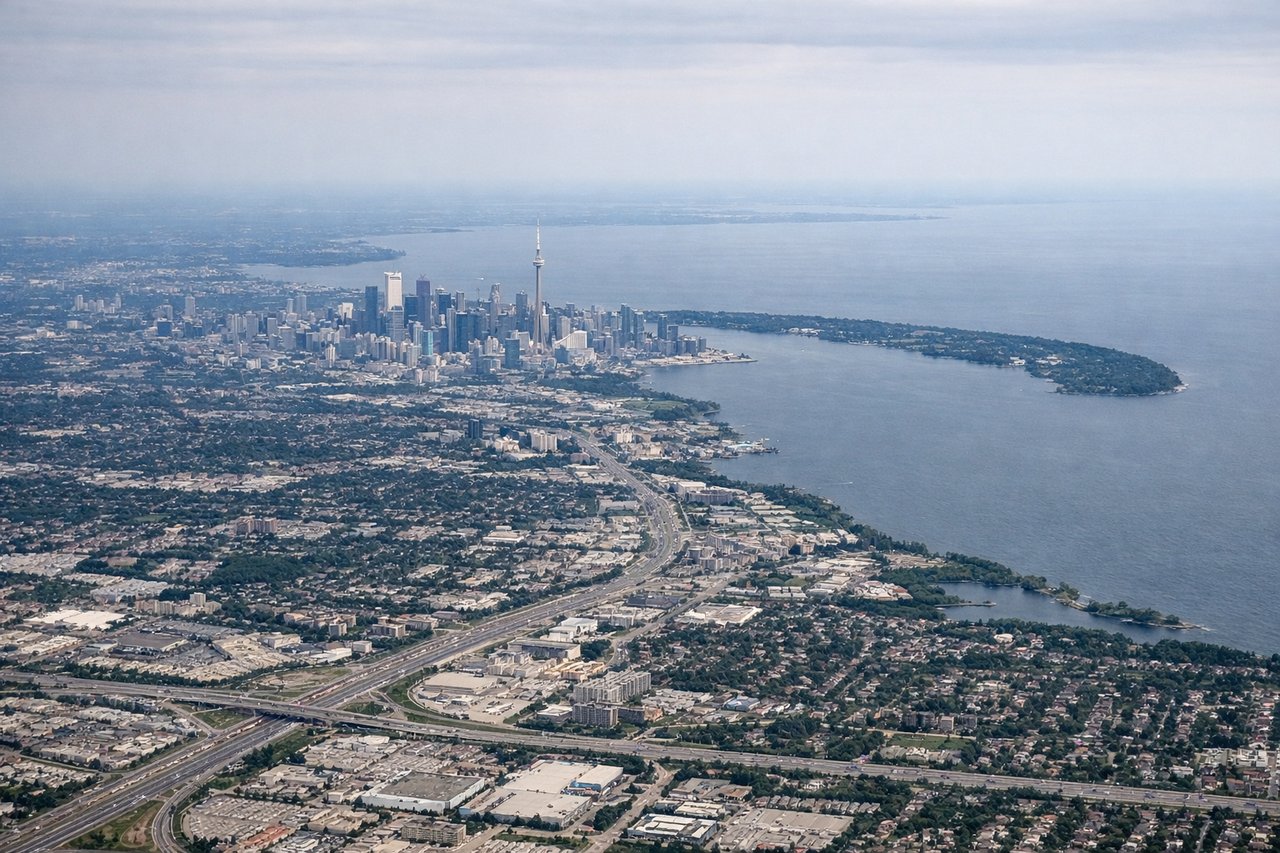
RIGHTYYZ typically departs eastbound (runways 24L/R or 06L/R depending on wind). Right-side seats capture the initial climb over Lake Ontario's northern shoreline and the Greater Toronto Area sprawl receding southward. You'll see the lake's expanse opening up as you gain altitude.
Landing at PLS
RIGHTApproach to PLS typically uses runway 09 (eastbound) or 27 (westbound) depending on wind. Right-side seats on descent capture the Caicos Bank's stunning turquoise shallow waters, the narrow island of Providenciales itself, and the deeper Atlantic blue beyond. The color contrast between bank and deep ocean is dramatic and unmissable.
Will your flight be in sunlight?
Pick a date and time in the Sun Map to watch the sun move across your whole flight.
About This Route
Which side of the plane should I sit on flying from Lester B Pearson International (YYZ) to Providenciales (PLS)?
Sit on the Right side of the plane for the best views on flights from Toronto to Providenciales. Right-side seats dominate both segments: Lake Ontario's dramatic expanse on departure and the Caicos Bank's unparalleled turquoise waters on arrival. The landing view alone justifies the right side for this route.
What can I see during takeoff from Lester B Pearson International in Toronto?
During takeoff from Lester B Pearson International (YYZ), sit on the Right side for the best views. YYZ typically departs eastbound (runways 24L/R or 06L/R depending on wind). Right-side seats capture the initial climb over Lake Ontario's northern shoreline and the Greater Toronto Area sprawl receding southward. You'll see the lake's expanse opening up as you gain altitude. Notable sights include: Lake Ontario (immediate south), Toronto downtown core and CN Tower area (southwest, receding), Scarborough Bluffs erosion formations (southeast shoreline), Oak Ridges Moraine forested ridge (north, distant).
What can I see when landing at Providenciales in Providenciales?
When landing at Providenciales (PLS), sit on the Right side for the best views. Approach to PLS typically uses runway 09 (eastbound) or 27 (westbound) depending on wind. Right-side seats on descent capture the Caicos Bank's stunning turquoise shallow waters, the narrow island of Providenciales itself, and the deeper Atlantic blue beyond. The color contrast between bank and deep ocean is dramatic and unmissable. Notable sights include: Caicos Bank turquoise shallows (dominant, light aquamarine), Providenciales island (narrow, low-lying landmass), Grace Bay Beach (northern coast, white sand), deeper Atlantic Ocean (dark blue, beyond the island).
How long is the flight from Toronto to Providenciales?
The flight from Lester B Pearson International (YYZ) to Providenciales (PLS) takes about 4 hours 15 minutes. The shortest flight path between them is 1,571 miles (2,528 km); winds and air traffic control usually add a few percent.
What does the Toronto to Providenciales flight path pass over?
The flight path crosses the Appalachian Mountains (visible around 1.5 hours out, appearing as a subtle ridge pattern below), then transitions over the Atlantic coastal plain. Around 2 hours in, you'll pass over the Outer Banks of North Carolina (visible as a thin barrier island chain if conditions allow). The remainder crosses open Atlantic with occasional cloud formations. The Bahamas archipelago becomes visible around 3.5 hours, with the turquoise waters of the Exuma Cays and Andros Island marking the approach to the Caribbean.