Toronto to Port of Spain is 2,534 miles (4,079 km), a flight of about 5 hours 15 minutes.
The left side wins at takeoff but the right side delivers the more dramatic payoff on arrival with the Northern Range, Port of Spain, and the Gulf of Paria all visible together during descent. Over the flight's midpoint the right side also faces east toward the Atlantic and the Lesser Antilles chain, giving occasional island views. On balance, right side passengers get more across the full journey.
Flight Path
The route tracks southeast over the eastern United States, crossing the Carolinas coast and then over open Atlantic. Around the midpoint the flight passes east of the Bahamas archipelago, with the shallow turquoise Bahama Banks potentially visible on clear days to the right. Further south the route crosses the Caribbean Sea, with the islands of Barbados and the southern Lesser Antilles arc appearing as small low shapes on the eastern horizon to the right side. The Venezuelan coast and the Orinoco Delta region become visible in the final descent toward Trinidad.
Great circle distance and headings ›
.jpeg?width=600)
Phase by phase
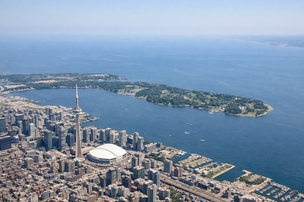
Takeoff from YYZ
LEFTYYZ departures on runway 23 (the most common westerly departure) swing southeast, putting Lake Ontario and the Toronto downtown skyline on the left side. You get a clear view of the CN Tower, the waterfront, and the lake stretching east toward Hamilton Bay.
Landing at POS
RIGHTPiarco typically uses runway 10 for easterly arrivals, meaning the approach track comes in from the west over central Trinidad. The right side gives you the Northern Range mountains running east-west across the island, the Gulf of Paria, and Port of Spain's waterfront as you descend.
Landmarks on this routeAll landmarks →
Will your flight be in sunlight?
Pick a date and time in the Sun Map to watch the sun move across your whole flight.
About This Route
Which side of the plane should I sit on flying from Lester B Pearson International (YYZ) to Piarco (POS)?
Sit on the Right side of the plane for the best views on flights from Toronto to Port of Spain. The left side wins at takeoff but the right side delivers the more dramatic payoff on arrival with the Northern Range, Port of Spain, and the Gulf of Paria all visible together during descent. Over the flight's midpoint the right side also faces east toward the Atlantic and the Lesser Antilles chain, giving occasional island views. On balance, right side passengers get more across the full journey.
What can I see during takeoff from Lester B Pearson International in Toronto?
During takeoff from Lester B Pearson International (YYZ), sit on the Left side for the best views. YYZ departures on runway 23 (the most common westerly departure) swing southeast, putting Lake Ontario and the Toronto downtown skyline on the left side. You get a clear view of the CN Tower, the waterfront, and the lake stretching east toward Hamilton Bay. Notable sights include: CN Tower and downtown Toronto skyline, Lake Ontario shoreline, Hamilton Harbour to the west, Scarborough Bluffs visible along the lake's north shore.
What can I see when landing at Piarco in Port of Spain?
When landing at Piarco (POS), sit on the Right side for the best views. Piarco typically uses runway 10 for easterly arrivals, meaning the approach track comes in from the west over central Trinidad. The right side gives you the Northern Range mountains running east-west across the island, the Gulf of Paria, and Port of Spain's waterfront as you descend. Notable sights include: Northern Range mountains of Trinidad, Gulf of Paria, Port of Spain waterfront and city, Caroni Swamp wetlands south of the capital.
How long is the flight from Toronto to Port of Spain?
The flight from Lester B Pearson International (YYZ) to Piarco (POS) takes about 5 hours 15 minutes. The shortest flight path between them is 2,534 miles (4,079 km); winds and air traffic control usually add a few percent.
What does the Toronto to Port of Spain flight path pass over?
The route tracks southeast over the eastern United States, crossing the Carolinas coast and then over open Atlantic. Around the midpoint the flight passes east of the Bahamas archipelago, with the shallow turquoise Bahama Banks potentially visible on clear days to the right. Further south the route crosses the Caribbean Sea, with the islands of Barbados and the southern Lesser Antilles arc appearing as small low shapes on the eastern horizon to the right side. The Venezuelan coast and the Orinoco Delta region become visible in the final descent toward Trinidad.