The left side wins on both ends: a scenic Toronto skyline and Great Lakes departure, plus a geographically interesting Yangtze delta and Shanghai urban approach, while the right side is dominated by featureless farmland and open ocean for most of the flight.
Flight Path
The route crosses northern Canada's Hudson Bay lowlands, the vast taiga and tundra of Siberia, Lake Baikal region, and the Gobi Desert before descending into eastern China — almost entirely over remote, sparsely visible terrain with few recognizable landmarks at cruising altitude.
Great circle distance and headings ›.jpg?width=600)

Phase by phase
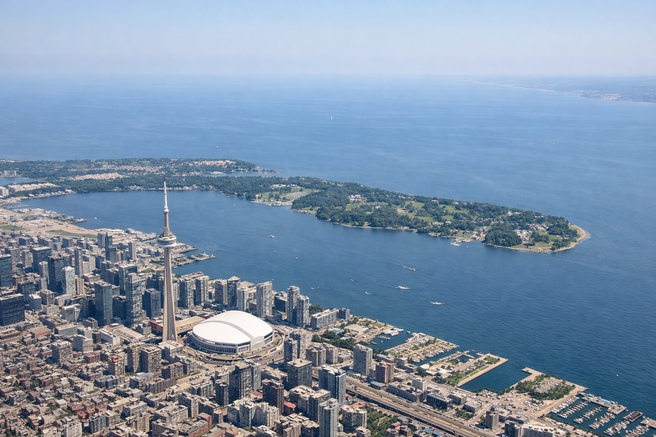
Takeoff from YYZ
LEFTDeparting YYZ heading northwest then over the Great Lakes region, the left side offers views of Toronto's skyline and Lake Ontario shoreline before the route curves toward northern Ontario's lake-studded Canadian Shield. The right side mostly shows suburban sprawl receding into flat farmland.
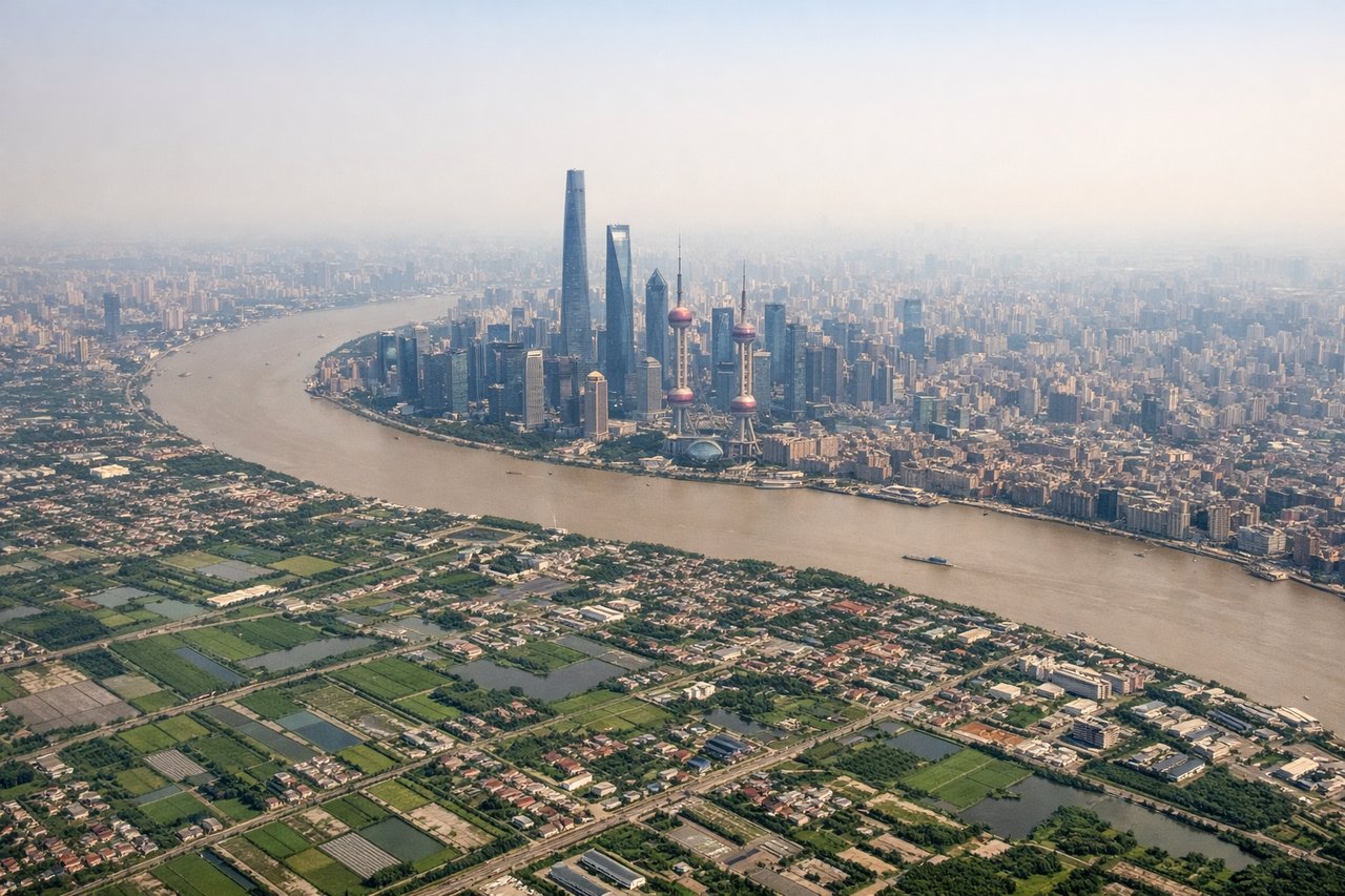
Landing at PVG
LEFTOn approach to PVG from the east over the East China Sea, the left side reveals the intricate delta geography of the Yangtze River mouth and Shanghai's dense urban sprawl including the Huangpu River winding through the city. The right side shows mostly open water and flat coastal wetlands with less definition.
Landmarks on this routeAll landmarks →
Will your flight be in sunlight?
See exactly which side of the plane gets sun and shade at your departure time.
About This Route
Which side of the plane should I sit on flying from Lester B Pearson International (YYZ) to Shanghai Pudong International (PVG)?
Sit on the Left side of the plane for the best views on flights from Toronto to Shanghai. The left side wins on both ends: a scenic Toronto skyline and Great Lakes departure, plus a geographically interesting Yangtze delta and Shanghai urban approach, while the right side is dominated by featureless farmland and open ocean for most of the flight.
What can I see during takeoff from Lester B Pearson International in Toronto?
During takeoff from Lester B Pearson International (YYZ), sit on the Left side for the best views. Departing YYZ heading northwest then over the Great Lakes region, the left side offers views of Toronto's skyline and Lake Ontario shoreline before the route curves toward northern Ontario's lake-studded Canadian Shield. The right side mostly shows suburban sprawl receding into flat farmland. Notable sights include: Toronto skyline and CN Tower, Lake Ontario shoreline, Canadian Shield lakes near Sudbury/North Bay region.
What can I see when landing at Shanghai Pudong International in Shanghai?
When landing at Shanghai Pudong International (PVG), sit on the Left side for the best views. On approach to PVG from the east over the East China Sea, the left side reveals the intricate delta geography of the Yangtze River mouth and Shanghai's dense urban sprawl including the Huangpu River winding through the city. The right side shows mostly open water and flat coastal wetlands with less definition. Notable sights include: Yangtze River estuary, Huangpu River, Shanghai's dense urban grid, Chongming Island.
How long is the flight from Toronto to Shanghai?
The flight from Lester B Pearson International (YYZ) to Shanghai Pudong International (PVG) takes 14h 40m.
What does the Toronto to Shanghai flight path pass over?
The route crosses northern Canada's Hudson Bay lowlands, the vast taiga and tundra of Siberia, Lake Baikal region, and the Gobi Desert before descending into eastern China — almost entirely over remote, sparsely visible terrain with few recognizable landmarks at cruising altitude.