While takeoff offers brief Lake Ontario views on the right, the landing approach provides sustained, dramatic scenery of the volcanic Windward Islands and Caribbean waters. Left-side seats capture the most visually distinctive portion of the flight—the final descent over Saint Vincent's mountainous terrain and the Grenadines.
Flown YYZ to SVD? Did we get it right?
Flight Path
Toronto to Kingstown is 2,376 miles (3,824 km), a flight of about 4 hours 45 minutes.
The flight path crosses the Atlantic Ocean southeastward. Notable geographic features include the Appalachian Mountains (visible during early climb if weather permits, far left-north), the U.S. East Coast (receding left during climb), and the open Atlantic. The mid-Atlantic crossing offers no major landmarks—primarily open ocean. As the aircraft approaches the Caribbean, the island chain of the Lesser Antilles becomes visible on the left, including Dominica, Martinique, and Saint Lucia before reaching Saint Vincent.
Great circle distance and headings ›


Phase by phase
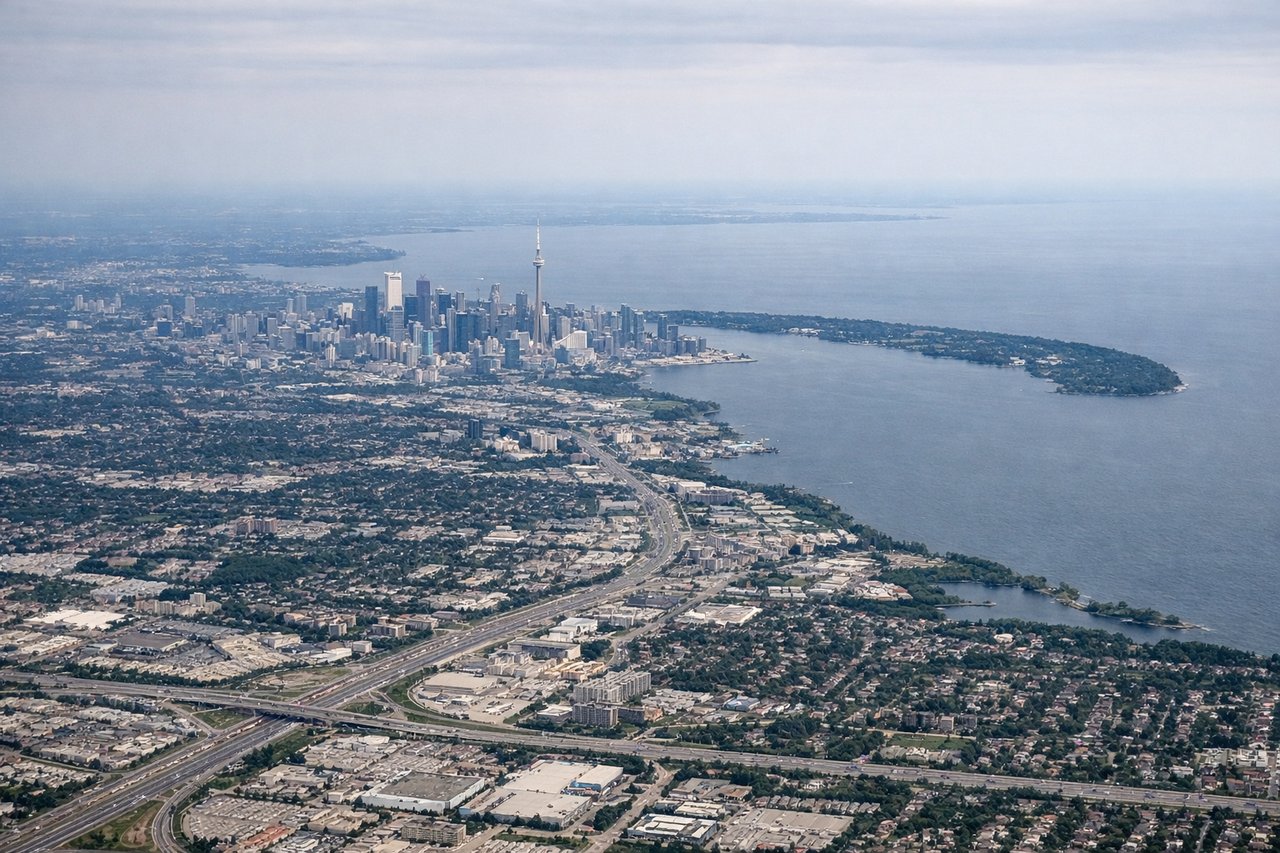
Takeoff from YYZ
RIGHTRight-side seats offer views of Lake Ontario and the Greater Toronto Area sprawl during initial climb. The aircraft departs eastbound over water, giving right-side passengers clear sightlines to the lake's northern shoreline and the city's eastern suburbs before turning south.
Landing at SVD
LEFTLeft-side seats provide the best views during descent into Saint Vincent. The aircraft approaches from the north, and left-side passengers see the Grenadines island chain, the Windward Islands' volcanic peaks, and the Caribbean Sea. The final approach over the island's western coast offers views of Kingstown harbor and the surrounding terrain.
Will your flight be in sunlight?
Pick a date and time in the Sun Map to watch the sun move across your whole flight.
About This Route
Which side of the plane should I sit on flying from Lester B Pearson International (YYZ) to Argyle International Airport (SVD)?
Sit on the Left side of the plane for the best views on flights from Toronto to Kingstown. While takeoff offers brief Lake Ontario views on the right, the landing approach provides sustained, dramatic scenery of the volcanic Windward Islands and Caribbean waters. Left-side seats capture the most visually distinctive portion of the flight—the final descent over Saint Vincent's mountainous terrain and the Grenadines.
What can I see during takeoff from Lester B Pearson International in Toronto?
During takeoff from Lester B Pearson International (YYZ), sit on the Right side for the best views. Right-side seats offer views of Lake Ontario and the Greater Toronto Area sprawl during initial climb. The aircraft departs eastbound over water, giving right-side passengers clear sightlines to the lake's northern shoreline and the city's eastern suburbs before turning south. Notable sights include: Lake Ontario (immediate right, north shore), Toronto downtown skyline (left-center distance), Scarborough Bluffs (right, receding eastward), Oak Ridges Moraine (far left, north).
What can I see when landing at Argyle International Airport in Kingstown?
When landing at Argyle International Airport (SVD), sit on the Left side for the best views. Left-side seats provide the best views during descent into Saint Vincent. The aircraft approaches from the north, and left-side passengers see the Grenadines island chain, the Windward Islands' volcanic peaks, and the Caribbean Sea. The final approach over the island's western coast offers views of Kingstown harbor and the surrounding terrain. Notable sights include: Saint Vincent's volcanic ridgeline (left, dominant), Bequia Island (left-center distance), Mustique Island (left-far distance), Caribbean Sea (right and below).
How long is the flight from Toronto to Kingstown?
The flight from Lester B Pearson International (YYZ) to Argyle International Airport (SVD) takes about 4 hours 45 minutes. The shortest flight path between them is 2,376 miles (3,824 km); winds and air traffic control usually add a few percent.
What does the Toronto to Kingstown flight path pass over?
The flight path crosses the Atlantic Ocean southeastward. Notable geographic features include the Appalachian Mountains (visible during early climb if weather permits, far left-north), the U.S. East Coast (receding left during climb), and the open Atlantic. The mid-Atlantic crossing offers no major landmarks—primarily open ocean. As the aircraft approaches the Caribbean, the island chain of the Lesser Antilles becomes visible on the left, including Dominica, Martinique, and Saint Lucia before reaching Saint Vincent.