Toronto to Edmonton is 1,671 miles (2,689 km), a flight of about 4 hours 5 minutes.
The right side captures the two most visually distinct moments of the flight: Toronto's skyline and lakefront during the departure turn, and Edmonton's river valley and downtown cluster on arrival. The left side mostly faces open farmland and boreal forest with fewer defining features.
Flight Path
The route crosses the Canadian Shield's lake-studded boreal forest of northern Ontario and Manitoba, passing north of Lake Superior, before transitioning into the flat, grid-patterned farmland of the Saskatchewan and Alberta prairies as it nears Edmonton.
Great circle distance and headings ›Phase by phase
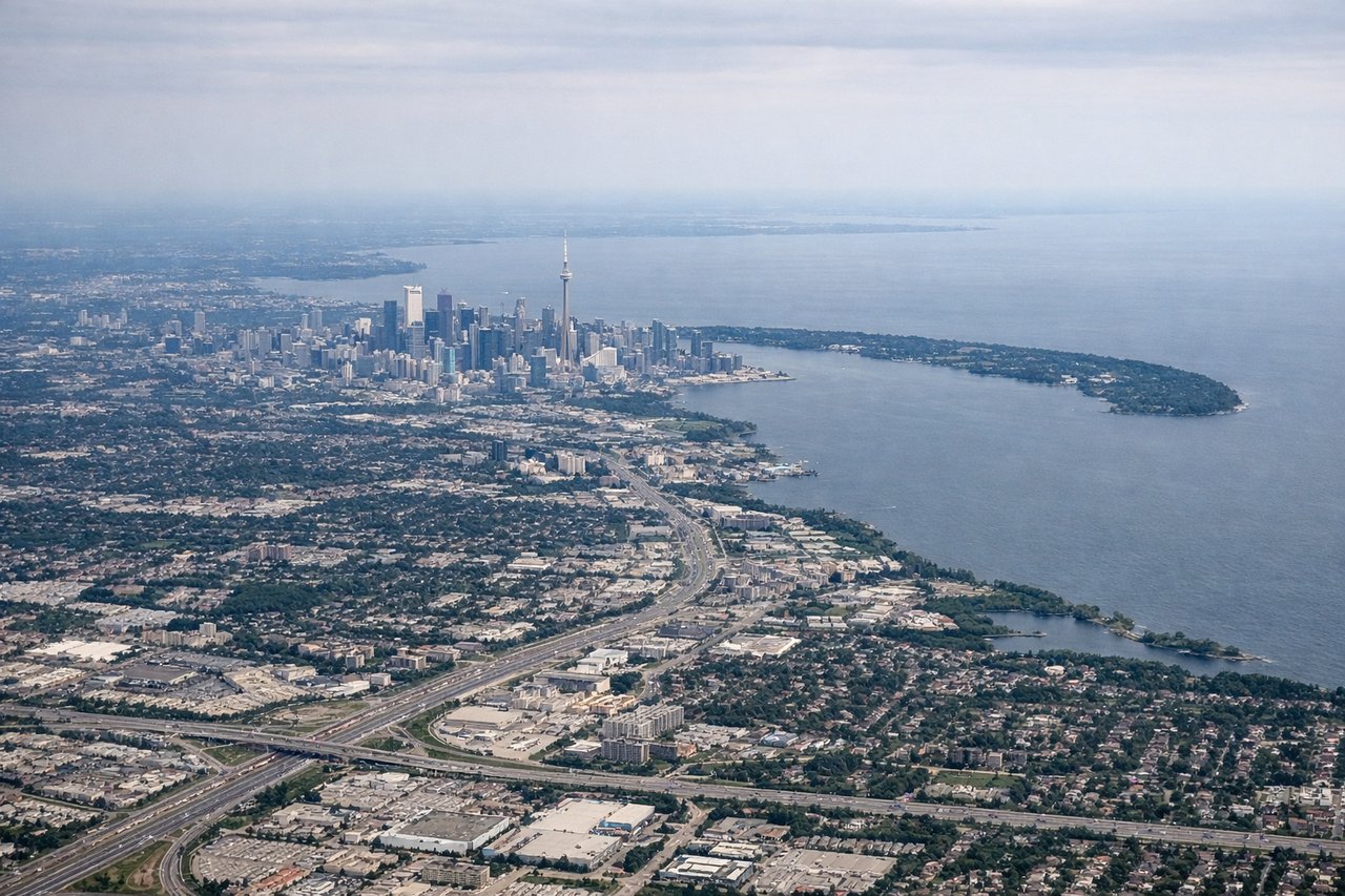
Takeoff from YYZ
RIGHTWestbound departures from YYZ typically use runway 23/24L, climbing southwest before banking right onto a northwesterly heading toward Edmonton. That right-hand turn tips the wing toward downtown Toronto and Lake Ontario, giving right-side passengers a brief but clear look at the skyline and harbor before the plane straightens out over the Ontario countryside.
Landing at YEG
RIGHTArriving from the east, aircraft inbound to YEG's runway 20 typically swing around the north and east side of the city before turning onto final, putting downtown Edmonton and the North Saskatchewan River valley on the right side during the turn. The flat farmland surrounding the airport offers little else, so this brief city/river view is the visual highlight of the approach.
Landmarks on this routeAll landmarks →
Will your flight be in sunlight?
Pick a date and time in the Sun Map to watch the sun move across your whole flight.
About This Route
Which side of the plane should I sit on flying from Lester B Pearson International (YYZ) to Edmonton International (YEG)?
Sit on the Right side of the plane for the best views on flights from Toronto to Edmonton. The right side captures the two most visually distinct moments of the flight: Toronto's skyline and lakefront during the departure turn, and Edmonton's river valley and downtown cluster on arrival. The left side mostly faces open farmland and boreal forest with fewer defining features.
What can I see during takeoff from Lester B Pearson International in Toronto?
During takeoff from Lester B Pearson International (YYZ), sit on the Right side for the best views. Westbound departures from YYZ typically use runway 23/24L, climbing southwest before banking right onto a northwesterly heading toward Edmonton. That right-hand turn tips the wing toward downtown Toronto and Lake Ontario, giving right-side passengers a brief but clear look at the skyline and harbor before the plane straightens out over the Ontario countryside. Notable sights include: CN Tower and downtown Toronto skyline, Toronto Islands, Lake Ontario shoreline, Pearson's parallel runway complex below.
What can I see when landing at Edmonton International in Edmonton?
When landing at Edmonton International (YEG), sit on the Right side for the best views. Arriving from the east, aircraft inbound to YEG's runway 20 typically swing around the north and east side of the city before turning onto final, putting downtown Edmonton and the North Saskatchewan River valley on the right side during the turn. The flat farmland surrounding the airport offers little else, so this brief city/river view is the visual highlight of the approach. Notable sights include: North Saskatchewan River valley, downtown Edmonton skyline, river bridges, patchwork farmland surrounding the airport.
How long is the flight from Toronto to Edmonton?
The flight from Lester B Pearson International (YYZ) to Edmonton International (YEG) takes about 4 hours 5 minutes. The shortest flight path between them is 1,671 miles (2,689 km); winds and air traffic control usually add a few percent.
What does the Toronto to Edmonton flight path pass over?
The route crosses the Canadian Shield's lake-studded boreal forest of northern Ontario and Manitoba, passing north of Lake Superior, before transitioning into the flat, grid-patterned farmland of the Saskatchewan and Alberta prairies as it nears Edmonton.