Toronto to Kelowna is 1,905 miles (3,066 km), a flight of about 4 hours 15 minutes.
Right side wins overall because takeoff views over Lake Ontario and the GTA are more dramatic and sustained than landing views. However, left side during descent offers excellent Okanagan Lake scenery. Right edges out left for the full journey.
Flight Path
The flight path crosses the Canadian Shield and Great Lakes region, then transitions into the agricultural belt of southwestern Ontario (visible around 1.5 hours out). By midpoint, you're over the transition zone between the Shield and the prairie, with scattered lakes and boreal forest. The final hour approaches the Rocky Mountain foothills and interior plateau of British Columbia, with increasing elevation and more dramatic terrain. Notable water features include the Great Lakes system on departure, and various smaller lakes scattered across Ontario and into the prairies. The landscape gradually transitions from dense urban/agricultural to increasingly forested and mountainous terrain as you move westward.
Great circle distance and headings ›

Phase by phase
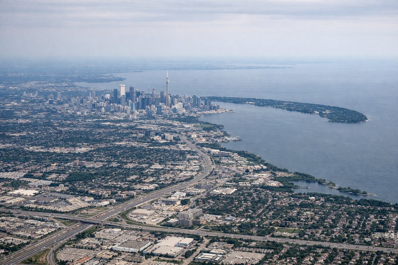
Takeoff from YYZ
RIGHTRight-side seats capture the initial climb over Lake Ontario and the Greater Toronto Area sprawl. You'll see the shoreline receding and the urban grid of Toronto and surrounding municipalities spread below before the aircraft turns westward.
Landing at YLW
LEFTLeft-side seats provide the best views during descent into Kelowna. You'll see Okanagan Lake in full, the valley floor, and the surrounding interior plateau landscape. The approach typically comes from the north or northeast, making the left side ideal for viewing the lake and surrounding terrain.
Landmarks on this routeAll landmarks →
Will your flight be in sunlight?
Pick a date and time in the Sun Map to watch the sun move across your whole flight.
About This Route
Which side of the plane should I sit on flying from Lester B Pearson International (YYZ) to Kelowna (YLW)?
Sit on the Right side of the plane for the best views on flights from Toronto to Kelowna. Right side wins overall because takeoff views over Lake Ontario and the GTA are more dramatic and sustained than landing views. However, left side during descent offers excellent Okanagan Lake scenery. Right edges out left for the full journey.
What can I see during takeoff from Lester B Pearson International in Toronto?
During takeoff from Lester B Pearson International (YYZ), sit on the Right side for the best views. Right-side seats capture the initial climb over Lake Ontario and the Greater Toronto Area sprawl. You'll see the shoreline receding and the urban grid of Toronto and surrounding municipalities spread below before the aircraft turns westward. Notable sights include: Lake Ontario (immediate south), Toronto downtown core and surrounding urban areas, Scarborough Bluffs (eastern lakeshore), Hamilton area to the southwest.
What can I see when landing at Kelowna in Kelowna?
When landing at Kelowna (YLW), sit on the Left side for the best views. Left-side seats provide the best views during descent into Kelowna. You'll see Okanagan Lake in full, the valley floor, and the surrounding interior plateau landscape. The approach typically comes from the north or northeast, making the left side ideal for viewing the lake and surrounding terrain. Notable sights include: Okanagan Lake (dominant feature), Kelowna city on the western shore, surrounding semi-arid plateau and grasslands, distant mountain ridges of the Okanagan Highlands.
How long is the flight from Toronto to Kelowna?
The flight from Lester B Pearson International (YYZ) to Kelowna (YLW) takes about 4 hours 15 minutes. The shortest flight path between them is 1,905 miles (3,066 km); winds and air traffic control usually add a few percent.
What does the Toronto to Kelowna flight path pass over?
The flight path crosses the Canadian Shield and Great Lakes region, then transitions into the agricultural belt of southwestern Ontario (visible around 1.5 hours out). By midpoint, you're over the transition zone between the Shield and the prairie, with scattered lakes and boreal forest. The final hour approaches the Rocky Mountain foothills and interior plateau of British Columbia, with increasing elevation and more dramatic terrain. Notable water features include the Great Lakes system on departure, and various smaller lakes scattered across Ontario and into the prairies. The landscape gradually transitions from dense urban/agricultural to increasingly forested and mountainous terrain as you move westward.