The right side delivers the most dramatic single moment of the flight — the Toronto skyline and Lake Ontario panorama on departure. The landing views on the left are excellent but the city is smaller and the approach is shorter. Right side wins overall for the takeoff spectacle alone.
Flown YYZ to YOW? Did we get it right?
Flight Path
Toronto to Ottawa is 226 miles (363 km), a flight of about 55 minutes.
The flight tracks northeast over the Oak Ridges Moraine north of Toronto, then crosses the Trent-Severn watershed region with numerous small lakes and rivers visible below. The Canadian Shield becomes apparent as you approach the Ottawa Valley, with exposed Precambrian rock, boreal forest, and the upper reaches of the Madawaska and Mississippi rivers (Ontario) visible. The Ottawa River valley opens up in the final descent.
Great circle distance and headings ›Phase by phase
Takeoff from YYZ
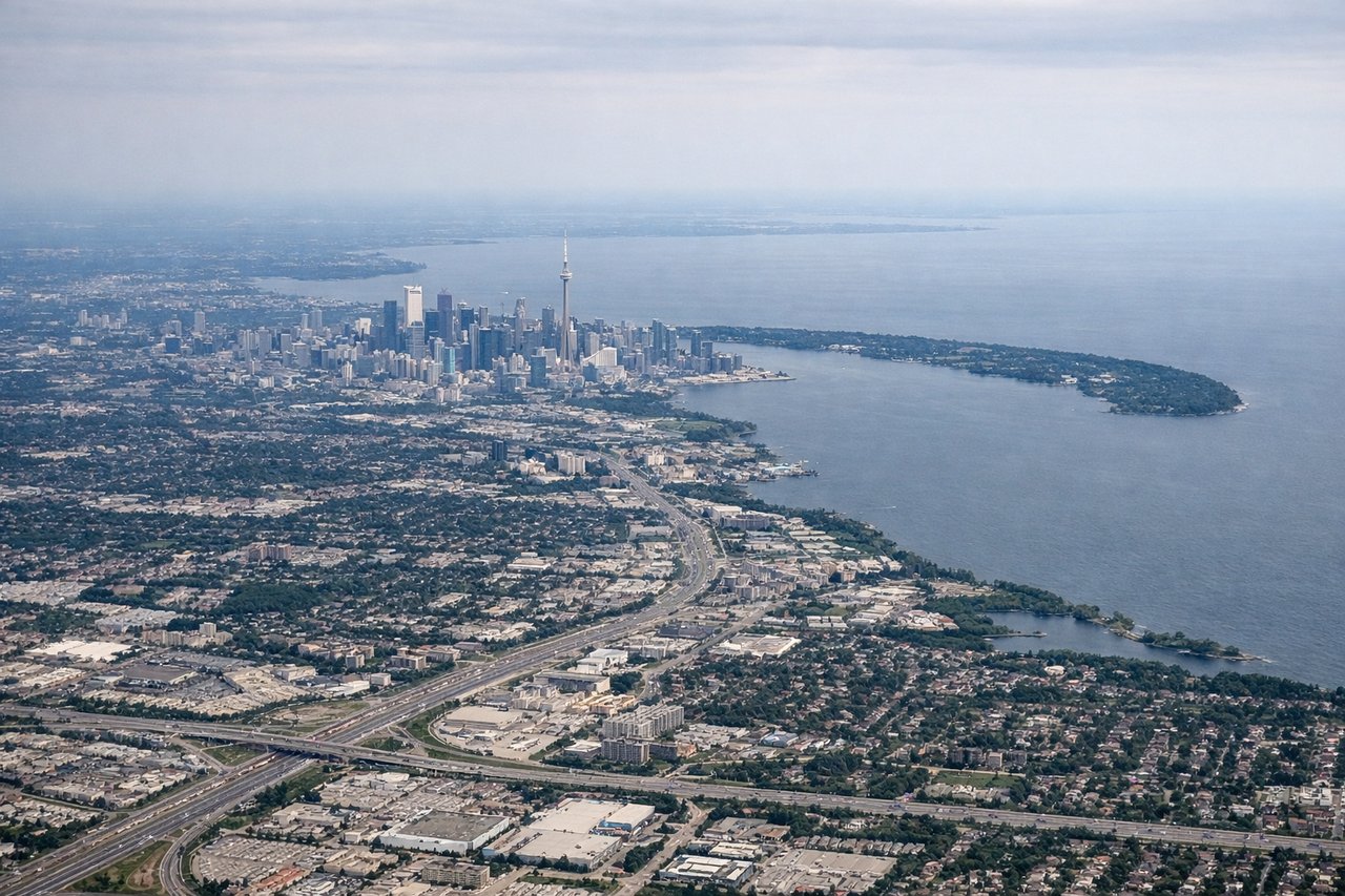
RIGHTYYZ's most common departures on runways 23 or 24L/R head southwest initially before turning northeast toward Ottawa, putting the right side facing southeast toward downtown Toronto, Lake Ontario, and the Toronto Islands. You get a clear view of the CN Tower and the city skyline as you climb out.
Landing at YOW
LEFTOttawa Macdonald-Cartier typically uses runway 07 for arrivals from the west, meaning the approach track runs roughly west to east. The left side faces north, giving a clear view of the Ottawa River, Gatineau across the river, and the Parliament Hill complex as you descend into the city.
Will your flight be in sunlight?
Pick a date and time in the Sun Map to watch the sun move across your whole flight.
About This Route
Which side of the plane should I sit on flying from Lester B Pearson International (YYZ) to Ottawa Macdonald Cartier International (YOW)?
Sit on the Right side of the plane for the best views on flights from Toronto to Ottawa. The right side delivers the most dramatic single moment of the flight — the Toronto skyline and Lake Ontario panorama on departure. The landing views on the left are excellent but the city is smaller and the approach is shorter. Right side wins overall for the takeoff spectacle alone.
What can I see during takeoff from Lester B Pearson International in Toronto?
During takeoff from Lester B Pearson International (YYZ), sit on the Right side for the best views. YYZ's most common departures on runways 23 or 24L/R head southwest initially before turning northeast toward Ottawa, putting the right side facing southeast toward downtown Toronto, Lake Ontario, and the Toronto Islands. You get a clear view of the CN Tower and the city skyline as you climb out. Notable sights include: CN Tower and downtown Toronto skyline, Toronto Islands and Billy Bishop Airport, Lake Ontario shoreline, Scarborough Bluffs to the east.
What can I see when landing at Ottawa Macdonald Cartier International in Ottawa?
When landing at Ottawa Macdonald Cartier International (YOW), sit on the Left side for the best views. Ottawa Macdonald-Cartier typically uses runway 07 for arrivals from the west, meaning the approach track runs roughly west to east. The left side faces north, giving a clear view of the Ottawa River, Gatineau across the river, and the Parliament Hill complex as you descend into the city. Notable sights include: Ottawa River, Parliament Hill and Centre Block, Gatineau Hills to the north, Rideau Canal corridor.
How long is the flight from Toronto to Ottawa?
The flight from Lester B Pearson International (YYZ) to Ottawa Macdonald Cartier International (YOW) takes about 55 minutes. The shortest flight path between them is 226 miles (363 km); winds and air traffic control usually add a few percent.
What does the Toronto to Ottawa flight path pass over?
The flight tracks northeast over the Oak Ridges Moraine north of Toronto, then crosses the Trent-Severn watershed region with numerous small lakes and rivers visible below. The Canadian Shield becomes apparent as you approach the Ottawa Valley, with exposed Precambrian rock, boreal forest, and the upper reaches of the Madawaska and Mississippi rivers (Ontario) visible. The Ottawa River valley opens up in the final descent.