Toronto to Windsor is 194 miles (312 km), a flight of about 45 minutes.
The Detroit River crossing and simultaneous view of two major international cities on final approach into Windsor is the single most dramatic visual moment of this short flight. The right seat delivers that payoff clearly, and also captures Lake Erie's north shore and the Lake St. Clair region during the cruise portion of the flight.
Flight Path
The flight tracks southwest over the flat agricultural landscape of southwestern Ontario, passing over or near Hamilton and Brantford, then crossing the Grand River valley. Lake Erie's north shore becomes visible to the south as you approach Windsor, and Lake St. Clair appears to the north near the destination. The terrain is uniformly flat with a patchwork of farm fields throughout.
Great circle distance and headings ›
Phase by phase
Takeoff from YYZ
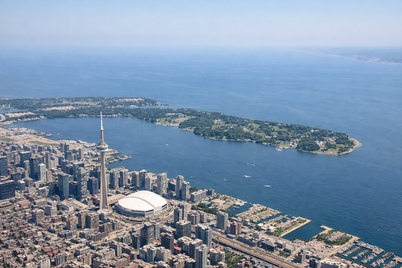
LEFTDeparting YYZ, aircraft typically use runways oriented east-west or northeast-southwest. A left-side seat during westbound departure gives you a clear view south over the city of Mississauga and Lake Ontario's north shore, with the Toronto skyline visible to the east as you climb out. The CN Tower and downtown core are distinctly identifiable against the lake backdrop.
Landing at YQG
RIGHTApproaching YQG from the east, aircraft typically fly a westward approach over the Detroit River corridor. The right side gives you a direct view of the Detroit River, the city of Windsor below, and across the river the Detroit skyline in Michigan, which is one of the most striking cross-border urban views in Canada. Ambassador Bridge is also visible spanning the river.
Landmarks on this routeAll landmarks →
Will your flight be in sunlight?
Pick a date and time in the Sun Map to watch the sun move across your whole flight.
About This Route
Which side of the plane should I sit on flying from Lester B Pearson International (YYZ) to Windsor (YQG)?
Sit on the Right side of the plane for the best views on flights from Toronto to Windsor. The Detroit River crossing and simultaneous view of two major international cities on final approach into Windsor is the single most dramatic visual moment of this short flight. The right seat delivers that payoff clearly, and also captures Lake Erie's north shore and the Lake St. Clair region during the cruise portion of the flight.
What can I see during takeoff from Lester B Pearson International in Toronto?
During takeoff from Lester B Pearson International (YYZ), sit on the Left side for the best views. Departing YYZ, aircraft typically use runways oriented east-west or northeast-southwest. A left-side seat during westbound departure gives you a clear view south over the city of Mississauga and Lake Ontario's north shore, with the Toronto skyline visible to the east as you climb out. The CN Tower and downtown core are distinctly identifiable against the lake backdrop. Notable sights include: Toronto downtown skyline and CN Tower to the east, Lake Ontario shoreline stretching southwest, Mississauga urban grid below, Pearson airport complex receding behind.
What can I see when landing at Windsor in Windsor?
When landing at Windsor (YQG), sit on the Right side for the best views. Approaching YQG from the east, aircraft typically fly a westward approach over the Detroit River corridor. The right side gives you a direct view of the Detroit River, the city of Windsor below, and across the river the Detroit skyline in Michigan, which is one of the most striking cross-border urban views in Canada. Ambassador Bridge is also visible spanning the river. Notable sights include: Detroit River running north-south below, Windsor urban core directly beneath, Detroit skyline across the river in Michigan, Ambassador Bridge connecting the two cities.
How long is the flight from Toronto to Windsor?
The flight from Lester B Pearson International (YYZ) to Windsor (YQG) takes about 45 minutes. The shortest flight path between them is 194 miles (312 km); winds and air traffic control usually add a few percent.
What does the Toronto to Windsor flight path pass over?
The flight tracks southwest over the flat agricultural landscape of southwestern Ontario, passing over or near Hamilton and Brantford, then crossing the Grand River valley. Lake Erie's north shore becomes visible to the south as you approach Windsor, and Lake St. Clair appears to the north near the destination. The terrain is uniformly flat with a patchwork of farm fields throughout.