While takeoff offers decent boreal scenery, the landing approach into Seattle provides superior views of the Cascade Range, Puget Sound, and San Juan Islands—more dramatic and visually distinctive geography than the departure from Yellowknife.
Flown YZF to SEA? Did we get it right?
Flight Path
Yellowknife to Seattle is 1,082 miles (1,741 km), a flight of about 3 hours 15 minutes.
Northern British Columbia wilderness (boreal forest and lakes), the Rocky Mountains as you pass near the British Columbia-Alberta border, the interior plateau of British Columbia with scattered peaks and valleys, transition from northern forest to temperate rainforest as you approach the Pacific Northwest
Great circle distance and headings ›

Phase by phase
Takeoff from YZF
RIGHTRight-side seats capture the Yellowknife area and the northern boreal landscape as you climb out. You'll see the city nestled on the north shore of Yellowknife Bay and the surrounding taiga forest stretching toward the horizon.
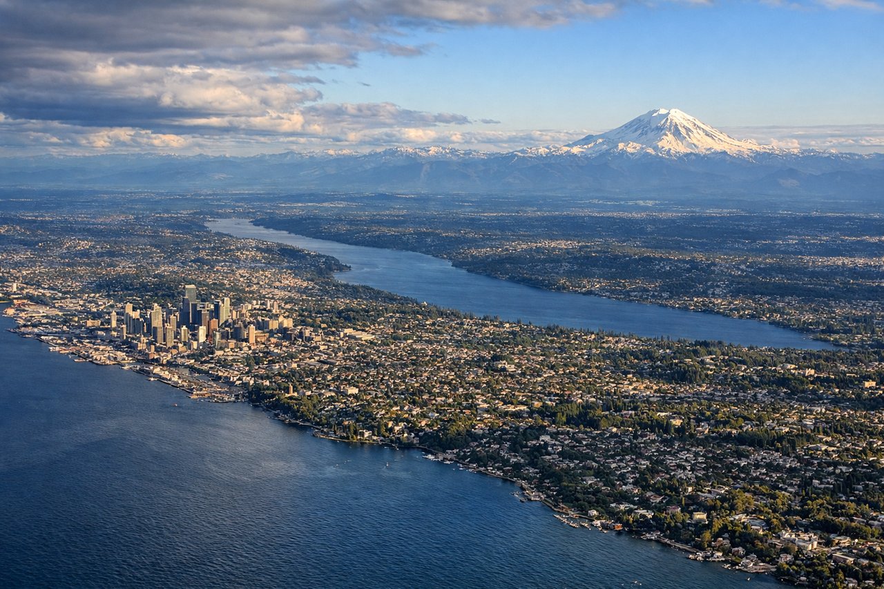
Landing at SEA
LEFTLeft-side seats offer the best views during descent into Seattle. You'll see the Cascade Range dominating the eastern horizon, then the Puget Sound and its islands as you approach, with the Olympic Mountains visible to the west across the water.
Will your flight be in sunlight?
Pick a date and time in the Sun Map to watch the sun move across your whole flight.
About This Route
Which side of the plane should I sit on flying from Yellowknife (YZF) to Seattle Tacoma International (SEA)?
Sit on the Left side of the plane for the best views on flights from Yellowknife to Seattle. While takeoff offers decent boreal scenery, the landing approach into Seattle provides superior views of the Cascade Range, Puget Sound, and San Juan Islands—more dramatic and visually distinctive geography than the departure from Yellowknife.
What can I see during takeoff from Yellowknife in Yellowknife?
During takeoff from Yellowknife (YZF), sit on the Right side for the best views. Right-side seats capture the Yellowknife area and the northern boreal landscape as you climb out. You'll see the city nestled on the north shore of Yellowknife Bay and the surrounding taiga forest stretching toward the horizon. Notable sights include: Yellowknife Bay, Yellowknife city and harbor, boreal forest and tundra transition zone, Great Slave Lake (visible to the south as you gain altitude).
What can I see when landing at Seattle Tacoma International in Seattle?
When landing at Seattle Tacoma International (SEA), sit on the Left side for the best views. Left-side seats offer the best views during descent into Seattle. You'll see the Cascade Range dominating the eastern horizon, then the Puget Sound and its islands as you approach, with the Olympic Mountains visible to the west across the water. Notable sights include: Cascade Range (snow-capped peaks including Mount Rainier visible on clear days), Puget Sound with San Juan Islands, Olympic Mountains across the sound, Seattle metropolitan area and Elliott Bay.
How long is the flight from Yellowknife to Seattle?
The flight from Yellowknife (YZF) to Seattle Tacoma International (SEA) takes about 3 hours 15 minutes. The shortest flight path between them is 1,082 miles (1,741 km); winds and air traffic control usually add a few percent.
What does the Yellowknife to Seattle flight path pass over?
Northern British Columbia wilderness (boreal forest and lakes), the Rocky Mountains as you pass near the British Columbia-Alberta border, the interior plateau of British Columbia with scattered peaks and valleys, transition from northern forest to temperate rainforest as you approach the Pacific Northwest