The takeoff view from Queenstown's Southern Alps is more dramatic and sustained than the landing approach. While Bankstown's left-side views of the Blue Mountains are notable, the alpine scenery during departure from Queenstown is more visually distinctive and geographically significant.
Flown ZQN to BWU? Did we get it right?
Flight Path
Queenstown International to Sydney is 1,214 miles (1,953 km), a flight of about 3 hours 15 minutes.
The flight crosses the Tasman Sea at roughly 35,000 feet. Notable geographic transition: departing the Southern Alps and Lake Wakatipu, the route crosses the South Island's west coast near Milford Sound region, then traverses open ocean. On approach to Sydney, the flight passes over the Hawkesbury River system and crosses the Blue Mountains escarpment, descending over the Cumberland Plain toward Bankstown in western Sydney.
Great circle distance and headings ›


Phase by phase
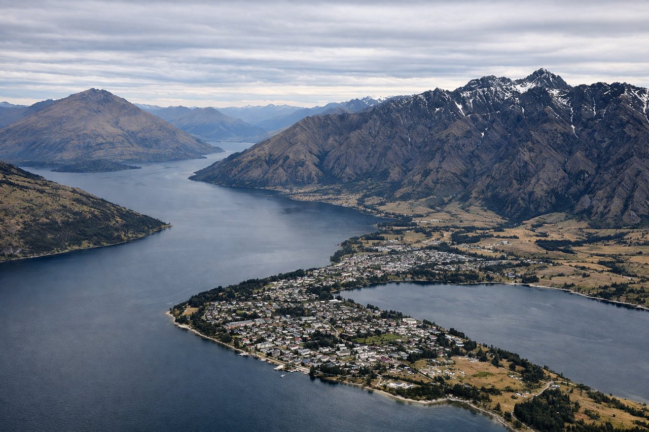
Takeoff from ZQN
RIGHTQueenstown typically departs runway 23 (southwest heading). Right-side seats face the Southern Alps and Lake Wakatipu immediately after rotation, with the dramatic peaks of Ben Lomond and Cecil Peak dominating the initial climb.
Landing at BWU
LEFTBankstown typically uses runway 29 (northwest approach). Left-side seats provide views of Sydney's western suburbs, the Nepean River valley, and the Blue Mountains escarpment during descent. The approach path crosses over Penrith and the Hawkesbury River system.
Will your flight be in sunlight?
Pick a date and time in the Sun Map to watch the sun move across your whole flight.
About This Route
Which side of the plane should I sit on flying from Queenstown (ZQN) to Sydney Bankstown (BWU)?
Sit on the Right side of the plane for the best views on flights from Queenstown International to Sydney. The takeoff view from Queenstown's Southern Alps is more dramatic and sustained than the landing approach. While Bankstown's left-side views of the Blue Mountains are notable, the alpine scenery during departure from Queenstown is more visually distinctive and geographically significant.
What can I see during takeoff from Queenstown in Queenstown International?
During takeoff from Queenstown (ZQN), sit on the Right side for the best views. Queenstown typically departs runway 23 (southwest heading). Right-side seats face the Southern Alps and Lake Wakatipu immediately after rotation, with the dramatic peaks of Ben Lomond and Cecil Peak dominating the initial climb. Notable sights include: Lake Wakatipu (long alpine lake directly below), Southern Alps ridgeline, Ben Lomond (3,100m peak), Cecil Peak.
What can I see when landing at Sydney Bankstown in Sydney?
When landing at Sydney Bankstown (BWU), sit on the Left side for the best views. Bankstown typically uses runway 29 (northwest approach). Left-side seats provide views of Sydney's western suburbs, the Nepean River valley, and the Blue Mountains escarpment during descent. The approach path crosses over Penrith and the Hawkesbury River system. Notable sights include: Blue Mountains escarpment (western horizon), Nepean River valley, Penrith Lakes, Sydney's western sprawl.
How long is the flight from Queenstown International to Sydney?
The flight from Queenstown (ZQN) to Sydney Bankstown (BWU) takes about 3 hours 15 minutes. The shortest flight path between them is 1,214 miles (1,953 km); winds and air traffic control usually add a few percent.
What does the Queenstown International to Sydney flight path pass over?
The flight crosses the Tasman Sea at roughly 35,000 feet. Notable geographic transition: departing the Southern Alps and Lake Wakatipu, the route crosses the South Island's west coast near Milford Sound region, then traverses open ocean. On approach to Sydney, the flight passes over the Hawkesbury River system and crosses the Blue Mountains escarpment, descending over the Cumberland Plain toward Bankstown in western Sydney.