The Queenstown departure offers more dramatic and sustained scenic value. The Southern Alps and Lake Wakatipu provide immediate, striking visual impact during takeoff and early climb. While Singapore's approach is urban-scenic, the majority of the 7+ hour flight crosses open ocean with minimal visual interest on either side. The left side's advantage comes from the exceptional quality of the departure sequence, which outweighs the right side's superior landing experience.
Flown ZQN to SIN? Did we get it right?
Flight Path
Queenstown International to Singapore is 5,075 miles (8,168 km), a flight of about 10 hours.
The flight path crosses the Tasman Sea (open ocean, minimal landmarks), passes east of Australia's east coast (typically at night or during cruise at 35,000+ feet where coastal detail is minimal), crosses the Coral Sea north of Australia, and approaches Southeast Asia over the Andaman Sea and Strait of Malacca. No major mountain ranges or distinctive landmarks are visible during the 5+ hour cruise phase over open water.
Great circle distance and headings ›


Phase by phase
Takeoff from ZQN
LEFTLeft side captures the dramatic Southern Alps and Lake Wakatipu during climb-out from Queenstown. The mountains rise steeply from the airport, creating immediate visual impact as the aircraft banks northeast or southwest depending on runway direction.
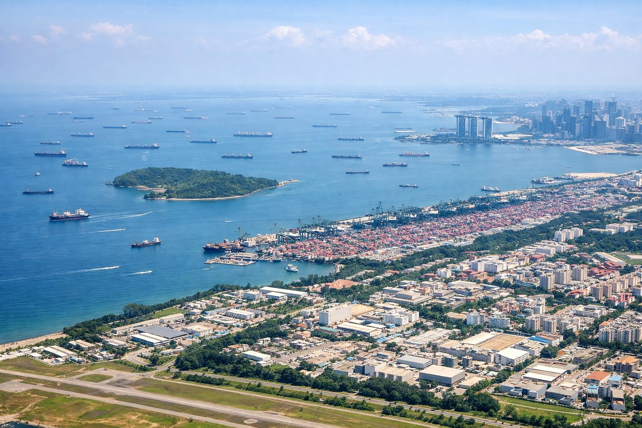
Landing at SIN
RIGHTRight side offers superior approach views into Singapore Changi. The descent path over the Strait of Malacca and approach to the island reveals the Singapore cityscape, harbor infrastructure, and the transition from open water to the densely developed urban landscape of the island.
Will your flight be in sunlight?
Pick a date and time in the Sun Map to watch the sun move across your whole flight.
About This Route
Which side of the plane should I sit on flying from Queenstown (ZQN) to Singapore Changi (SIN)?
Sit on the Left side of the plane for the best views on flights from Queenstown International to Singapore. The Queenstown departure offers more dramatic and sustained scenic value. The Southern Alps and Lake Wakatipu provide immediate, striking visual impact during takeoff and early climb. While Singapore's approach is urban-scenic, the majority of the 7+ hour flight crosses open ocean with minimal visual interest on either side. The left side's advantage comes from the exceptional quality of the departure sequence, which outweighs the right side's superior landing experience.
What can I see during takeoff from Queenstown in Queenstown International?
During takeoff from Queenstown (ZQN), sit on the Left side for the best views. Left side captures the dramatic Southern Alps and Lake Wakatipu during climb-out from Queenstown. The mountains rise steeply from the airport, creating immediate visual impact as the aircraft banks northeast or southwest depending on runway direction. Notable sights include: Lake Wakatipu (long alpine lake directly adjacent to airport), The Remarkables mountain range (jagged peaks south of airport), Cecil Peak and Walter Peak (prominent summits flanking the lake).
What can I see when landing at Singapore Changi in Singapore?
When landing at Singapore Changi (SIN), sit on the Right side for the best views. Right side offers superior approach views into Singapore Changi. The descent path over the Strait of Malacca and approach to the island reveals the Singapore cityscape, harbor infrastructure, and the transition from open water to the densely developed urban landscape of the island. Notable sights include: Strait of Malacca (shipping lanes and open water), Singapore Harbor and container terminals (Port of Singapore), Sentosa Island and southern Singapore coastline, Marina Bay and central business district skyline.
How long is the flight from Queenstown International to Singapore?
The flight from Queenstown (ZQN) to Singapore Changi (SIN) takes about 10 hours. The shortest flight path between them is 5,075 miles (8,168 km); winds and air traffic control usually add a few percent.
What does the Queenstown International to Singapore flight path pass over?
The flight path crosses the Tasman Sea (open ocean, minimal landmarks), passes east of Australia's east coast (typically at night or during cruise at 35,000+ feet where coastal detail is minimal), crosses the Coral Sea north of Australia, and approaches Southeast Asia over the Andaman Sea and Strait of Malacca. No major mountain ranges or distinctive landmarks are visible during the 5+ hour cruise phase over open water.