The left side delivers a continuous scenic arc: Southern Alps and Lake Wakatipu during departure, a distant view of the Alps' northern reaches during cruise, and Wellington's harbour and city skyline on arrival. The right side offers decent but shorter-lived views of the Remarkables and Cook Strait's open water.
Flown ZQN to WLG? Did we get it right?
Flight Path
Queenstown International to Wellington is 398 miles (640 km), a flight of about 1 hour 10 minutes.
Around the midpoint the route crosses the eastern edge of the Southern Alps near the Canterbury high country, with the Kaikoura Ranges and Pacific coastline visible before the aircraft heads out over Cook Strait toward the North Island.
Great circle distance and headings ›

Phase by phase
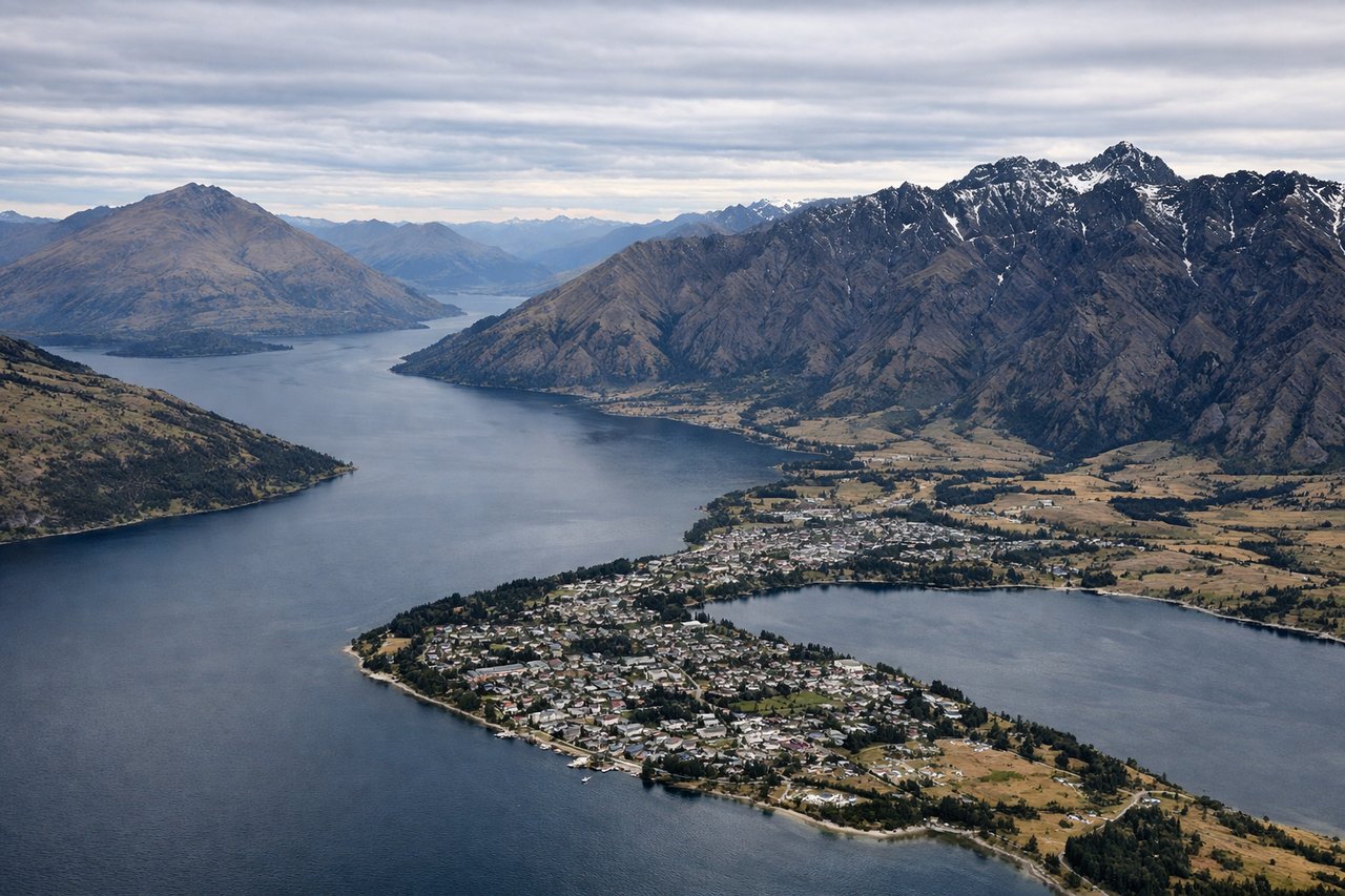
Takeoff from ZQN
LEFTDeparting Queenstown, the climb-out and turn toward Wellington keeps the Southern Alps spine and Lake Wakatipu's western arm in view on the left, with Coronet Peak and the Wakatipu Basin falling away below before the Alps stretch north toward Mount Aspiring. The right side mostly shows the closer but shorter-lived Remarkables range before the aircraft turns away from it.
Landing at WLG
LEFTOn the typical northerly approach into Wellington (runway 34), the final descent over Cook Strait puts the city's harbour and CBD skyline on the left, with Kapiti Island visible further out to the northwest. The right side mainly shows the Miramar Peninsula and open Cook Strait with less city detail.
Will your flight be in sunlight?
Pick a date and time in the Sun Map to watch the sun move across your whole flight.
About This Route
Which side of the plane should I sit on flying from Queenstown (ZQN) to Wellington International (WLG)?
Sit on the Left side of the plane for the best views on flights from Queenstown International to Wellington. The left side delivers a continuous scenic arc: Southern Alps and Lake Wakatipu during departure, a distant view of the Alps' northern reaches during cruise, and Wellington's harbour and city skyline on arrival. The right side offers decent but shorter-lived views of the Remarkables and Cook Strait's open water.
What can I see during takeoff from Queenstown in Queenstown International?
During takeoff from Queenstown (ZQN), sit on the Left side for the best views. Departing Queenstown, the climb-out and turn toward Wellington keeps the Southern Alps spine and Lake Wakatipu's western arm in view on the left, with Coronet Peak and the Wakatipu Basin falling away below before the Alps stretch north toward Mount Aspiring. The right side mostly shows the closer but shorter-lived Remarkables range before the aircraft turns away from it. Notable sights include: Lake Wakatipu, Coronet Peak, Southern Alps foothills, Wakatipu Basin.
What can I see when landing at Wellington International in Wellington?
When landing at Wellington International (WLG), sit on the Left side for the best views. On the typical northerly approach into Wellington (runway 34), the final descent over Cook Strait puts the city's harbour and CBD skyline on the left, with Kapiti Island visible further out to the northwest. The right side mainly shows the Miramar Peninsula and open Cook Strait with less city detail. Notable sights include: Wellington Harbour, Wellington CBD skyline, Kapiti Island, Cook Strait.
How long is the flight from Queenstown International to Wellington?
The flight from Queenstown (ZQN) to Wellington International (WLG) takes about 1 hour 10 minutes. The shortest flight path between them is 398 miles (640 km); winds and air traffic control usually add a few percent.
What does the Queenstown International to Wellington flight path pass over?
Around the midpoint the route crosses the eastern edge of the Southern Alps near the Canterbury high country, with the Kaikoura Ranges and Pacific coastline visible before the aircraft heads out over Cook Strait toward the North Island.