While the right side wins at takeoff for the Sandias, the left side captures more of the flight's geographic highlights overall — including views of the Colorado Plateau and southern Cascades during cruise, and the spectacular Seattle approach over Puget Sound and the Olympic Peninsula. The left side also gets the Columbia River crossing in southern Washington.
Flown ABQ to SEA? Did we get it right?
Flight Path
Albuquerque to Seattle is 1,179 miles (1,897 km), a flight of about 2 hours 55 minutes.
The route crosses the Colorado Plateau and Four Corners region of northern New Mexico and southern Utah, then tracks over the Great Basin of Nevada and southern Oregon. The Snake River Plain of southern Idaho may be visible depending on exact routing. The Cascade Range is crossed in southern Washington, with volcanic peaks including Mt. Adams and potentially Mt. Rainier visible. The Columbia River Gorge is crossed in the final descent phase.
Great circle distance and headings ›


Phase by phase
Takeoff from ABQ
RIGHTABQ typically departs runway 08 (heading east) or 26 (heading west). On the more common westbound departure (Rwy 26), the aircraft turns northwest, putting the Sandia Mountains — a dramatic 10,000-ft granite escarpment rising 5,000 ft above the city — on the right side. The Rio Grande valley and the city grid are also clearly visible to the right during the climbing turn.
Landing at SEA
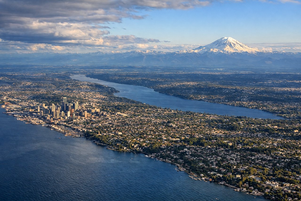
LEFTSEA primarily lands on runways 16L/16R (heading south) or 34L/34R (heading north). On the common southbound approach over Puget Sound, the left side offers views of downtown Seattle, Elliott Bay, and the Olympic Mountains across the water. The right side faces east toward the Cascades, which are also impressive, but the left side captures the iconic water-and-city combination.
Will your flight be in sunlight?
Pick a date and time in the Sun Map to watch the sun move across your whole flight.
About This Route
Which side of the plane should I sit on flying from Albuquerque International Sunport (ABQ) to Seattle Tacoma International (SEA)?
Sit on the Left side of the plane for the best views on flights from Albuquerque to Seattle. While the right side wins at takeoff for the Sandias, the left side captures more of the flight's geographic highlights overall — including views of the Colorado Plateau and southern Cascades during cruise, and the spectacular Seattle approach over Puget Sound and the Olympic Peninsula. The left side also gets the Columbia River crossing in southern Washington.
What can I see during takeoff from Albuquerque International Sunport in Albuquerque?
During takeoff from Albuquerque International Sunport (ABQ), sit on the Right side for the best views. ABQ typically departs runway 08 (heading east) or 26 (heading west). On the more common westbound departure (Rwy 26), the aircraft turns northwest, putting the Sandia Mountains — a dramatic 10,000-ft granite escarpment rising 5,000 ft above the city — on the right side. The Rio Grande valley and the city grid are also clearly visible to the right during the climbing turn. Notable sights include: Sandia Mountains (Sandia Crest at 10,678 ft), Rio Grande valley, Albuquerque city grid, Jemez Mountains to the northwest.
What can I see when landing at Seattle Tacoma International in Seattle?
When landing at Seattle Tacoma International (SEA), sit on the Left side for the best views. SEA primarily lands on runways 16L/16R (heading south) or 34L/34R (heading north). On the common southbound approach over Puget Sound, the left side offers views of downtown Seattle, Elliott Bay, and the Olympic Mountains across the water. The right side faces east toward the Cascades, which are also impressive, but the left side captures the iconic water-and-city combination. Notable sights include: Downtown Seattle skyline and Elliott Bay, Puget Sound, Olympic Mountains (across the Sound to the west), Lake Washington.
How long is the flight from Albuquerque to Seattle?
The flight from Albuquerque International Sunport (ABQ) to Seattle Tacoma International (SEA) takes about 2 hours 55 minutes. The shortest flight path between them is 1,179 miles (1,897 km); winds and air traffic control usually add a few percent.
What does the Albuquerque to Seattle flight path pass over?
The route crosses the Colorado Plateau and Four Corners region of northern New Mexico and southern Utah, then tracks over the Great Basin of Nevada and southern Oregon. The Snake River Plain of southern Idaho may be visible depending on exact routing. The Cascade Range is crossed in southern Washington, with volcanic peaks including Mt. Adams and potentially Mt. Rainier visible. The Columbia River Gorge is crossed in the final descent phase.