Kodiak to Portland is 1,513 miles (2,435 km), a flight of about 3 hours 15 minutes.
Left side scores higher due to superior scenery on both takeoff and landing. Kodiak's coastal mountains and island geography provide dramatic departure views, while the Cascade Range and Mount Hood create a spectacular approach into Portland. The flight path itself crosses significant terrain variation—from coastal Alaska through interior mountains to the Columbia River Gorge—making the left side consistently more visually rewarding than the right side's flatter, more monotonous terrain.
Flight Path
Alaska Range (distant, far north of direct route), interior boreal forest and tundra of British Columbia and northern Washington, Cascade Range volcanic peaks including Mount Shasta (visible far right on clear days), Columbia River Gorge with steep basalt walls
Great circle distance and headings ›Phase by phase
Takeoff from ADQ
LEFTLeft side captures Kodiak Island's dramatic coastal terrain, including Chiniak Bay and the surrounding peaks of the Kodiak Mountains during climb-out. Right side faces inland toward flat tundra and boreal forest with minimal visual interest.
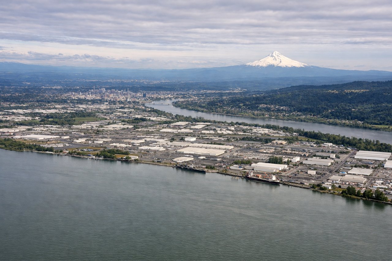
Landing at PDX
LEFTLeft side provides the scenic approach into Portland, with views of the Cascade Range, Mount Hood, and the Columbia River Gorge during descent. Right side shows the Willamette Valley's agricultural flatlands and suburban sprawl with less dramatic terrain.
Will your flight be in sunlight?
Pick a date and time in the Sun Map to watch the sun move across your whole flight.
About This Route
Which side of the plane should I sit on flying from Kodiak (ADQ) to Portland International (PDX)?
Sit on the Left side of the plane for the best views on flights from Kodiak to Portland. Left side scores higher due to superior scenery on both takeoff and landing. Kodiak's coastal mountains and island geography provide dramatic departure views, while the Cascade Range and Mount Hood create a spectacular approach into Portland. The flight path itself crosses significant terrain variation—from coastal Alaska through interior mountains to the Columbia River Gorge—making the left side consistently more visually rewarding than the right side's flatter, more monotonous terrain.
What can I see during takeoff from Kodiak in Kodiak?
During takeoff from Kodiak (ADQ), sit on the Left side for the best views. Left side captures Kodiak Island's dramatic coastal terrain, including Chiniak Bay and the surrounding peaks of the Kodiak Mountains during climb-out. Right side faces inland toward flat tundra and boreal forest with minimal visual interest. Notable sights include: Chiniak Bay, Kodiak Mountains, Barometer Mountain, Kodiak harbor and waterfront.
What can I see when landing at Portland International in Portland?
When landing at Portland International (PDX), sit on the Left side for the best views. Left side provides the scenic approach into Portland, with views of the Cascade Range, Mount Hood, and the Columbia River Gorge during descent. Right side shows the Willamette Valley's agricultural flatlands and suburban sprawl with less dramatic terrain. Notable sights include: Mount Hood, Columbia River Gorge, Cascade Range, Willamette Valley.
How long is the flight from Kodiak to Portland?
The flight from Kodiak (ADQ) to Portland International (PDX) takes about 3 hours 15 minutes. The shortest flight path between them is 1,513 miles (2,435 km); winds and air traffic control usually add a few percent.
What does the Kodiak to Portland flight path pass over?
Alaska Range (distant, far north of direct route), interior boreal forest and tundra of British Columbia and northern Washington, Cascade Range volcanic peaks including Mount Shasta (visible far right on clear days), Columbia River Gorge with steep basalt walls