The right side combines a scenic takeoff over Amsterdam and the Dutch coast with the far more dramatic cruise segment across Scotland, the Faroe Islands, Iceland, and southern Greenland's ice sheet and fjords, a rare and visually striking stretch. The left side's Mount Hood approach is excellent, but it's a short final-approach payoff compared to the sustained, extraordinary scenery available earlier on the right.
Flight Path
Scottish Highlands and coastline, Faroe Islands, Iceland's volcanic terrain, southern Greenland's ice sheet and fjords, Davis Strait, Hudson Bay, Canadian prairies of Manitoba/Saskatchewan, and the foothills of the Canadian Rockies in Alberta/British Columbia before descending into the Pacific Northwest.
Great circle distance and headings ›


.jpg?width=600)


Phase by phase
Takeoff from AMS
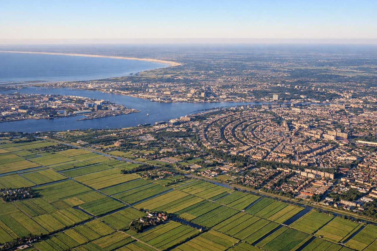
RIGHTDepartures from Schiphol's Polderbaan typically launch southbound then bank right toward the northwest to pick up the transatlantic track, putting the Amsterdam conurbation, Dutch polders, and North Sea coastline directly below the right side during the turn. The left side mostly sees open sky during this maneuver.
Landing at PDX
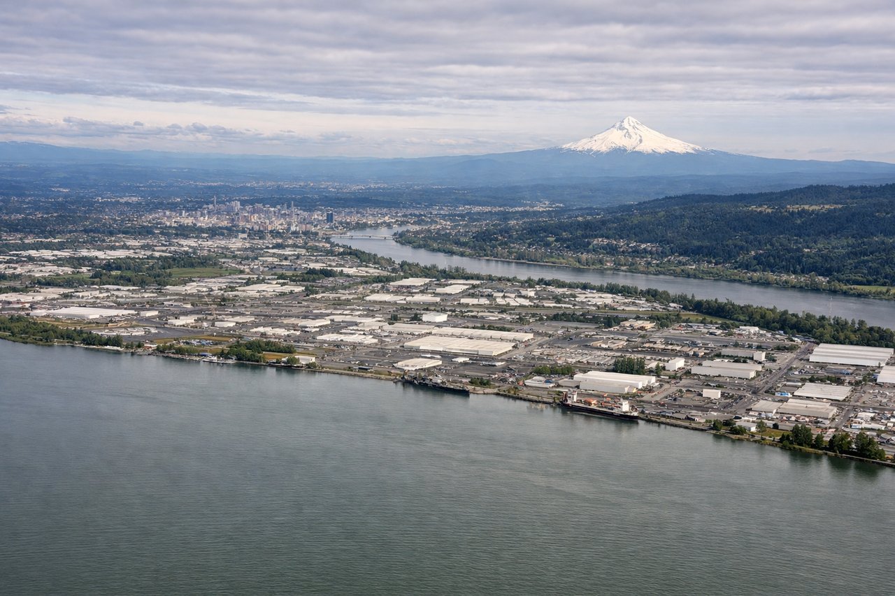
LEFTArriving from the north, flights swing east of Portland to line up for the westerly runways, tracking near the Columbia River Gorge before turning onto final. This places the snow-capped cone of Mount Hood and the Gorge's cliffs on the left side of the aircraft during the descent and final approach.
Landmarks on this routeAll landmarks →
Will your flight be in sunlight?
See exactly which side of the plane gets sun and shade at your departure time.
About This Route
Which side of the plane should I sit on flying from Schiphol (AMS) to Portland International (PDX)?
Sit on the Right side of the plane for the best views on flights from Amsterdam to Portland. The right side combines a scenic takeoff over Amsterdam and the Dutch coast with the far more dramatic cruise segment across Scotland, the Faroe Islands, Iceland, and southern Greenland's ice sheet and fjords, a rare and visually striking stretch. The left side's Mount Hood approach is excellent, but it's a short final-approach payoff compared to the sustained, extraordinary scenery available earlier on the right.
What can I see during takeoff from Schiphol in Amsterdam?
During takeoff from Schiphol (AMS), sit on the Right side for the best views. Departures from Schiphol's Polderbaan typically launch southbound then bank right toward the northwest to pick up the transatlantic track, putting the Amsterdam conurbation, Dutch polders, and North Sea coastline directly below the right side during the turn. The left side mostly sees open sky during this maneuver. Notable sights include: Amsterdam suburbs and canal patterns, Dutch polder farmland and greenhouses, IJmeer/Markermeer waterway, North Sea coastline.
What can I see when landing at Portland International in Portland?
When landing at Portland International (PDX), sit on the Left side for the best views. Arriving from the north, flights swing east of Portland to line up for the westerly runways, tracking near the Columbia River Gorge before turning onto final. This places the snow-capped cone of Mount Hood and the Gorge's cliffs on the left side of the aircraft during the descent and final approach. Notable sights include: Mount Hood, Columbia River Gorge, Willamette Valley, distant Mount St. Helens.
How long is the flight from Amsterdam to Portland?
The flight from Schiphol (AMS) to Portland International (PDX) takes 10h 20m.
What does the Amsterdam to Portland flight path pass over?
Scottish Highlands and coastline, Faroe Islands, Iceland's volcanic terrain, southern Greenland's ice sheet and fjords, Davis Strait, Hudson Bay, Canadian prairies of Manitoba/Saskatchewan, and the foothills of the Canadian Rockies in Alberta/British Columbia before descending into the Pacific Northwest.