While the takeoff offers dramatic mountain scenery, the landing approach provides more sustained and varied views of a major metropolitan area, waterways, and industrial landscape. Right side captures the most visually interesting segments of both climb and descent.
Flown ANC to HOU? Did we get it right?
Flight Path
Anchorage to Houston is 3,283 miles (5,284 km), a flight of about 5 hours 15 minutes.
The flight path crosses the Rocky Mountains (visible from altitude over Colorado and New Mexico), the Great Plains of Texas, and follows a generally southeastward trajectory. Notable midpoint features include the Continental Divide in Colorado, the Canadian Rockies during initial climb (if visible), and the transition from mountainous terrain to high plains and eventually coastal lowlands approaching Texas.
Great circle distance and headings ›


Phase by phase
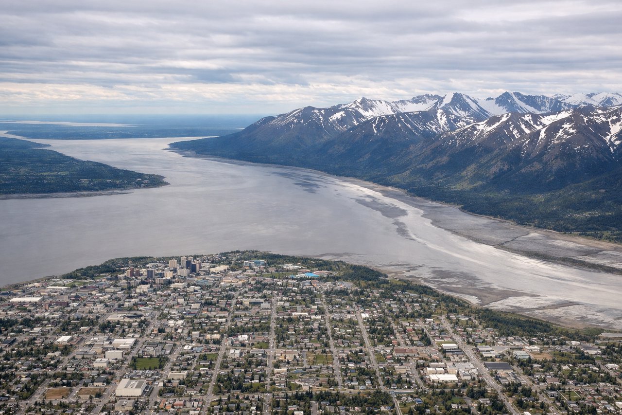
Takeoff from ANC
LEFTLeft side offers immediate views of the Chugach Mountains and Cook Inlet as the aircraft climbs out southeastward from Anchorage. The right side faces inland toward less dramatic terrain.
Landing at HOU
RIGHTRight side provides views of the Houston metropolitan area, Buffalo Bayou, and the ship channel as the aircraft descends toward Hobby Airport from the north. The left side faces less developed terrain and refineries.
Will your flight be in sunlight?
Pick a date and time in the Sun Map to watch the sun move across your whole flight.
About This Route
Which side of the plane should I sit on flying from Ted Stevens Anchorage International (ANC) to William P Hobby (HOU)?
Sit on the Right side of the plane for the best views on flights from Anchorage to Houston. While the takeoff offers dramatic mountain scenery, the landing approach provides more sustained and varied views of a major metropolitan area, waterways, and industrial landscape. Right side captures the most visually interesting segments of both climb and descent.
What can I see during takeoff from Ted Stevens Anchorage International in Anchorage?
During takeoff from Ted Stevens Anchorage International (ANC), sit on the Left side for the best views. Left side offers immediate views of the Chugach Mountains and Cook Inlet as the aircraft climbs out southeastward from Anchorage. The right side faces inland toward less dramatic terrain. Notable sights include: Chugach Mountains, Cook Inlet, Turnagain Arm, Anchorage city grid.
What can I see when landing at William P Hobby in Houston?
When landing at William P Hobby (HOU), sit on the Right side for the best views. Right side provides views of the Houston metropolitan area, Buffalo Bayou, and the ship channel as the aircraft descends toward Hobby Airport from the north. The left side faces less developed terrain and refineries. Notable sights include: Buffalo Bayou, Houston Ship Channel, downtown Houston skyline, Galveston Bay (distant).
How long is the flight from Anchorage to Houston?
The flight from Ted Stevens Anchorage International (ANC) to William P Hobby (HOU) takes about 5 hours 15 minutes. The shortest flight path between them is 3,283 miles (5,284 km); winds and air traffic control usually add a few percent.
What does the Anchorage to Houston flight path pass over?
The flight path crosses the Rocky Mountains (visible from altitude over Colorado and New Mexico), the Great Plains of Texas, and follows a generally southeastward trajectory. Notable midpoint features include the Continental Divide in Colorado, the Canadian Rockies during initial climb (if visible), and the transition from mountainous terrain to high plains and eventually coastal lowlands approaching Texas.