While the takeoff offers dramatic Alaskan mountain scenery on the left, the landing approach on the right provides more sustained visual interest over a longer period—the St. Johns River's meanders and Jacksonville's coastal geography are compelling and clearly visible during descent. Right-side seats capture the more memorable final approach.
Flown ANC to JAX? Did we get it right?
Flight Path
Anchorage to Jacksonville is 3,680 miles (5,923 km), a flight of about 7 hours 30 minutes.
The flight path crosses the continental United States from northwest to southeast. Notable visible features include the Rocky Mountains (particularly in Colorado and Wyoming), the Mississippi River valley, and the Appalachian Mountains in the eastern United States. The Great Plains dominate the central portion of the flight. Depending on exact routing, the flight may pass over or near the Tennessee River valley and various river systems in the Southeast before reaching Florida's coastal plain.
Great circle distance and headings ›


Phase by phase
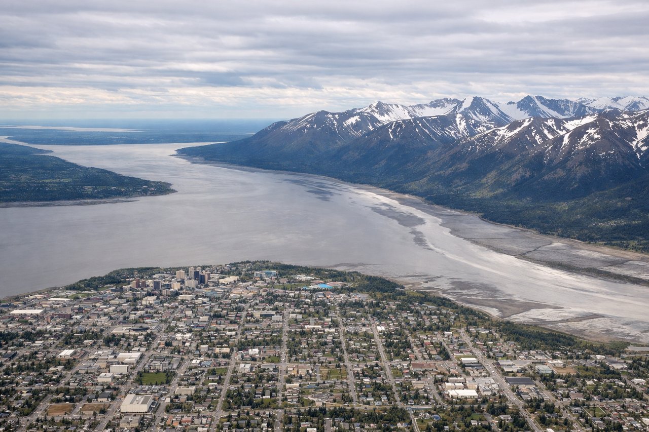
Takeoff from ANC
LEFTLeft-side seats offer views of the Chugach Mountains immediately after departure, with Cook Inlet visible to the west. The aircraft climbs southeastward out of Anchorage, making the left side the optimal vantage point for these dramatic peaks.
Landing at JAX
RIGHTRight-side seats provide excellent views during the descent into Jacksonville, particularly of the St. Johns River and its distinctive meanders as the aircraft approaches from the northwest. The river's serpentine pattern is striking from altitude and dominates the approach corridor.
Will your flight be in sunlight?
Pick a date and time in the Sun Map to watch the sun move across your whole flight.
About This Route
Which side of the plane should I sit on flying from Ted Stevens Anchorage International (ANC) to Jacksonville International (JAX)?
Sit on the Right side of the plane for the best views on flights from Anchorage to Jacksonville. While the takeoff offers dramatic Alaskan mountain scenery on the left, the landing approach on the right provides more sustained visual interest over a longer period—the St. Johns River's meanders and Jacksonville's coastal geography are compelling and clearly visible during descent. Right-side seats capture the more memorable final approach.
What can I see during takeoff from Ted Stevens Anchorage International in Anchorage?
During takeoff from Ted Stevens Anchorage International (ANC), sit on the Left side for the best views. Left-side seats offer views of the Chugach Mountains immediately after departure, with Cook Inlet visible to the west. The aircraft climbs southeastward out of Anchorage, making the left side the optimal vantage point for these dramatic peaks. Notable sights include: Chugach Mountains, Cook Inlet, Knik Arm, Anchorage urban area.
What can I see when landing at Jacksonville International in Jacksonville?
When landing at Jacksonville International (JAX), sit on the Right side for the best views. Right-side seats provide excellent views during the descent into Jacksonville, particularly of the St. Johns River and its distinctive meanders as the aircraft approaches from the northwest. The river's serpentine pattern is striking from altitude and dominates the approach corridor. Notable sights include: St. Johns River, Jacksonville urban core, Atlantic Ocean coastline, Intracoastal Waterway.
How long is the flight from Anchorage to Jacksonville?
The flight from Ted Stevens Anchorage International (ANC) to Jacksonville International (JAX) takes about 7 hours 30 minutes. The shortest flight path between them is 3,680 miles (5,923 km); winds and air traffic control usually add a few percent.
What does the Anchorage to Jacksonville flight path pass over?
The flight path crosses the continental United States from northwest to southeast. Notable visible features include the Rocky Mountains (particularly in Colorado and Wyoming), the Mississippi River valley, and the Appalachian Mountains in the eastern United States. The Great Plains dominate the central portion of the flight. Depending on exact routing, the flight may pass over or near the Tennessee River valley and various river systems in the Southeast before reaching Florida's coastal plain.