Asuncion to Buenos Aires is 646 miles (1,040 km), a flight of about 2 hours.
While takeoff offers good river views on the right, the landing approach on the left provides superior geography—the entire Río de la Plata estuary and Buenos Aires waterfront are far more visually distinctive and iconic than the departure landscape. The left side captures the dramatic transition from open water to one of South America's major cities.
Flight Path
The flight path crosses the Paraná River system and its wetlands (Esteros del Ibera region visible to the southeast), then transitions over the flat Mesopotamia region of Argentina (Entre Ríos province). The landscape gradually shifts from subtropical wetlands and forests to agricultural plains. The Río Uruguay forms the eastern border of Argentina during the southern portion of the flight. As the aircraft descends toward Buenos Aires, the Río de la Plata estuary becomes visible, marking the final approach corridor.
Great circle distance and headings ›
_(cropped).jpg?width=600)
Phase by phase
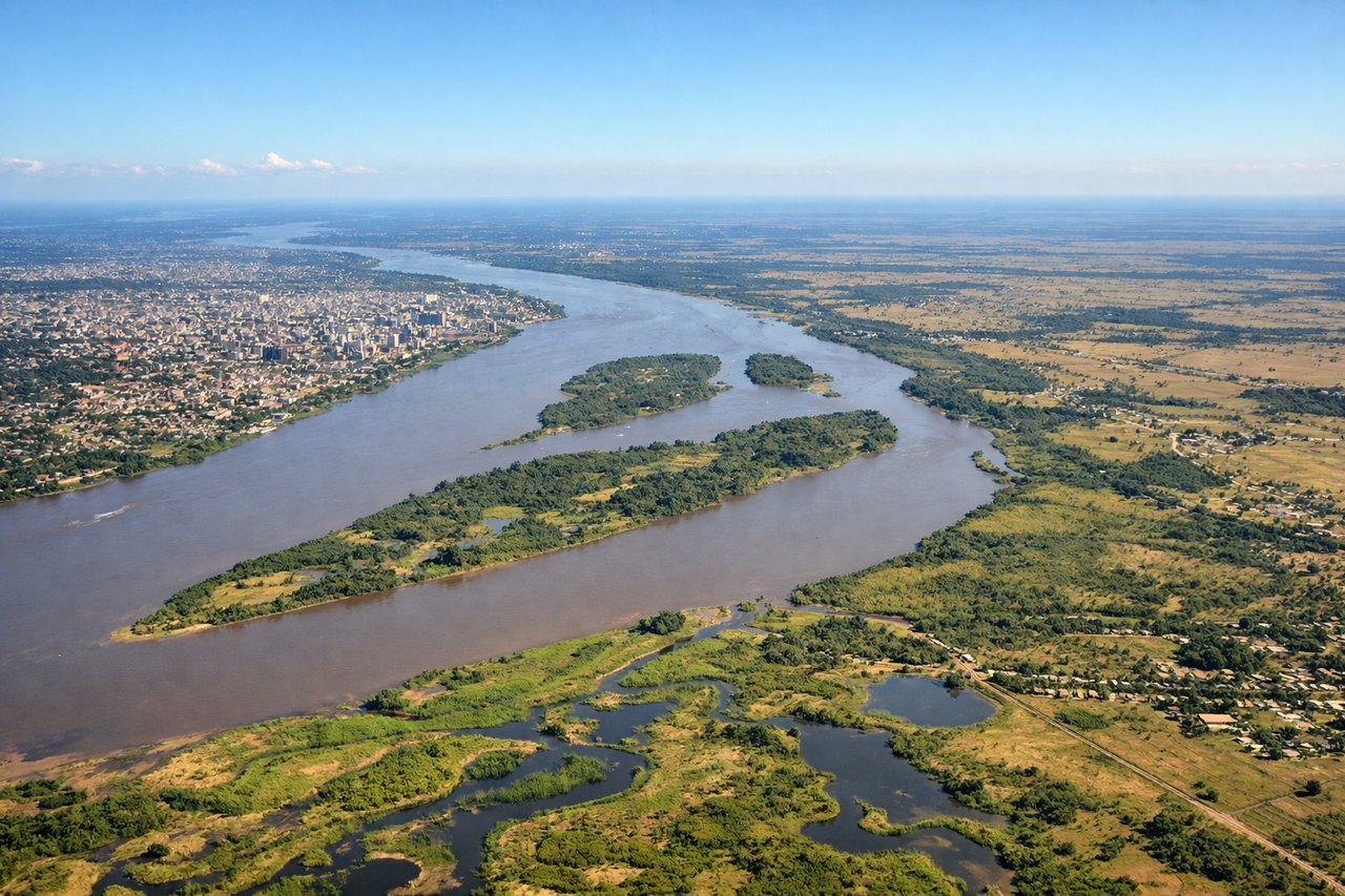
Takeoff from ASU
RIGHTASU typically departs to the south or southeast. Right-side seats offer views of the Paraná River's eastern banks and the sprawling city of Asunción receding below, with clear sightlines across the river system that dominates the landscape immediately after departure.

Landing at AEP
LEFTAEP approaches from the north or northeast, descending over the Río de la Plata estuary. Left-side seats provide direct views of the wide estuary, the city of Buenos Aires spreading across the western shore, and the approach path down the river toward the runway. This is the classic approach geometry for AEP.
Landmarks on this routeAll landmarks →
Will your flight be in sunlight?
Pick a date and time in the Sun Map to watch the sun move across your whole flight.
About This Route
Which side of the plane should I sit on flying from Silvio Pettirossi International (ASU) to Aeroparque Jorge Newbery (AEP)?
Sit on the Left side of the plane for the best views on flights from Asuncion to Buenos Aires. While takeoff offers good river views on the right, the landing approach on the left provides superior geography—the entire Río de la Plata estuary and Buenos Aires waterfront are far more visually distinctive and iconic than the departure landscape. The left side captures the dramatic transition from open water to one of South America's major cities.
What can I see during takeoff from Silvio Pettirossi International in Asuncion?
During takeoff from Silvio Pettirossi International (ASU), sit on the Right side for the best views. ASU typically departs to the south or southeast. Right-side seats offer views of the Paraná River's eastern banks and the sprawling city of Asunción receding below, with clear sightlines across the river system that dominates the landscape immediately after departure. Notable sights include: Paraná River (main channel and islands), Asunción city grid, Chaco region (flat, sparse terrain to the west), Iguazú region forests (distant, southeast).
What can I see when landing at Aeroparque Jorge Newbery in Buenos Aires?
When landing at Aeroparque Jorge Newbery (AEP), sit on the Left side for the best views. AEP approaches from the north or northeast, descending over the Río de la Plata estuary. Left-side seats provide direct views of the wide estuary, the city of Buenos Aires spreading across the western shore, and the approach path down the river toward the runway. This is the classic approach geometry for AEP. Notable sights include: Río de la Plata estuary (wide, muddy-brown water), Buenos Aires waterfront and Puerto Madero district, Palermo and Recoleta neighborhoods, Tigre Delta (upstream, visible as intricate waterway network).
How long is the flight from Asuncion to Buenos Aires?
The flight from Silvio Pettirossi International (ASU) to Aeroparque Jorge Newbery (AEP) takes about 2 hours. The shortest flight path between them is 646 miles (1,040 km); winds and air traffic control usually add a few percent.
What does the Asuncion to Buenos Aires flight path pass over?
The flight path crosses the Paraná River system and its wetlands (Esteros del Ibera region visible to the southeast), then transitions over the flat Mesopotamia region of Argentina (Entre Ríos province). The landscape gradually shifts from subtropical wetlands and forests to agricultural plains. The Río Uruguay forms the eastern border of Argentina during the southern portion of the flight. As the aircraft descends toward Buenos Aires, the Río de la Plata estuary becomes visible, marking the final approach corridor.