Asuncion to Bogota is 2,351 miles (3,783 km), a flight of about 5 hours 5 minutes.
While takeoff offers river views, the landing approach into Bogotá provides the flight's most dramatic and visually distinctive moment—the Andes cordillera rising from the valley floor is a genuine highlight that outweighs the Paraguay River's subtler appeal.
Flight Path
The flight path crosses the Amazon Basin's northern edge, with the Putumayo River visible as a dark linear feature around the 2-hour mark (near the Peru-Colombia border). Dense rainforest canopy dominates the midpoint, with occasional river oxbows and small clearings. As the aircraft approaches Colombian airspace, the landscape transitions from flat jungle to rolling foothills, with the Andes' western slopes becoming visible approximately 45 minutes before landing.
Great circle distance and headings ›.jpg?width=600)

Phase by phase
Takeoff from ASU
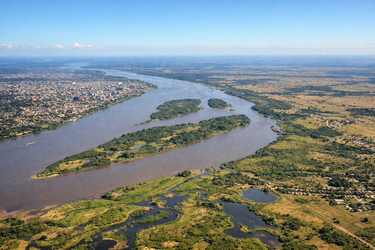
RIGHTASU typically departs runway 10/28; northbound departures favor the right side to capture the Paraguay River's meandering course and the eastern Chaco landscape. The right wing seat gives unobstructed views during the initial climb-out over the river delta.
Landing at BOG
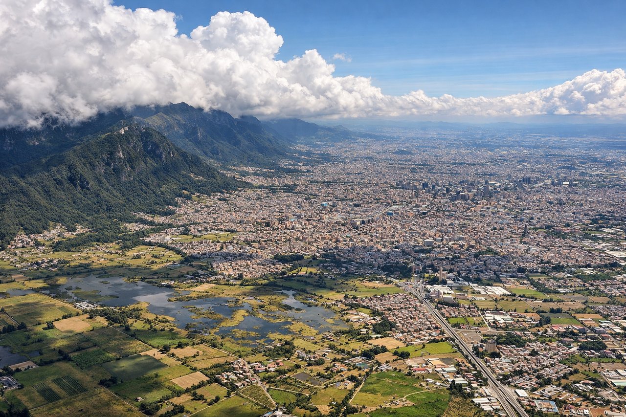
LEFTBOG typically lands runway 13L/31R; southbound approaches favor the left side to see the Andes' eastern cordillera rising dramatically from the Magdalena River valley. The left wing provides the best perspective of Bogotá's high-altitude basin and the mountain wall that defines the city's eastern boundary.
Landmarks on this routeAll landmarks →
Will your flight be in sunlight?
Pick a date and time in the Sun Map to watch the sun move across your whole flight.
About This Route
Which side of the plane should I sit on flying from Silvio Pettirossi International (ASU) to Eldorado International (BOG)?
Sit on the Left side of the plane for the best views on flights from Asuncion to Bogota. While takeoff offers river views, the landing approach into Bogotá provides the flight's most dramatic and visually distinctive moment—the Andes cordillera rising from the valley floor is a genuine highlight that outweighs the Paraguay River's subtler appeal.
What can I see during takeoff from Silvio Pettirossi International in Asuncion?
During takeoff from Silvio Pettirossi International (ASU), sit on the Right side for the best views. ASU typically departs runway 10/28; northbound departures favor the right side to capture the Paraguay River's meandering course and the eastern Chaco landscape. The right wing seat gives unobstructed views during the initial climb-out over the river delta. Notable sights include: Paraguay River (immediate foreground, flowing south-north), Asunción city grid (receding westward), Iguazu region wetlands (eastern horizon), Chaco plains extending northeast.
What can I see when landing at Eldorado International in Bogota?
When landing at Eldorado International (BOG), sit on the Left side for the best views. BOG typically lands runway 13L/31R; southbound approaches favor the left side to see the Andes' eastern cordillera rising dramatically from the Magdalena River valley. The left wing provides the best perspective of Bogotá's high-altitude basin and the mountain wall that defines the city's eastern boundary. Notable sights include: Eastern Cordillera of the Colombian Andes (dominant skyline), Magdalena River valley (broad depression below), Bogotá's urban sprawl (valley floor), Monserrate peak (eastern ridge accent).
How long is the flight from Asuncion to Bogota?
The flight from Silvio Pettirossi International (ASU) to Eldorado International (BOG) takes about 5 hours 5 minutes. The shortest flight path between them is 2,351 miles (3,783 km); winds and air traffic control usually add a few percent.
What does the Asuncion to Bogota flight path pass over?
The flight path crosses the Amazon Basin's northern edge, with the Putumayo River visible as a dark linear feature around the 2-hour mark (near the Peru-Colombia border). Dense rainforest canopy dominates the midpoint, with occasional river oxbows and small clearings. As the aircraft approaches Colombian airspace, the landscape transitions from flat jungle to rolling foothills, with the Andes' western slopes becoming visible approximately 45 minutes before landing.