While takeoff favors the right, the landing view of the Panama Canal and Gatun Lake is geographically unique and visually dominant. Left-side seats capture the most distinctive feature of this route.
Flown ASU to PTY? Did we get it right?
Flight Path
Asuncion to Panama City is 2,790 miles (4,490 km), a flight of about 5 hours 50 minutes.
The flight path crosses the Paraná River basin and enters Central America over Costa Rica or western Panama. At cruise altitude, the Andes' eastern foothills recede to the west; the Amazon Basin's northern edge lies to the east. The transition from South American lowlands to Central American terrain occurs roughly 90 minutes into the flight. Scattered cumulus clouds typically obscure ground detail over the interior, but river valleys and forest canopy patterns are visible during clear segments.
Great circle distance and headings ›

Phase by phase
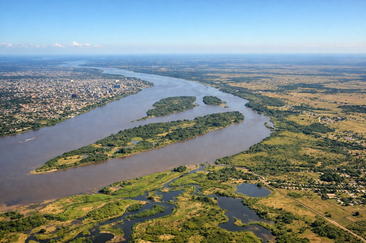
Takeoff from ASU
RIGHTASU typically departs runway 10/28; northbound departures on runway 10 climb toward the Paraguay River and Chaco region. Right-side seats capture the river's meandering course and the transition from urban Asuncion to wetlands and savanna.
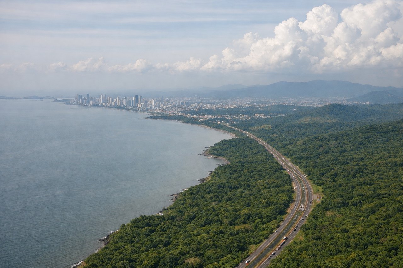
Landing at PTY
LEFTPTY typically lands runway 03/21; southbound approaches on runway 03 descend over the Panama Canal and Gatun Lake from the north. Left-side seats provide direct views of the canal's Gatun Locks, the lake's eastern shoreline, and the approach corridor over Panama City.
Will your flight be in sunlight?
Pick a date and time in the Sun Map to watch the sun move across your whole flight.
About This Route
Which side of the plane should I sit on flying from Silvio Pettirossi International (ASU) to Tocumen International (PTY)?
Sit on the Left side of the plane for the best views on flights from Asuncion to Panama City. While takeoff favors the right, the landing view of the Panama Canal and Gatun Lake is geographically unique and visually dominant. Left-side seats capture the most distinctive feature of this route.
What can I see during takeoff from Silvio Pettirossi International in Asuncion?
During takeoff from Silvio Pettirossi International (ASU), sit on the Right side for the best views. ASU typically departs runway 10/28; northbound departures on runway 10 climb toward the Paraguay River and Chaco region. Right-side seats capture the river's meandering course and the transition from urban Asuncion to wetlands and savanna. Notable sights include: Paraguay River (immediate, flowing north-south), Asuncion city grid (receding southwest), Chaco lowlands (expanding to the north and east as altitude increases).
What can I see when landing at Tocumen International in Panama City?
When landing at Tocumen International (PTY), sit on the Left side for the best views. PTY typically lands runway 03/21; southbound approaches on runway 03 descend over the Panama Canal and Gatun Lake from the north. Left-side seats provide direct views of the canal's Gatun Locks, the lake's eastern shoreline, and the approach corridor over Panama City. Notable sights include: Gatun Lake (large, irregular water body with visible islands), Panama Canal Gatun Locks (linear structure with lock chambers), Panama City skyline (receding toward the coast), Colón province lowlands (to the north and west).
How long is the flight from Asuncion to Panama City?
The flight from Silvio Pettirossi International (ASU) to Tocumen International (PTY) takes about 5 hours 50 minutes. The shortest flight path between them is 2,790 miles (4,490 km); winds and air traffic control usually add a few percent.
What does the Asuncion to Panama City flight path pass over?
The flight path crosses the Paraná River basin and enters Central America over Costa Rica or western Panama. At cruise altitude, the Andes' eastern foothills recede to the west; the Amazon Basin's northern edge lies to the east. The transition from South American lowlands to Central American terrain occurs roughly 90 minutes into the flight. Scattered cumulus clouds typically obscure ground detail over the interior, but river valleys and forest canopy patterns are visible during clear segments.