The left side wins overall because while the right side has the better Atlanta departure view, the left side captures the Gulf of Mexico coastline appearing as you descend into Florida, plus the spectacular Tampa Bay and Sunshine Skyway Bridge arrival sequence, which is the more memorable visual payoff of the two.
Flight Path
Atlanta to Tampa is 407 miles (655 km), a flight of about 1 hour 15 minutes.
The flight tracks southwest over central Georgia, crossing the Flint River and the flat pine forests and agricultural land of south Georgia. Around the Florida state line you cross the Suwannee River lowlands. The route then passes over the flat scrubland and citrus groves of central Florida before the Gulf Coast and Tampa Bay come into view on descent.
Great circle distance and headings ›Phase by phase

Takeoff from ATL
RIGHTATL typically departs south on runways 26L/26R or 28, meaning a right-side seat faces north and northwest, giving you a clear view back over downtown Atlanta's skyline as you climb out. The city grid and Midtown towers are distinctly visible before you bank southwest toward Tampa.
Landing at TPA
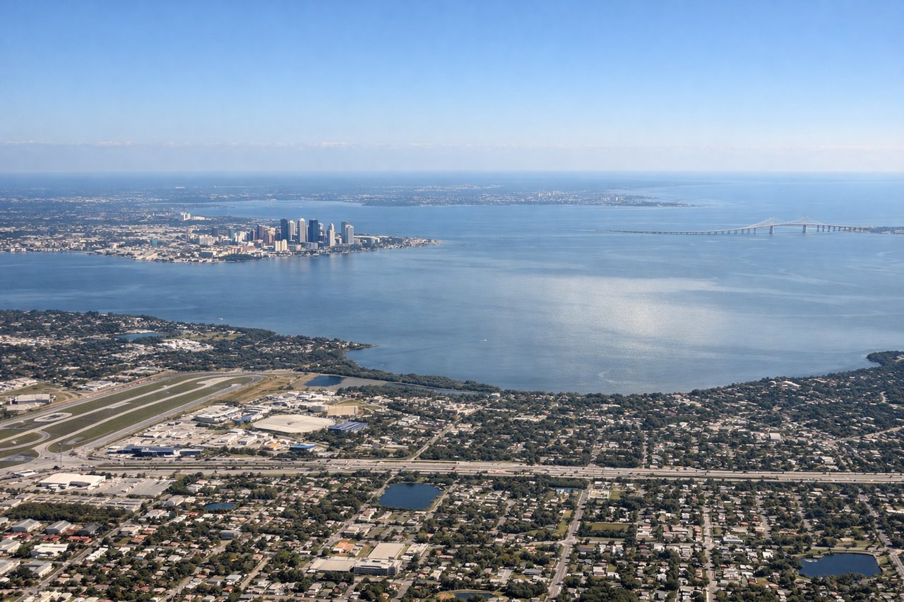
LEFTTPA typically lands on runway 19L/19R heading south, so a left-side seat faces east toward Tampa Bay, the downtown Tampa skyline, and the Sunshine Skyway Bridge. This is one of the more dramatic urban approach views in the southeastern US.
Will your flight be in sunlight?
Pick a date and time in the Sun Map to watch the sun move across your whole flight.
About This Route
Which side of the plane should I sit on flying from The William B Hartsfield Atlanta International (ATL) to Tampa International (TPA)?
Sit on the Left side of the plane for the best views on flights from Atlanta to Tampa. The left side wins overall because while the right side has the better Atlanta departure view, the left side captures the Gulf of Mexico coastline appearing as you descend into Florida, plus the spectacular Tampa Bay and Sunshine Skyway Bridge arrival sequence, which is the more memorable visual payoff of the two.
What can I see during takeoff from The William B Hartsfield Atlanta International in Atlanta?
During takeoff from The William B Hartsfield Atlanta International (ATL), sit on the Right side for the best views. ATL typically departs south on runways 26L/26R or 28, meaning a right-side seat faces north and northwest, giving you a clear view back over downtown Atlanta's skyline as you climb out. The city grid and Midtown towers are distinctly visible before you bank southwest toward Tampa. Notable sights include: Downtown Atlanta skyline, Stone Mountain (visible to the northeast as a distinctive granite dome), Lake Allatoona reservoir to the northwest, I-285 perimeter highway loop.
What can I see when landing at Tampa International in Tampa?
When landing at Tampa International (TPA), sit on the Left side for the best views. TPA typically lands on runway 19L/19R heading south, so a left-side seat faces east toward Tampa Bay, the downtown Tampa skyline, and the Sunshine Skyway Bridge. This is one of the more dramatic urban approach views in the southeastern US. Notable sights include: Tampa Bay, downtown Tampa skyline, Sunshine Skyway Bridge, St. Petersburg waterfront across the bay.
How long is the flight from Atlanta to Tampa?
The flight from The William B Hartsfield Atlanta International (ATL) to Tampa International (TPA) takes about 1 hour 15 minutes. The shortest flight path between them is 407 miles (655 km); winds and air traffic control usually add a few percent.
What does the Atlanta to Tampa flight path pass over?
The flight tracks southwest over central Georgia, crossing the Flint River and the flat pine forests and agricultural land of south Georgia. Around the Florida state line you cross the Suwannee River lowlands. The route then passes over the flat scrubland and citrus groves of central Florida before the Gulf Coast and Tampa Bay come into view on descent.