The right side strings together Austin's skyline and Hill Country lakes at departure, glimpses of the San Francisco Peaks and southern Sierra Nevada along the route, and the Diablo Range with Silicon Valley on arrival, giving it more consistent landmark density than the left side's flatter desert views.
Flown AUS to SJC? Did we get it right?
Flight Path
Austin to San Jose is 1,474 miles (2,372 km), a flight of about 3 hours 40 minutes.
White Sands National Park's gypsum dunes near the flight path in southern New Mexico, the high desert plateau of eastern Arizona, San Francisco Peaks near Flagstaff to the north, and the southern Sierra Nevada foothills before descent into California's Central Valley
Great circle distance and headings ›


Phase by phase

Takeoff from AUS
RIGHTAUS departures head south before banking right toward the northwest heading for California, swinging the downtown Austin skyline, Lady Bird Lake, and the Hill Country lakes into view on the right side of the aircraft.
Landing at SJC
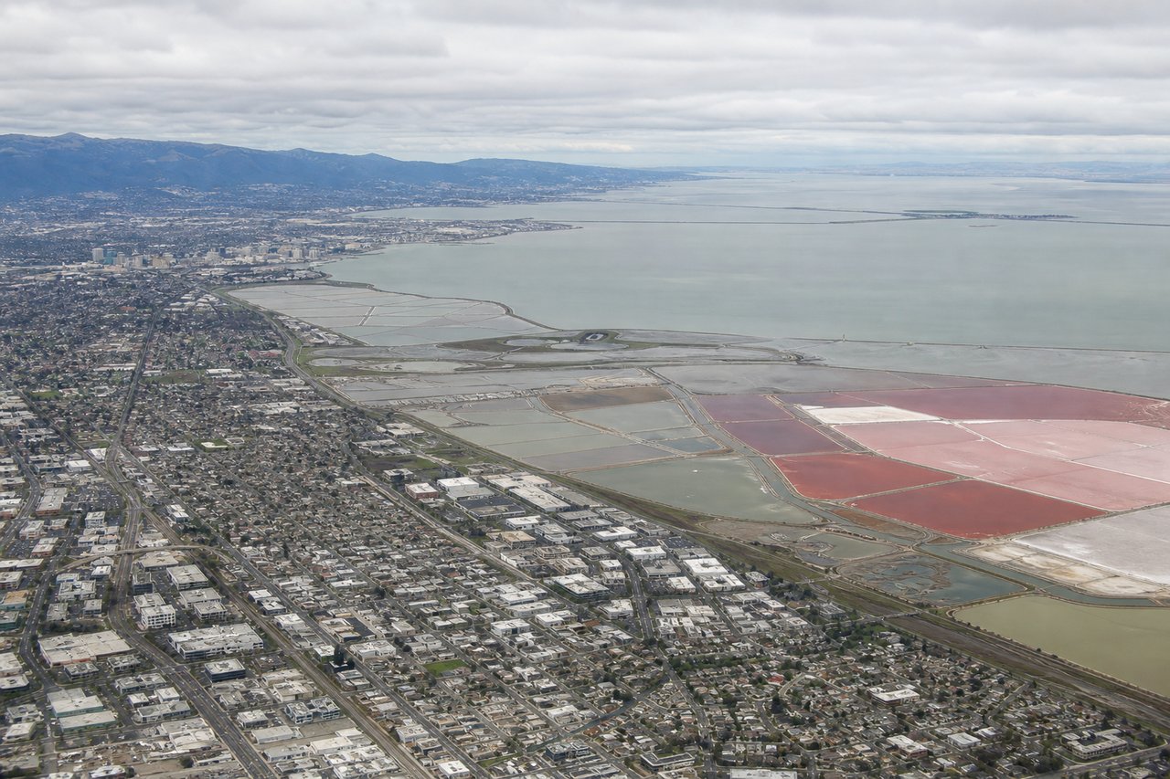
RIGHTOn approach to SJC's runway 30, the flight path crosses the Diablo Range before turning onto final, putting Mount Hamilton's ridgeline and the Lick Observatory dome on the right side, with the South Bay's tech campuses and salt ponds unfolding below as the plane descends.
Will your flight be in sunlight?
Pick a date and time in the Sun Map to watch the sun move across your whole flight.
About This Route
Which side of the plane should I sit on flying from Austin Bergstrom International (AUS) to Norman Y Mineta San Jose International (SJC)?
Sit on the Right side of the plane for the best views on flights from Austin to San Jose. The right side strings together Austin's skyline and Hill Country lakes at departure, glimpses of the San Francisco Peaks and southern Sierra Nevada along the route, and the Diablo Range with Silicon Valley on arrival, giving it more consistent landmark density than the left side's flatter desert views.
What can I see during takeoff from Austin Bergstrom International in Austin?
During takeoff from Austin Bergstrom International (AUS), sit on the Right side for the best views. AUS departures head south before banking right toward the northwest heading for California, swinging the downtown Austin skyline, Lady Bird Lake, and the Hill Country lakes into view on the right side of the aircraft. Notable sights include: Downtown Austin skyline, Lady Bird Lake, Lake Travis, Balcones Escarpment hill country.
What can I see when landing at Norman Y Mineta San Jose International in San Jose?
When landing at Norman Y Mineta San Jose International (SJC), sit on the Right side for the best views. On approach to SJC's runway 30, the flight path crosses the Diablo Range before turning onto final, putting Mount Hamilton's ridgeline and the Lick Observatory dome on the right side, with the South Bay's tech campuses and salt ponds unfolding below as the plane descends. Notable sights include: Mount Hamilton and Lick Observatory, Diablo Range foothills, Silicon Valley tech campuses, southern San Francisco Bay salt flats.
How long is the flight from Austin to San Jose?
The flight from Austin Bergstrom International (AUS) to Norman Y Mineta San Jose International (SJC) takes about 3 hours 40 minutes. The shortest flight path between them is 1,474 miles (2,372 km); winds and air traffic control usually add a few percent.
What does the Austin to San Jose flight path pass over?
White Sands National Park's gypsum dunes near the flight path in southern New Mexico, the high desert plateau of eastern Arizona, San Francisco Peaks near Flagstaff to the north, and the southern Sierra Nevada foothills before descent into California's Central Valley