The right side wins primarily on the strength of the Uluru departure view — a globally rare, singularly dramatic landmark — which outweighs the largely flat, featureless outback cruise phase shared by both sides and the more modest coastal arrival on the left.
Flown AYQ to BNE? Did we get it right?
Flight Path
Yulara to Brisbane is 1,378 miles (2,218 km), a flight of about 2 hours 50 minutes.
Central Australian outback scrubland, the Channel Country's dry floodplains, and the western Queensland plains before the terrain rises into the Great Dividing Range near the Darling Downs approaching Brisbane
Great circle distance and headings ›

Phase by phase
Takeoff from AYQ
RIGHTDeparting AYQ, the climb-out gives a brief but genuinely spectacular view of Uluru's red monolith rising from the flat scrubland, visible off the right side as the aircraft turns onto its eastbound track toward Brisbane. This is a rare, unmistakable landmark seen from very few other flights in the world.
Landing at BNE
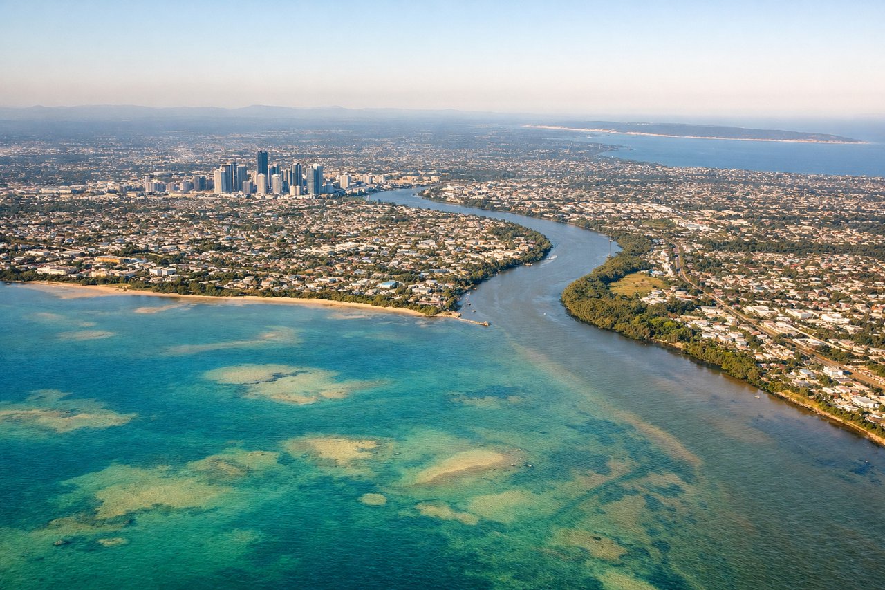
LEFTOn the descent into Brisbane, the approach typically tracks in from the west over the Great Dividing Range before curving toward the coast, giving left-side passengers a view of Moreton Bay's islands and the Brisbane River winding through the city skyline as the plane lines up for landing.
Will your flight be in sunlight?
Pick a date and time in the Sun Map to watch the sun move across your whole flight.
About This Route
Which side of the plane should I sit on flying from Ayers Rock Connellan Airport (AYQ) to Brisbane International (BNE)?
Sit on the Right side of the plane for the best views on flights from Yulara to Brisbane. The right side wins primarily on the strength of the Uluru departure view — a globally rare, singularly dramatic landmark — which outweighs the largely flat, featureless outback cruise phase shared by both sides and the more modest coastal arrival on the left.
What can I see during takeoff from Ayers Rock Connellan Airport in Yulara?
During takeoff from Ayers Rock Connellan Airport (AYQ), sit on the Right side for the best views. Departing AYQ, the climb-out gives a brief but genuinely spectacular view of Uluru's red monolith rising from the flat scrubland, visible off the right side as the aircraft turns onto its eastbound track toward Brisbane. This is a rare, unmistakable landmark seen from very few other flights in the world. Notable sights include: Uluru (Ayers Rock), surrounding red desert plains, Lasseter Highway snaking through the outback.
What can I see when landing at Brisbane International in Brisbane?
When landing at Brisbane International (BNE), sit on the Left side for the best views. On the descent into Brisbane, the approach typically tracks in from the west over the Great Dividing Range before curving toward the coast, giving left-side passengers a view of Moreton Bay's islands and the Brisbane River winding through the city skyline as the plane lines up for landing. Notable sights include: Moreton Bay and its sand islands, Brisbane River, Brisbane CBD skyline, D'Aguilar Range foothills.
How long is the flight from Yulara to Brisbane?
The flight from Ayers Rock Connellan Airport (AYQ) to Brisbane International (BNE) takes about 2 hours 50 minutes. The shortest flight path between them is 1,378 miles (2,218 km); winds and air traffic control usually add a few percent.
What does the Yulara to Brisbane flight path pass over?
Central Australian outback scrubland, the Channel Country's dry floodplains, and the western Queensland plains before the terrain rises into the Great Dividing Range near the Darling Downs approaching Brisbane