While the Brisbane takeoff offers a nice city and bay view, the left side's approach into AYQ delivers the flight's true highlight: an unobstructed, iconic view of Uluru and Kata Tjuta rising from the desert, a rare and visually striking landmark seen from cruising and descent altitude.
Flown BNE to AYQ? Did we get it right?
Flight Path
Brisbane to Yulara is 1,378 miles (2,218 km), a flight of about 2 hours 50 minutes.
Great Dividing Range and Darling Downs give way to flat outback plains, with the fringes of the Simpson Desert and distant red sand dune fields visible before the MacDonnell Ranges appear far to the north near Alice Springs.
Great circle distance and headings ›

Phase by phase
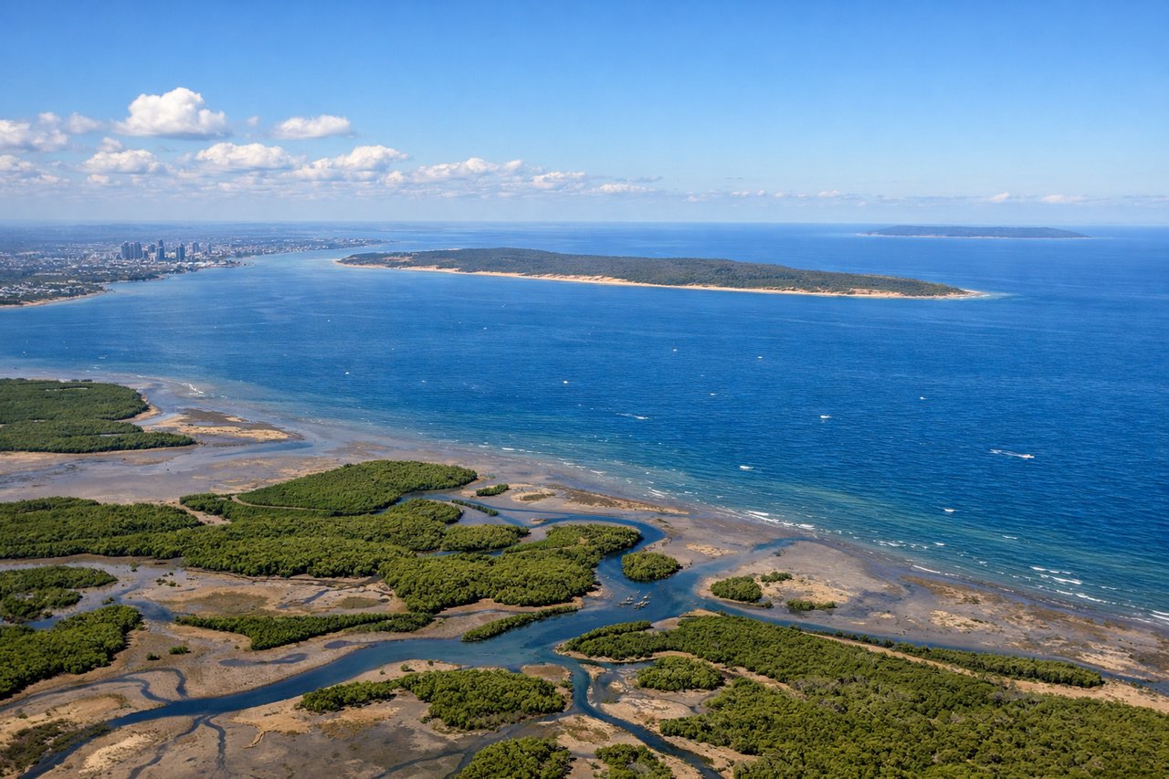
Takeoff from BNE
RIGHTDeparting BNE to the south before banking west, the right side of the aircraft faces north across the Brisbane CBD skyline and the waters of Moreton Bay before the plane turns onto its westbound track. The left side mostly shows the flatter southern suburbs and Logan hinterland.
Landing at AYQ
LEFTOn the descent into AYQ, the approach path brings the aircraft in from the east, giving left-side passengers a clear view of Uluru's massive red dome rising from the flat desert, with the multiple domes of Kata Tjuta visible further southwest. This is one of the most distinctive natural landmarks visible from any commercial flight in Australia.
Will your flight be in sunlight?
Pick a date and time in the Sun Map to watch the sun move across your whole flight.
About This Route
Which side of the plane should I sit on flying from Brisbane International (BNE) to Ayers Rock Connellan Airport (AYQ)?
Sit on the Left side of the plane for the best views on flights from Brisbane to Yulara. While the Brisbane takeoff offers a nice city and bay view, the left side's approach into AYQ delivers the flight's true highlight: an unobstructed, iconic view of Uluru and Kata Tjuta rising from the desert, a rare and visually striking landmark seen from cruising and descent altitude.
What can I see during takeoff from Brisbane International in Brisbane?
During takeoff from Brisbane International (BNE), sit on the Right side for the best views. Departing BNE to the south before banking west, the right side of the aircraft faces north across the Brisbane CBD skyline and the waters of Moreton Bay before the plane turns onto its westbound track. The left side mostly shows the flatter southern suburbs and Logan hinterland. Notable sights include: Brisbane CBD skyline, Moreton Bay, Story Bridge/Brisbane River bends, D'Aguilar Range foothills.
What can I see when landing at Ayers Rock Connellan Airport in Yulara?
When landing at Ayers Rock Connellan Airport (AYQ), sit on the Left side for the best views. On the descent into AYQ, the approach path brings the aircraft in from the east, giving left-side passengers a clear view of Uluru's massive red dome rising from the flat desert, with the multiple domes of Kata Tjuta visible further southwest. This is one of the most distinctive natural landmarks visible from any commercial flight in Australia. Notable sights include: Uluru (Ayers Rock), Kata Tjuta (The Olgas), surrounding red sand desert plains, sparse mulga scrubland.
How long is the flight from Brisbane to Yulara?
The flight from Brisbane International (BNE) to Ayers Rock Connellan Airport (AYQ) takes about 2 hours 50 minutes. The shortest flight path between them is 1,378 miles (2,218 km); winds and air traffic control usually add a few percent.
What does the Brisbane to Yulara flight path pass over?
Great Dividing Range and Darling Downs give way to flat outback plains, with the fringes of the Simpson Desert and distant red sand dune fields visible before the MacDonnell Ranges appear far to the north near Alice Springs.