While takeoff offers dramatic geological features, the landing approach into Heathrow provides more sustained and visually rewarding scenery—the Thames estuary, London's vast urban landscape, and the Chiltern Hills create a compelling finale. Left-side seats capture the most iconic features of the approach.
Flown BDQ to LHR? Did we get it right?
Flight Path
Baroda to London is 4,330 miles (6,968 km), a flight of about 9 hours 30 minutes.
The flight path crosses the Mediterranean (visible as a deep blue expanse around 4-5 hours into flight), the Alps (snow-capped peaks visible on clear days during the central European portion), the Rhine valley (a linear green corridor through central Europe), and the English Channel (final water crossing before reaching southern England). The Pyrenees may be visible on the southern horizon during the western Mediterranean phase. Over central Europe, the Danube valley and various river systems create linear features in the landscape. The transition from Mediterranean climate to temperate European landscape is gradual but noticeable over the course of the flight.
Great circle distance and headings ›


Phase by phase
Takeoff from BDQ
RIGHTRight-side seats offer views of the Narmada River valley and the Western Ghats escarpment as the aircraft climbs northwestward from Vadodara. The terrain transitions from the flat Gujarat plains into dramatic elevated plateau edges within the first 20-30 minutes of flight.
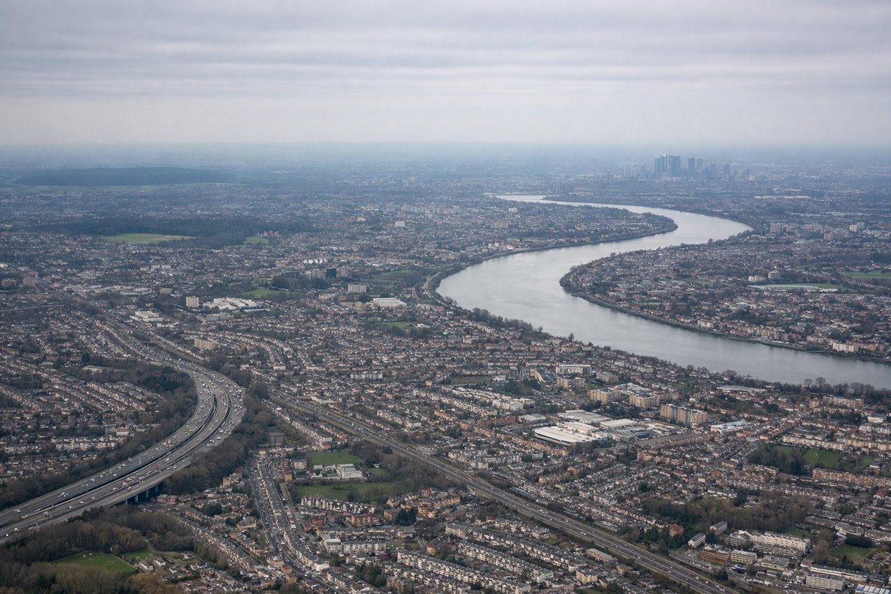
Landing at LHR
LEFTLeft-side seats provide extended views of the Thames estuary, London's urban sprawl, and the approach corridor over southern England. The descent path into Heathrow crosses over the Chiltern Hills and the Thames valley, both prominent on the left side during final approach.
Will your flight be in sunlight?
Pick a date and time in the Sun Map to watch the sun move across your whole flight.
About This Route
Which side of the plane should I sit on flying from Vadodara (BDQ) to Heathrow (LHR)?
Sit on the Left side of the plane for the best views on flights from Baroda to London. While takeoff offers dramatic geological features, the landing approach into Heathrow provides more sustained and visually rewarding scenery—the Thames estuary, London's vast urban landscape, and the Chiltern Hills create a compelling finale. Left-side seats capture the most iconic features of the approach.
What can I see during takeoff from Vadodara in Baroda?
During takeoff from Vadodara (BDQ), sit on the Right side for the best views. Right-side seats offer views of the Narmada River valley and the Western Ghats escarpment as the aircraft climbs northwestward from Vadodara. The terrain transitions from the flat Gujarat plains into dramatic elevated plateau edges within the first 20-30 minutes of flight. Notable sights include: Narmada River (flowing southeast to northwest through the valley below), Western Ghats mountain range (eastern edge visible as a ridge line), Vadodara city grid (visible briefly during initial climb), Pavagadh Hill (isolated peak south of flight path).
What can I see when landing at Heathrow in London?
When landing at Heathrow (LHR), sit on the Left side for the best views. Left-side seats provide extended views of the Thames estuary, London's urban sprawl, and the approach corridor over southern England. The descent path into Heathrow crosses over the Chiltern Hills and the Thames valley, both prominent on the left side during final approach. Notable sights include: Thames River and estuary (wide, meandering waterway with distinctive bends), Greater London urban area (extensive built-up zone), Chiltern Hills (elevated terrain northwest of London), Windsor Castle area (visible as a distinct settlement cluster on the Thames).
How long is the flight from Baroda to London?
The flight from Vadodara (BDQ) to Heathrow (LHR) takes about 9 hours 30 minutes. The shortest flight path between them is 4,330 miles (6,968 km); winds and air traffic control usually add a few percent.
What does the Baroda to London flight path pass over?
The flight path crosses the Mediterranean (visible as a deep blue expanse around 4-5 hours into flight), the Alps (snow-capped peaks visible on clear days during the central European portion), the Rhine valley (a linear green corridor through central Europe), and the English Channel (final water crossing before reaching southern England). The Pyrenees may be visible on the southern horizon during the western Mediterranean phase. Over central Europe, the Danube valley and various river systems create linear features in the landscape. The transition from Mediterranean climate to temperate European landscape is gradual but noticeable over the course of the flight.