The right side offers the more consistently interesting view: Mount Lebanon at departure, glimpses of the Turkish Taurus foothills and Anatolian terrain during cruise, and the Bosphorus/Istanbul skyline on arrival, compared to the largely featureless Mediterranean seen from the left.
Flight Path
Eastern Mediterranean Sea west of Cyprus, transitioning to the southern Turkish coastline and foothills of the Taurus Mountains before the route continues north over the Anatolian plateau toward Istanbul
Great circle distance and headings ›Phase by phase
Takeoff from BEY
RIGHTDeparting BEY, right-side passengers get a dramatic view of the Mount Lebanon range rising steeply right behind the coastal city, while the left side only shows open Mediterranean water.
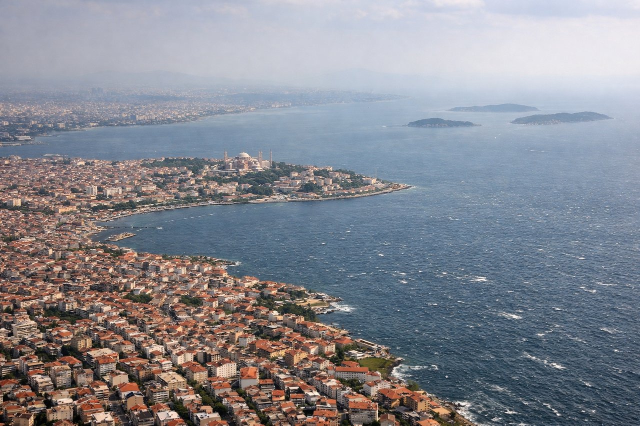
Landing at IST
RIGHTOn approach into IST from the south, the right side faces east toward the Bosphorus strait and Istanbul's sprawling skyline along the Sea of Marmara, while the left side faces mostly rural Thracian farmland.
Landmarks on this routeAll landmarks →
Will your flight be in sunlight?
See exactly which side of the plane gets sun and shade at your departure time.
About This Route
Which side of the plane should I sit on flying from Beirut International (BEY) to İstanbul Airport (IST)?
Sit on the Right side of the plane for the best views on flights from Beirut to Istanbul. The right side offers the more consistently interesting view: Mount Lebanon at departure, glimpses of the Turkish Taurus foothills and Anatolian terrain during cruise, and the Bosphorus/Istanbul skyline on arrival, compared to the largely featureless Mediterranean seen from the left.
What can I see during takeoff from Beirut International in Beirut?
During takeoff from Beirut International (BEY), sit on the Right side for the best views. Departing BEY, right-side passengers get a dramatic view of the Mount Lebanon range rising steeply right behind the coastal city, while the left side only shows open Mediterranean water. Notable sights include: Mount Lebanon range, Beirut coastline and harbor, Mediterranean Sea to the west.
What can I see when landing at İstanbul Airport in Istanbul?
When landing at İstanbul Airport (IST), sit on the Right side for the best views. On approach into IST from the south, the right side faces east toward the Bosphorus strait and Istanbul's sprawling skyline along the Sea of Marmara, while the left side faces mostly rural Thracian farmland. Notable sights include: Bosphorus strait, Sea of Marmara coastline, Istanbul city skyline, Princes' Islands.
How long is the flight from Beirut to Istanbul?
The flight from Beirut International (BEY) to İstanbul Airport (IST) takes 1h 50m.
What does the Beirut to Istanbul flight path pass over?
Eastern Mediterranean Sea west of Cyprus, transitioning to the southern Turkish coastline and foothills of the Taurus Mountains before the route continues north over the Anatolian plateau toward Istanbul