Right-side seats deliver superior scenery on departure with the dramatic Cascade Range and Mount Rainier. While left wins on landing approach, the takeoff experience is more visually rewarding and lasts longer. The midpoint flight path over the Great Plains offers minimal scenic value from either side.
Flown BFI to IND? Did we get it right?
Flight Path
Seattle to Indianapolis is 1,861 miles (2,995 km), a flight of about 4 hours 15 minutes.
After crossing the Cascades, the flight path traverses the Columbia Plateau (eastern Washington and Oregon) with sparse vegetation and subtle terrain variations. Crossing into Idaho and Montana, you'll see the Rocky Mountain foothills and occasional mountain ranges (Bitterroot Range, Flathead region) on the right side, though these appear as distant ridges. The flight then crosses the Great Plains of Montana, Wyoming, and Nebraska—largely flat agricultural and grassland terrain with minimal distinctive landmarks. The Missouri River may be visible as a thin line in places. No major mountain ranges or significant water bodies dominate the central portion of this route. Descent begins over Indiana's agricultural landscape with increasing suburban development as you approach Indianapolis.
Great circle distance and headings ›

Phase by phase
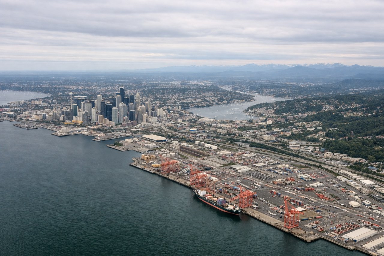
Takeoff from BFI
RIGHTRight-side seats capture the Cascade Range immediately after departure. Aircraft typically climb eastbound out of BFI, and the Cascades dominate the right window during the first 15-20 minutes of flight. Left side faces Puget Sound and the Olympic Mountains, but they're less dramatic from this angle.
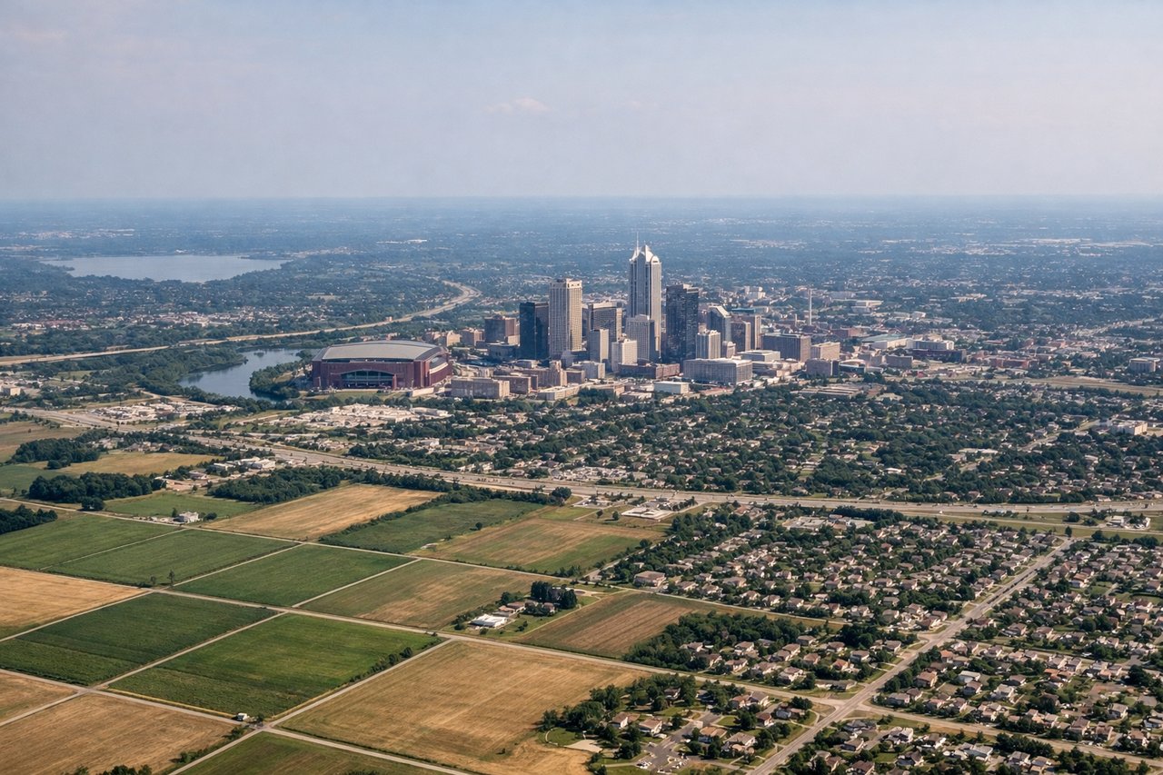
Landing at IND
LEFTLeft-side seats offer the best approach views into Indianapolis. Aircraft descend from the northwest on typical approach vectors, and the left window frames the White River valley and downtown Indianapolis skyline as you descend toward IND. Right side faces farmland and lacks distinctive visual markers.
Will your flight be in sunlight?
Pick a date and time in the Sun Map to watch the sun move across your whole flight.
About This Route
Which side of the plane should I sit on flying from Boeing Fld King Co International (BFI) to Indianapolis International (IND)?
Sit on the Right side of the plane for the best views on flights from Seattle to Indianapolis. Right-side seats deliver superior scenery on departure with the dramatic Cascade Range and Mount Rainier. While left wins on landing approach, the takeoff experience is more visually rewarding and lasts longer. The midpoint flight path over the Great Plains offers minimal scenic value from either side.
What can I see during takeoff from Boeing Fld King Co International in Seattle?
During takeoff from Boeing Fld King Co International (BFI), sit on the Right side for the best views. Right-side seats capture the Cascade Range immediately after departure. Aircraft typically climb eastbound out of BFI, and the Cascades dominate the right window during the first 15-20 minutes of flight. Left side faces Puget Sound and the Olympic Mountains, but they're less dramatic from this angle. Notable sights include: Cascade Range (Mount Rainier visible on clear days ~50 miles southeast), Lake Washington (directly below during initial climb), Puget Sound (left side, receding westward), Seattle metropolitan area (beneath and behind).
What can I see when landing at Indianapolis International in Indianapolis?
When landing at Indianapolis International (IND), sit on the Left side for the best views. Left-side seats offer the best approach views into Indianapolis. Aircraft descend from the northwest on typical approach vectors, and the left window frames the White River valley and downtown Indianapolis skyline as you descend toward IND. Right side faces farmland and lacks distinctive visual markers. Notable sights include: White River (winding through central Indianapolis), Downtown Indianapolis skyline (visible 10-15 miles out), Broad Ripple area and residential neighborhoods (north of downtown), flat agricultural plains (surrounding the metro area).
How long is the flight from Seattle to Indianapolis?
The flight from Boeing Fld King Co International (BFI) to Indianapolis International (IND) takes about 4 hours 15 minutes. The shortest flight path between them is 1,861 miles (2,995 km); winds and air traffic control usually add a few percent.
What does the Seattle to Indianapolis flight path pass over?
After crossing the Cascades, the flight path traverses the Columbia Plateau (eastern Washington and Oregon) with sparse vegetation and subtle terrain variations. Crossing into Idaho and Montana, you'll see the Rocky Mountain foothills and occasional mountain ranges (Bitterroot Range, Flathead region) on the right side, though these appear as distant ridges. The flight then crosses the Great Plains of Montana, Wyoming, and Nebraska—largely flat agricultural and grassland terrain with minimal distinctive landmarks. The Missouri River may be visible as a thin line in places. No major mountain ranges or significant water bodies dominate the central portion of this route. Descent begins over Indiana's agricultural landscape with increasing suburban development as you approach Indianapolis.