Seattle to Reno is 569 miles (916 km), a flight of about 1 hour 35 minutes.
The right side consistently faces west toward the Cascade volcanoes near departure and the Sierra Nevada near arrival, giving passengers the most dramatic and varied mountain scenery of the flight, while the left side spends most of the trip over flat high-desert terrain in eastern Oregon and Nevada.
Flight Path
Central Oregon high desert and the northern Great Basin, with distant views of the Cascade volcanoes (Mount Hood, Mount Shasta) to the west before the route descends into the Sierra Nevada foothills approaching Reno.
Great circle distance and headings ›


Phase by phase
Takeoff from BFI
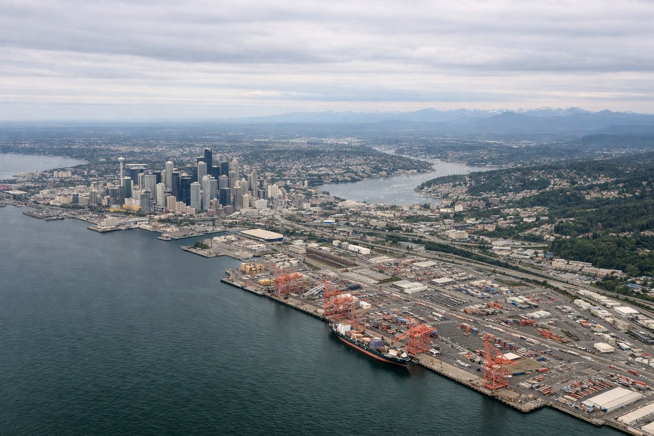
RIGHTDeparting BFI on runway 14 and turning south, the right side offers views over Puget Sound toward the Olympic Mountains while Mount Rainier's massive snow-capped cone dominates the horizon to the southwest as the plane climbs. The left side mostly shows the flatter suburban sprawl east of Lake Washington with less dramatic terrain.
Landing at RNO
RIGHTOn approach into RNO, the descent path skirts the eastern edge of the Sierra Nevada, giving right-side passengers a clear view of the range's granite ridgelines and, depending on the day's runway direction, glimpses toward the Lake Tahoe basin just southwest of the airport. The left side instead faces the flatter, scrub-covered Great Basin terrain east of Reno with far less visual interest.
Landmarks on this routeAll landmarks →
Will your flight be in sunlight?
Pick a date and time in the Sun Map to watch the sun move across your whole flight.
About This Route
Which side of the plane should I sit on flying from Boeing Fld King Co International (BFI) to Reno Tahoe International (RNO)?
Sit on the Right side of the plane for the best views on flights from Seattle to Reno. The right side consistently faces west toward the Cascade volcanoes near departure and the Sierra Nevada near arrival, giving passengers the most dramatic and varied mountain scenery of the flight, while the left side spends most of the trip over flat high-desert terrain in eastern Oregon and Nevada.
What can I see during takeoff from Boeing Fld King Co International in Seattle?
During takeoff from Boeing Fld King Co International (BFI), sit on the Right side for the best views. Departing BFI on runway 14 and turning south, the right side offers views over Puget Sound toward the Olympic Mountains while Mount Rainier's massive snow-capped cone dominates the horizon to the southwest as the plane climbs. The left side mostly shows the flatter suburban sprawl east of Lake Washington with less dramatic terrain. Notable sights include: Puget Sound, Olympic Mountains, Mount Rainier, Lake Washington.
What can I see when landing at Reno Tahoe International in Reno?
When landing at Reno Tahoe International (RNO), sit on the Right side for the best views. On approach into RNO, the descent path skirts the eastern edge of the Sierra Nevada, giving right-side passengers a clear view of the range's granite ridgelines and, depending on the day's runway direction, glimpses toward the Lake Tahoe basin just southwest of the airport. The left side instead faces the flatter, scrub-covered Great Basin terrain east of Reno with far less visual interest. Notable sights include: Sierra Nevada ridgeline, Lake Tahoe basin (partial), Truckee River valley, Reno's downtown grid.
How long is the flight from Seattle to Reno?
The flight from Boeing Fld King Co International (BFI) to Reno Tahoe International (RNO) takes about 1 hour 35 minutes. The shortest flight path between them is 569 miles (916 km); winds and air traffic control usually add a few percent.
What does the Seattle to Reno flight path pass over?
Central Oregon high desert and the northern Great Basin, with distant views of the Cascade volcanoes (Mount Hood, Mount Shasta) to the west before the route descends into the Sierra Nevada foothills approaching Reno.