Reno to Seattle is 569 miles (916 km), a flight of about 2 hours 15 minutes.
While takeoff offers excellent Sierra Nevada views, the landing approach to BFI provides the more memorable visual payoff with Mount Rainier's iconic presence. The right side captures this signature landmark during the descent phase when it becomes increasingly prominent.
Flight Path
The flight path crosses the Cascade Range roughly 90 minutes into the flight. Northbound from Reno, the aircraft climbs over the Sierra Nevada crest (11,000-13,000 ft terrain), then cruises at 25,000-35,000 feet across central Oregon and Washington. Notable midpoint landmarks include the Deschutes River valley (visible as a linear feature in central Oregon), and the transition from high desert to forested Cascade foothills. On clear days, peaks like Mount Hood (11,240 ft) and Mount Jefferson (10,497 ft) are visible as distant white cones during the cruise phase, though they appear small on the horizon. The Willamette Valley (Oregon's agricultural region) is visible as a patchwork of fields west of the Cascades during the approach descent into Washington.
Great circle distance and headings ›


Phase by phase
Takeoff from RNO
LEFTRNO typically departs northbound (Runway 16L/R). Left seats face west toward the Sierra Nevada escarpment, which rises dramatically just 20-30 miles west of the airport. Right seats see the high desert plateau extending eastward—visually flat and less distinctive.
Landing at BFI
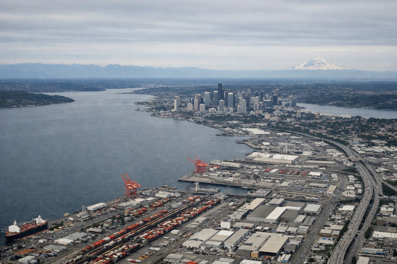
RIGHTBFI approaches from the south (typically Runway 16L/R, landing northbound). Right seats face east during descent, capturing the Cascade Range and Mount Rainier as they come into view 40-50 miles away. Left seats see Puget Sound and the Olympic Mountains to the west—equally scenic but Mount Rainier is the more iconic landmark.
Landmarks on this routeAll landmarks →
Will your flight be in sunlight?
Pick a date and time in the Sun Map to watch the sun move across your whole flight.
About This Route
Which side of the plane should I sit on flying from Reno Tahoe International (RNO) to Boeing Fld King Co International (BFI)?
Sit on the Right side of the plane for the best views on flights from Reno to Seattle. While takeoff offers excellent Sierra Nevada views, the landing approach to BFI provides the more memorable visual payoff with Mount Rainier's iconic presence. The right side captures this signature landmark during the descent phase when it becomes increasingly prominent.
What can I see during takeoff from Reno Tahoe International in Reno?
During takeoff from Reno Tahoe International (RNO), sit on the Left side for the best views. RNO typically departs northbound (Runway 16L/R). Left seats face west toward the Sierra Nevada escarpment, which rises dramatically just 20-30 miles west of the airport. Right seats see the high desert plateau extending eastward—visually flat and less distinctive. Notable sights include: Sierra Nevada (western escarpment), Lake Tahoe (visible on clear days 40 miles southwest), Washoe Lake (small, closer to the north), Virginia Range (low mountains immediately west).
What can I see when landing at Boeing Fld King Co International in Seattle?
When landing at Boeing Fld King Co International (BFI), sit on the Right side for the best views. BFI approaches from the south (typically Runway 16L/R, landing northbound). Right seats face east during descent, capturing the Cascade Range and Mount Rainier as they come into view 40-50 miles away. Left seats see Puget Sound and the Olympic Mountains to the west—equally scenic but Mount Rainier is the more iconic landmark. Notable sights include: Mount Rainier (14,411 ft, visible 40+ miles away on clear days), Cascade Range (extending north-south), Lake Union (visible near Seattle), Puget Sound (water body west of approach path).
How long is the flight from Reno to Seattle?
The flight from Reno Tahoe International (RNO) to Boeing Fld King Co International (BFI) takes about 2 hours 15 minutes. The shortest flight path between them is 569 miles (916 km); winds and air traffic control usually add a few percent.
What does the Reno to Seattle flight path pass over?
The flight path crosses the Cascade Range roughly 90 minutes into the flight. Northbound from Reno, the aircraft climbs over the Sierra Nevada crest (11,000-13,000 ft terrain), then cruises at 25,000-35,000 feet across central Oregon and Washington. Notable midpoint landmarks include the Deschutes River valley (visible as a linear feature in central Oregon), and the transition from high desert to forested Cascade foothills. On clear days, peaks like Mount Hood (11,240 ft) and Mount Jefferson (10,497 ft) are visible as distant white cones during the cruise phase, though they appear small on the horizon. The Willamette Valley (Oregon's agricultural region) is visible as a patchwork of fields west of the Cascades during the approach descent into Washington.