Seattle to Taipei is 6,060 miles (9,752 km), a flight of about 13 hours 30 minutes.
While the takeoff favors the left with Seattle's skyline and the Olympics, the right side wins overall thanks to a distant glimpse of the Cascades near Mount Rainier during climb-out and a dramatic final approach past Taipei's volcanic peaks and skyline into TPE.
Flight Path
Aleutian Islands chain, Kamchatka Peninsula coastline, Sea of Japan, East China Sea approaching Taiwan
Great circle distance and headings ›Phase by phase
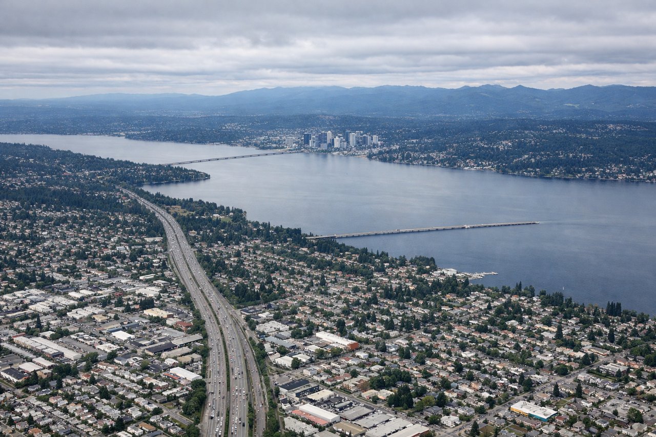
Takeoff from BFI
LEFTDeparting BFI on runway 14 southeast, the aircraft typically banks north toward the transpacific corridor, putting Seattle's downtown skyline, Elliott Bay, and Puget Sound on the left. The Olympic Mountains rise beyond the water, giving a strong opening sequence before the turn out over open water.
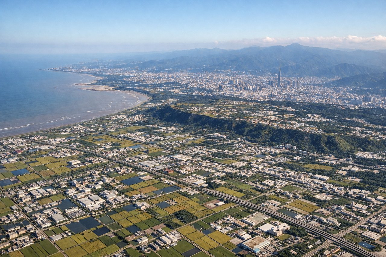
Landing at TPE
RIGHTOn approach into TPE from the southwest, landing to the northeast, the right side faces the volcanic Yangmingshan massif and the Taipei basin, with the city's skyline and the Tamsui River visible just before touchdown. The left side mostly shows the flatter Taiwan Strait coastline.
Landmarks on this routeAll landmarks →
Will your flight be in sunlight?
Pick a date and time in the Sun Map to watch the sun move across your whole flight.
About This Route
Which side of the plane should I sit on flying from Boeing Fld King Co International (BFI) to Chiang Kai Shek International (TPE)?
Sit on the Right side of the plane for the best views on flights from Seattle to Taipei. While the takeoff favors the left with Seattle's skyline and the Olympics, the right side wins overall thanks to a distant glimpse of the Cascades near Mount Rainier during climb-out and a dramatic final approach past Taipei's volcanic peaks and skyline into TPE.
What can I see during takeoff from Boeing Fld King Co International in Seattle?
During takeoff from Boeing Fld King Co International (BFI), sit on the Left side for the best views. Departing BFI on runway 14 southeast, the aircraft typically banks north toward the transpacific corridor, putting Seattle's downtown skyline, Elliott Bay, and Puget Sound on the left. The Olympic Mountains rise beyond the water, giving a strong opening sequence before the turn out over open water. Notable sights include: Seattle skyline and Elliott Bay, Puget Sound, Olympic Mountains, Bainbridge Island.
What can I see when landing at Chiang Kai Shek International in Taipei?
When landing at Chiang Kai Shek International (TPE), sit on the Right side for the best views. On approach into TPE from the southwest, landing to the northeast, the right side faces the volcanic Yangmingshan massif and the Taipei basin, with the city's skyline and the Tamsui River visible just before touchdown. The left side mostly shows the flatter Taiwan Strait coastline. Notable sights include: Yangmingshan volcanic peaks, Taipei skyline (Taipei 101), Tamsui River estuary, Taipei Basin farmland.
How long is the flight from Seattle to Taipei?
The flight from Boeing Fld King Co International (BFI) to Chiang Kai Shek International (TPE) takes about 13 hours 30 minutes. The shortest flight path between them is 6,060 miles (9,752 km); winds and air traffic control usually add a few percent.
What does the Seattle to Taipei flight path pass over?
Aleutian Islands chain, Kamchatka Peninsula coastline, Sea of Japan, East China Sea approaching Taiwan