The left side wins primarily on the descent into Chiang Rai, where the mountainous terrain of northern Thailand near the Myanmar border becomes visible, contrasting with the otherwise flat and unremarkable central plains seen during takeoff and cruise.
Flown BKK to CEI? Did we get it right?
Flight Path
Bangkok to Chiang Rai is 437 miles (703 km), a flight of about 1 hour 10 minutes.
Central Thai plains, the Chao Phraya river basin, and the northern edge of the Khao Khwang foothills as the terrain begins rising toward Chiang Rai
Great circle distance and headings ›Phase by phase
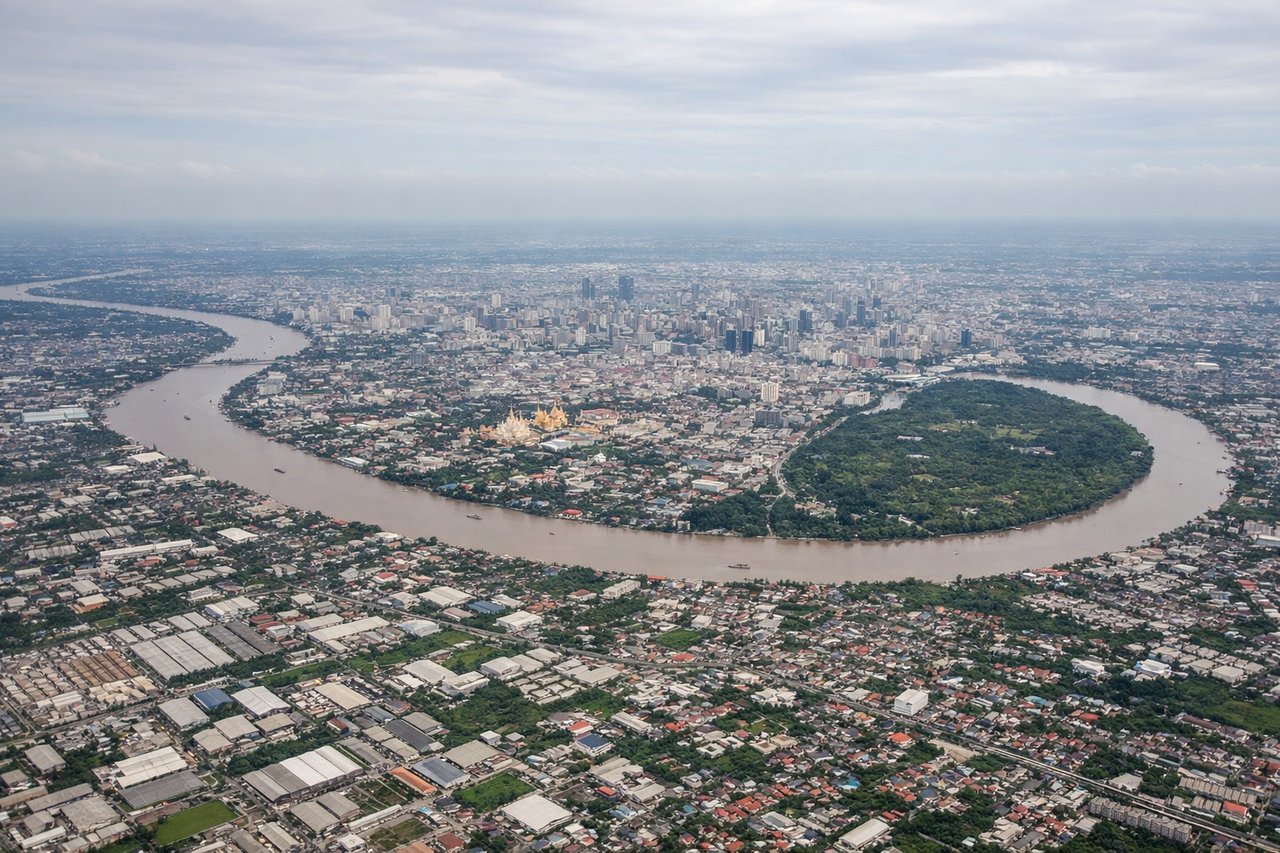
Takeoff from BKK
LEFTDeparting BKK heading north, the left side offers a brief glimpse of the Chao Phraya river delta and Bangkok's northern suburbs before the plains take over. It's not dramatic, but slightly more visual interest than the featureless paddy fields on the right.
Landing at CEI
LEFTChiang Rai sits in a valley ringed by mountains, and approaches typically swing past the ranges along the Myanmar border to the west before lining up on runway 03/21. Passengers on the left get sweeping views of forested ridgelines and the Golden Triangle highlands as the plane descends.
Will your flight be in sunlight?
Pick a date and time in the Sun Map to watch the sun move across your whole flight.
About This Route
Which side of the plane should I sit on flying from Suvarnabhumi Airport (BKK) to Mae Fah Luang - Chiang Rai International Airport (CEI)?
Sit on the Left side of the plane for the best views on flights from Bangkok to Chiang Rai. The left side wins primarily on the descent into Chiang Rai, where the mountainous terrain of northern Thailand near the Myanmar border becomes visible, contrasting with the otherwise flat and unremarkable central plains seen during takeoff and cruise.
What can I see during takeoff from Suvarnabhumi Airport in Bangkok?
During takeoff from Suvarnabhumi Airport (BKK), sit on the Left side for the best views. Departing BKK heading north, the left side offers a brief glimpse of the Chao Phraya river delta and Bangkok's northern suburbs before the plains take over. It's not dramatic, but slightly more visual interest than the featureless paddy fields on the right. Notable sights include: Chao Phraya River, Bangkok's northern sprawl, patchwork rice paddies.
What can I see when landing at Mae Fah Luang - Chiang Rai International Airport in Chiang Rai?
When landing at Mae Fah Luang - Chiang Rai International Airport (CEI), sit on the Left side for the best views. Chiang Rai sits in a valley ringed by mountains, and approaches typically swing past the ranges along the Myanmar border to the west before lining up on runway 03/21. Passengers on the left get sweeping views of forested ridgelines and the Golden Triangle highlands as the plane descends. Notable sights include: Doi Tung mountain range, forested ridgelines near the Myanmar border, Kok River valley, Chiang Rai's mountain-ringed basin.
How long is the flight from Bangkok to Chiang Rai?
The flight from Suvarnabhumi Airport (BKK) to Mae Fah Luang - Chiang Rai International Airport (CEI) takes about 1 hour 10 minutes. The shortest flight path between them is 437 miles (703 km); winds and air traffic control usually add a few percent.
What does the Bangkok to Chiang Rai flight path pass over?
Central Thai plains, the Chao Phraya river basin, and the northern edge of the Khao Khwang foothills as the terrain begins rising toward Chiang Rai