The left side wins because the route's northern half tracks close to the eastern Tibetan Plateau's mountainous fringe and the Tian Shan range near Kazakhstan, both of which sit to the west/southwest of the flight path and are best seen from the left window, while the right side mostly overlooks featureless plains and basins.
Flown BKK to CIT? Did we get it right?
Flight Path
Bangkok to Chimkent is 2,721 miles (4,379 km), a flight of about 5 hours 10 minutes.
Hengduan Mountains and eastern Tibetan Plateau foothills over Yunnan/Sichuan, the arid Tarim Basin fringe in Xinjiang, and the western Tian Shan range approaching Kazakhstan
Great circle distance and headings ›


Phase by phase
Takeoff from BKK
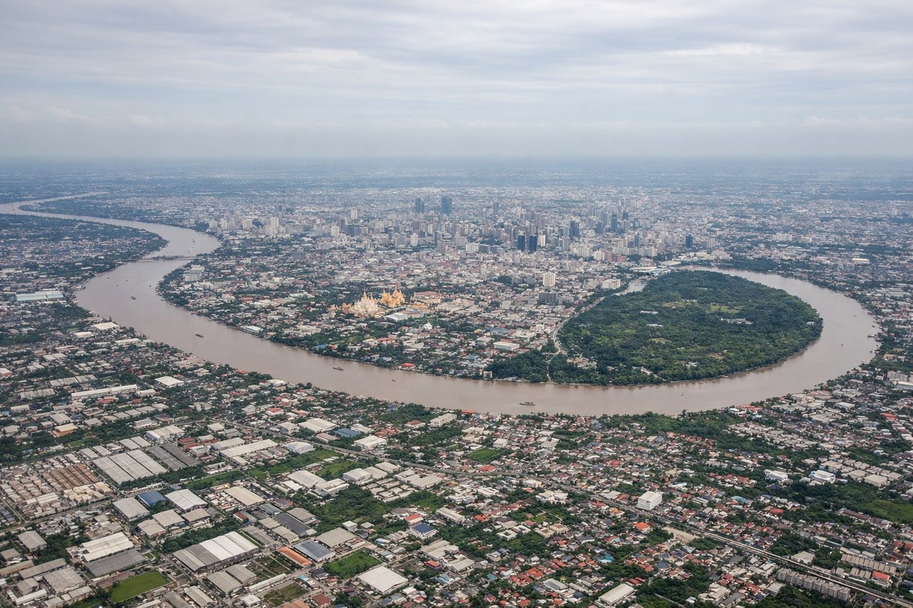
LEFTDeparting BKK to the north, the initial climb and turn onto a northwesterly heading puts Bangkok's western sprawl and the winding Chao Phraya River beneath the left side, with the city's skyline and river bends more prominent than the flatter eastern suburbs on the right.
Landing at CIT
LEFTOn approach into Shymkent, the descent path curves in from the south, bringing the snow-streaked foothills of the western Tian Shan into view on the left side before the flat Kazakh steppe dominates the final turn to the runway.
Will your flight be in sunlight?
Pick a date and time in the Sun Map to watch the sun move across your whole flight.
About This Route
Which side of the plane should I sit on flying from Suvarnabhumi Airport (BKK) to Shymkent (CIT)?
Sit on the Left side of the plane for the best views on flights from Bangkok to Chimkent. The left side wins because the route's northern half tracks close to the eastern Tibetan Plateau's mountainous fringe and the Tian Shan range near Kazakhstan, both of which sit to the west/southwest of the flight path and are best seen from the left window, while the right side mostly overlooks featureless plains and basins.
What can I see during takeoff from Suvarnabhumi Airport in Bangkok?
During takeoff from Suvarnabhumi Airport (BKK), sit on the Left side for the best views. Departing BKK to the north, the initial climb and turn onto a northwesterly heading puts Bangkok's western sprawl and the winding Chao Phraya River beneath the left side, with the city's skyline and river bends more prominent than the flatter eastern suburbs on the right. Notable sights include: Chao Phraya River bends, Bangkok skyline (Sathorn/Silom towers), Suvarnabhumi's parallel runway pair, western Bangkok suburbs.
What can I see when landing at Shymkent in Chimkent?
When landing at Shymkent (CIT), sit on the Left side for the best views. On approach into Shymkent, the descent path curves in from the south, bringing the snow-streaked foothills of the western Tian Shan into view on the left side before the flat Kazakh steppe dominates the final turn to the runway. Notable sights include: Western Tian Shan foothills, Arys River valley, Shymkent's grid-pattern outskirts, Kazakh steppe.
How long is the flight from Bangkok to Chimkent?
The flight from Suvarnabhumi Airport (BKK) to Shymkent (CIT) takes about 5 hours 10 minutes. The shortest flight path between them is 2,721 miles (4,379 km); winds and air traffic control usually add a few percent.
What does the Bangkok to Chimkent flight path pass over?
Hengduan Mountains and eastern Tibetan Plateau foothills over Yunnan/Sichuan, the arid Tarim Basin fringe in Xinjiang, and the western Tian Shan range approaching Kazakhstan