The left side wins overall because the polar great-circle route puts the Tibetan Plateau's eastern foothills and the vast, texture-rich Siberian taiga and Arctic ice pack on that side during the long cruise phase, adding more visual variety than the right side's more monotonous Pacific-facing views, even though the right side has the better landing approach.
Flown BKK to IAD? Did we get it right?
Flight Path
Bangkok to Washington is 8,799 miles (14,160 km), a flight of about 16 hours 45 minutes.
Eastern Tibetan Plateau foothills, Gobi Desert fringes, Siberian taiga, Arctic sea ice near the pole, Hudson Bay coastline, Canadian Shield lake country
Great circle distance and headings ›


Phase by phase
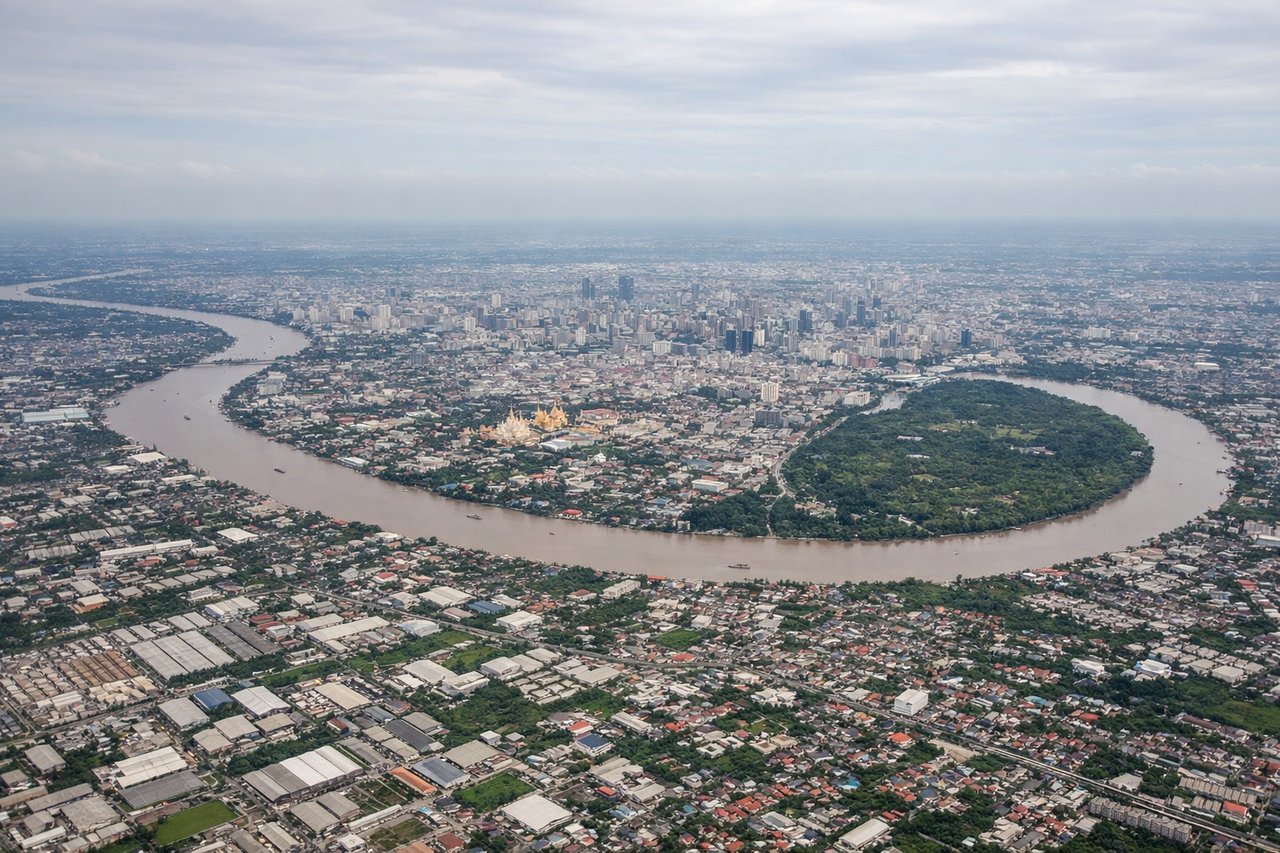
Takeoff from BKK
LEFTDeparting Suvarnabhumi on the northbound runway during the dry season, the initial climb keeps Bangkok's sprawling cityscape and the looping Chao Phraya River on the left, while the right side shows mostly flat rice-paddy delta toward the Gulf of Thailand.
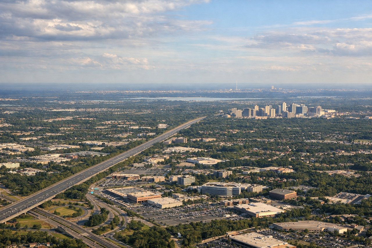
Landing at IAD
RIGHTOn the descent into Dulles from the north, a southbound landing on runway 19 puts the forested ridges of the Blue Ridge Mountains and Shenandoah Valley on the right, offering more relief than the flatter Piedmont farmland visible on the left.
Will your flight be in sunlight?
Pick a date and time in the Sun Map to watch the sun move across your whole flight.
About This Route
Which side of the plane should I sit on flying from Suvarnabhumi Airport (BKK) to Washington Dulles International (IAD)?
Sit on the Left side of the plane for the best views on flights from Bangkok to Washington. The left side wins overall because the polar great-circle route puts the Tibetan Plateau's eastern foothills and the vast, texture-rich Siberian taiga and Arctic ice pack on that side during the long cruise phase, adding more visual variety than the right side's more monotonous Pacific-facing views, even though the right side has the better landing approach.
What can I see during takeoff from Suvarnabhumi Airport in Bangkok?
During takeoff from Suvarnabhumi Airport (BKK), sit on the Left side for the best views. Departing Suvarnabhumi on the northbound runway during the dry season, the initial climb keeps Bangkok's sprawling cityscape and the looping Chao Phraya River on the left, while the right side shows mostly flat rice-paddy delta toward the Gulf of Thailand. Notable sights include: Chao Phraya River, Bangkok skyline, Bang Pa-In delta farmland.
What can I see when landing at Washington Dulles International in Washington?
When landing at Washington Dulles International (IAD), sit on the Right side for the best views. On the descent into Dulles from the north, a southbound landing on runway 19 puts the forested ridges of the Blue Ridge Mountains and Shenandoah Valley on the right, offering more relief than the flatter Piedmont farmland visible on the left. Notable sights include: Blue Ridge Mountains, Shenandoah Valley ridgelines, Potomac River headwaters area.
How long is the flight from Bangkok to Washington?
The flight from Suvarnabhumi Airport (BKK) to Washington Dulles International (IAD) takes about 16 hours 45 minutes. The shortest flight path between them is 8,799 miles (14,160 km); winds and air traffic control usually add a few percent.
What does the Bangkok to Washington flight path pass over?
Eastern Tibetan Plateau foothills, Gobi Desert fringes, Siberian taiga, Arctic sea ice near the pole, Hudson Bay coastline, Canadian Shield lake country