While the left side gets a brief urban view of Bangkok at takeoff, the right side delivers the flight's defining feature: genuine, sustained Himalayan mountain scenery during the descent and approach into Kathmandu, which is far more visually dramatic than anything visible from the left over the rest of the route.
Flight Path
Route crosses the Shan Hills and Ayeyarwady basin of Myanmar, then the flat deltaic plains of Bangladesh near the Sundarbans, followed by the wide agricultural plains of the Ganges basin in northern India before rising terrain signals the approach to the Himalayan front near Nepal.
Great circle distance and headings ›.jpg?width=600)

Phase by phase
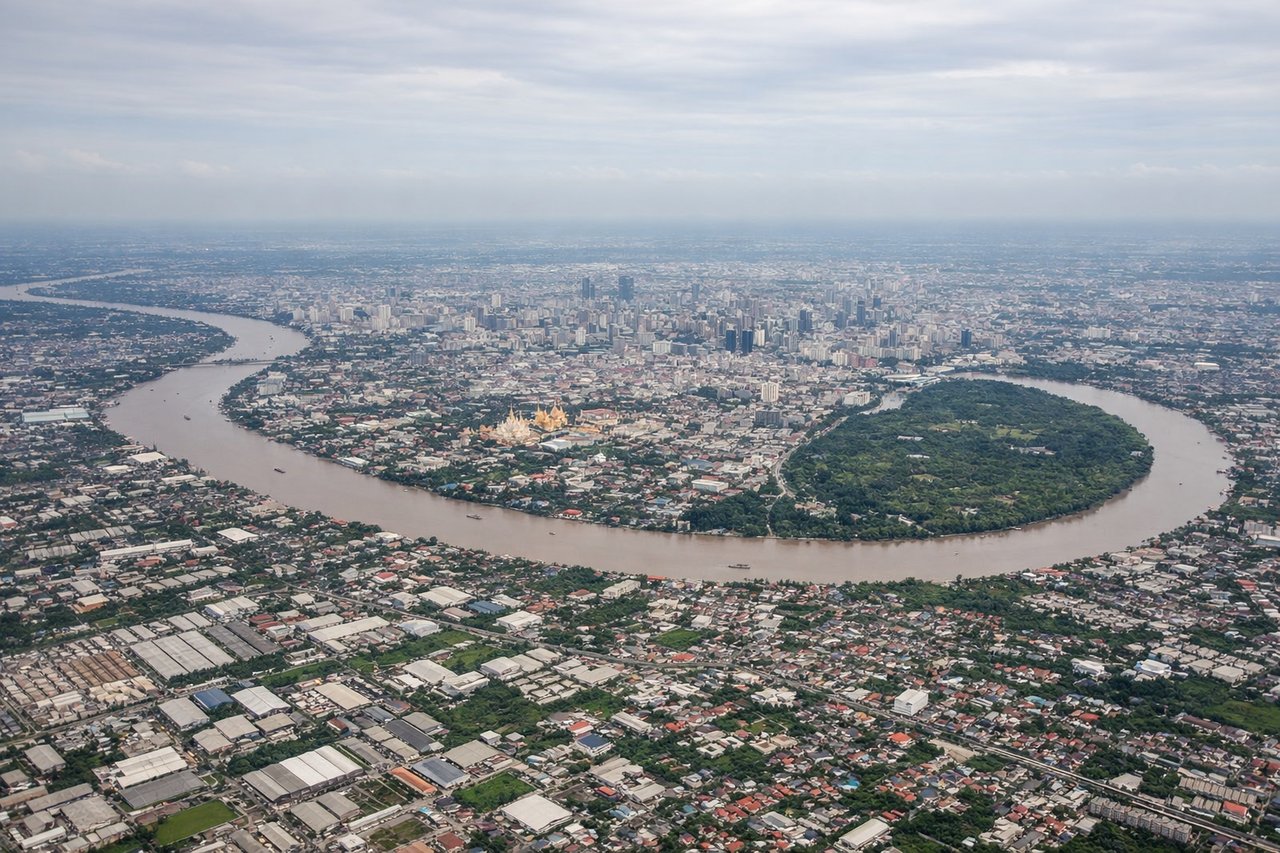
Takeoff from BKK
LEFTDeparting Suvarnabhumi, the aircraft typically climbs out and banks toward the northwest to set course for Myanmar, putting Bangkok's skyline and the looping bends of the Chao Phraya River under the left wing during the turn. This is the only real urban scenery on the entire route, since the rest of the flight is over rural terrain.
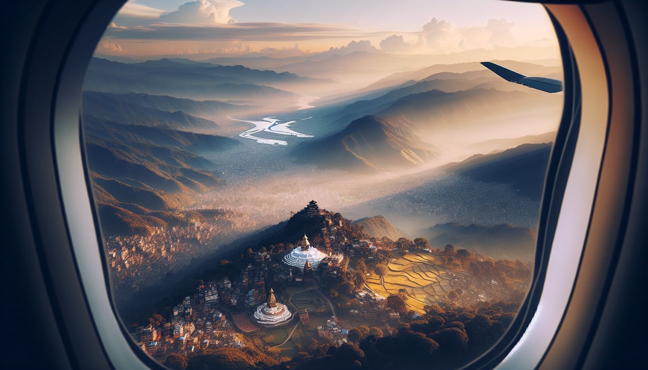
Landing at KTM
RIGHTOn approach to Kathmandu from the southeast, the aircraft descends over the terraced hills of the valley and turns to align with runway 02, bringing the snow-capped Himalayan wall into view on the right side. This is the dramatic payoff of the whole flight, with real high-relief mountain scenery replacing the flat plains flown over for hours before.
Landmarks on this routeAll landmarks →
Will your flight be in sunlight?
See exactly which side of the plane gets sun and shade at your departure time.
About This Route
Which side of the plane should I sit on flying from Suvarnabhumi Airport (BKK) to Tribhuvan International (KTM)?
Sit on the Right side of the plane for the best views on flights from Bangkok to Kathmandu. While the left side gets a brief urban view of Bangkok at takeoff, the right side delivers the flight's defining feature: genuine, sustained Himalayan mountain scenery during the descent and approach into Kathmandu, which is far more visually dramatic than anything visible from the left over the rest of the route.
What can I see during takeoff from Suvarnabhumi Airport in Bangkok?
During takeoff from Suvarnabhumi Airport (BKK), sit on the Left side for the best views. Departing Suvarnabhumi, the aircraft typically climbs out and banks toward the northwest to set course for Myanmar, putting Bangkok's skyline and the looping bends of the Chao Phraya River under the left wing during the turn. This is the only real urban scenery on the entire route, since the rest of the flight is over rural terrain. Notable sights include: Chao Phraya River bends, Bangkok skyscraper cluster (Sathorn/Silom), Suvarnabhumi's canal-crossed rice paddies, greater Bangkok sprawl.
What can I see when landing at Tribhuvan International in Kathmandu?
When landing at Tribhuvan International (KTM), sit on the Right side for the best views. On approach to Kathmandu from the southeast, the aircraft descends over the terraced hills of the valley and turns to align with runway 02, bringing the snow-capped Himalayan wall into view on the right side. This is the dramatic payoff of the whole flight, with real high-relief mountain scenery replacing the flat plains flown over for hours before. Notable sights include: Himalayan foothills and Langtang Himal massif, Ganesh Himal peaks, terraced green ridgelines of the Kathmandu Valley, Bagmati River valley below.
How long is the flight from Bangkok to Kathmandu?
The flight from Suvarnabhumi Airport (BKK) to Tribhuvan International (KTM) takes 3h 35m.
What does the Bangkok to Kathmandu flight path pass over?
Route crosses the Shan Hills and Ayeyarwady basin of Myanmar, then the flat deltaic plains of Bangladesh near the Sundarbans, followed by the wide agricultural plains of the Ganges basin in northern India before rising terrain signals the approach to the Himalayan front near Nepal.