While the Bangkok departure offers a brief urban and river view, the ONT arrival delivers sustained, dramatic mountain scenery with the San Gabriels and Cajon Pass, giving the right side the stronger overall visual payoff.
Flown BKK to ONT? Did we get it right?
Flight Path
Bangkok to Ontario is 8,286 miles (13,335 km), a flight of about 15 hours 45 minutes.
Route crosses southern China's mountainous Yunnan plateau, then Mongolia's steppe, the Sea of Okhotsk, Kamchatka Peninsula, the Aleutian chain, the Gulf of Alaska, and the Alaska Range before tracking down the Pacific Northwest coastline toward California.
Great circle distance and headings ›


Phase by phase
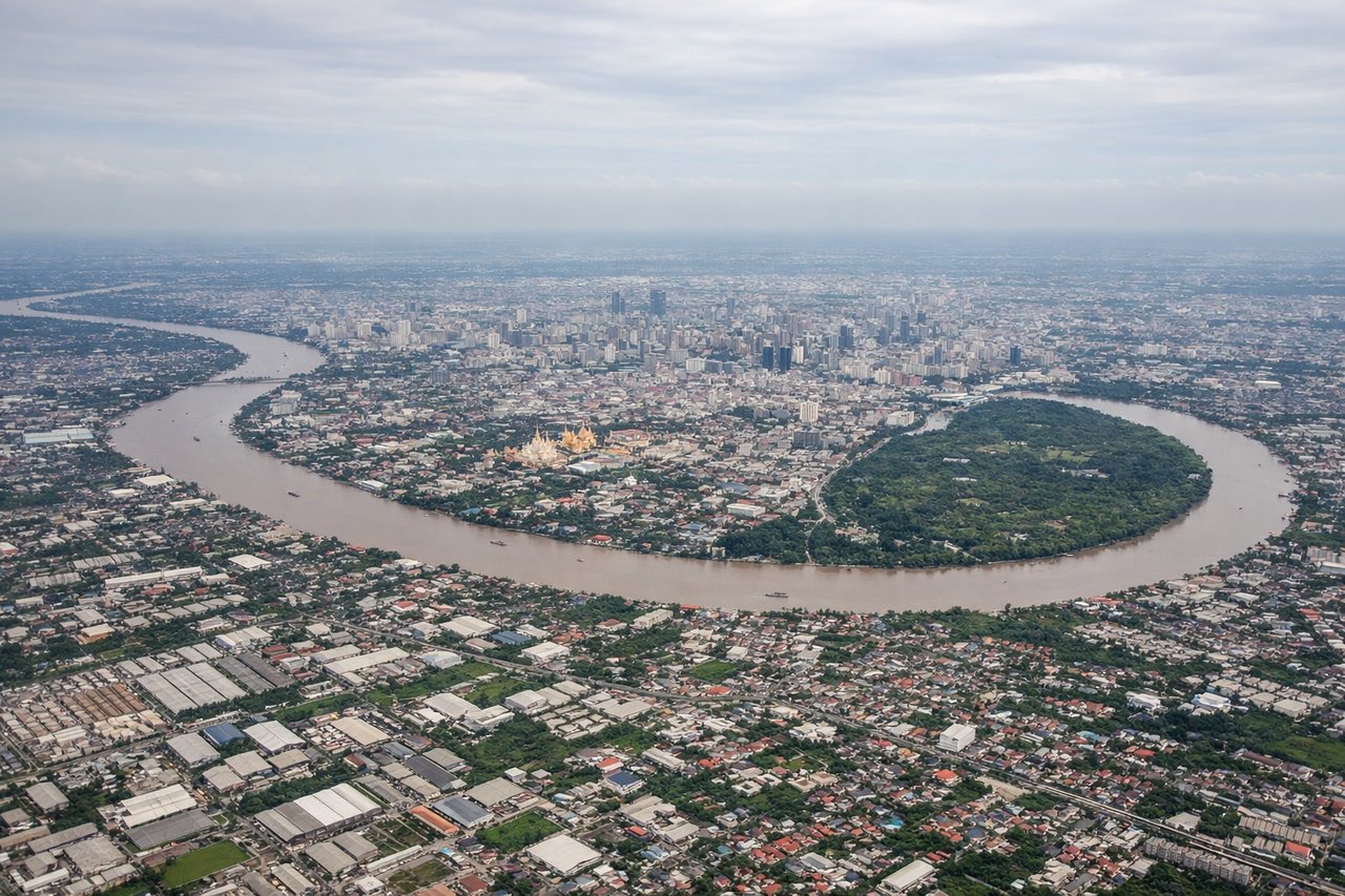
Takeoff from BKK
LEFTDeparting Suvarnabhumi on the northbound runway during dry season, the aircraft banks east toward the China/Siberia routing, swinging Bangkok's skyline, the Chao Phraya River, and the patchwork of central Thai rice paddies into view on the left side before the turn.
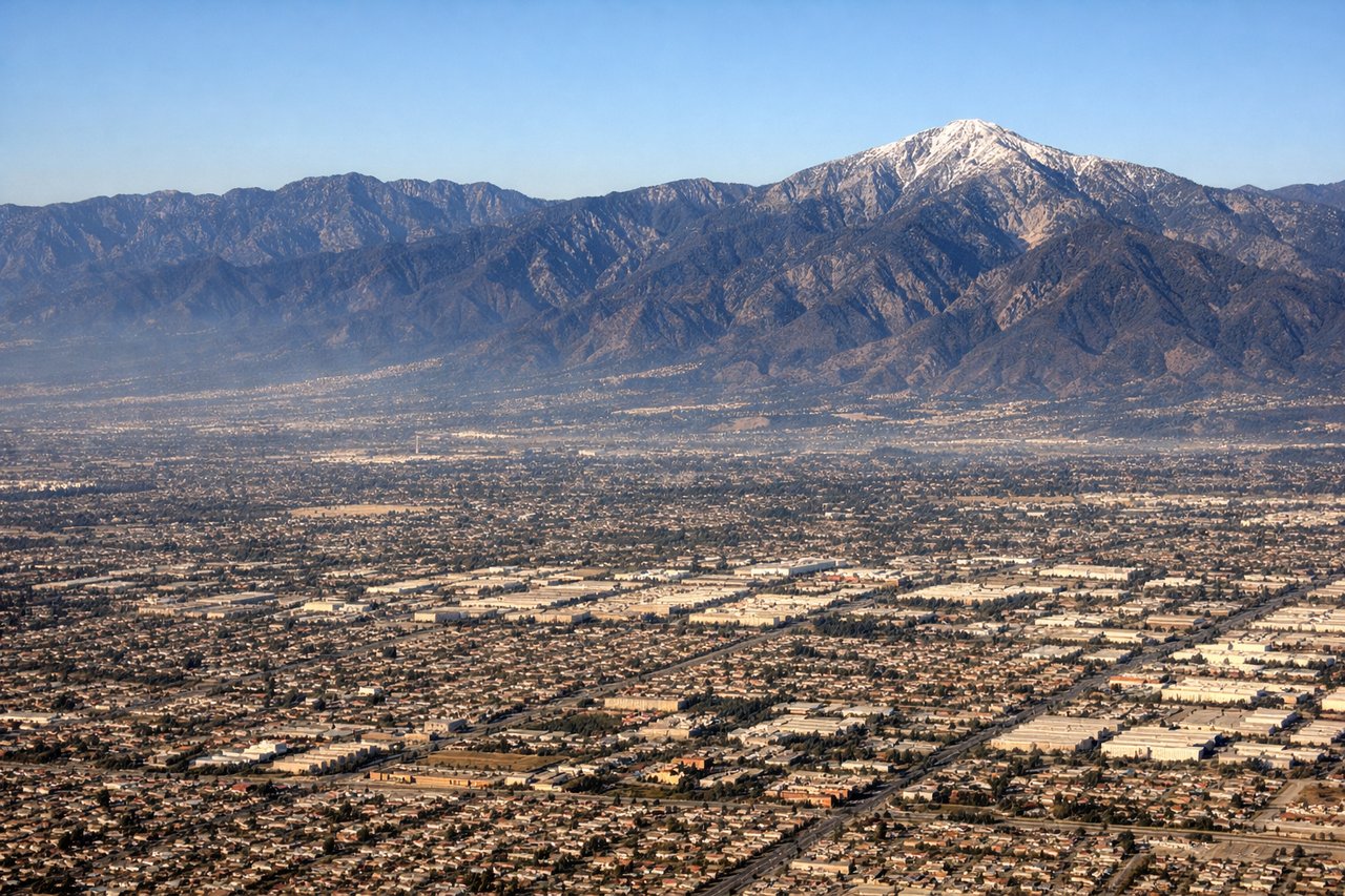
Landing at ONT
RIGHTOn the typical westerly approach into ONT (runway 26), the aircraft descends from the east across the high desert, putting the San Gabriel Mountains and Mount Baldy's often snow-dusted summit on the right side as the plane threads past Cajon Pass into the Inland Empire.
Will your flight be in sunlight?
Pick a date and time in the Sun Map to watch the sun move across your whole flight.
About This Route
Which side of the plane should I sit on flying from Suvarnabhumi Airport (BKK) to Ontario International (ONT)?
Sit on the Right side of the plane for the best views on flights from Bangkok to Ontario. While the Bangkok departure offers a brief urban and river view, the ONT arrival delivers sustained, dramatic mountain scenery with the San Gabriels and Cajon Pass, giving the right side the stronger overall visual payoff.
What can I see during takeoff from Suvarnabhumi Airport in Bangkok?
During takeoff from Suvarnabhumi Airport (BKK), sit on the Left side for the best views. Departing Suvarnabhumi on the northbound runway during dry season, the aircraft banks east toward the China/Siberia routing, swinging Bangkok's skyline, the Chao Phraya River, and the patchwork of central Thai rice paddies into view on the left side before the turn. Notable sights include: Chao Phraya River, Bangkok skyline (Sathorn/Silom towers), rice paddy patchwork, Gulf of Thailand coastline.
What can I see when landing at Ontario International in Ontario?
When landing at Ontario International (ONT), sit on the Right side for the best views. On the typical westerly approach into ONT (runway 26), the aircraft descends from the east across the high desert, putting the San Gabriel Mountains and Mount Baldy's often snow-dusted summit on the right side as the plane threads past Cajon Pass into the Inland Empire. Notable sights include: San Gabriel Mountains, Mount Baldy, Cajon Pass, Inland Empire suburban grid.
How long is the flight from Bangkok to Ontario?
The flight from Suvarnabhumi Airport (BKK) to Ontario International (ONT) takes about 15 hours 45 minutes. The shortest flight path between them is 8,286 miles (13,335 km); winds and air traffic control usually add a few percent.
What does the Bangkok to Ontario flight path pass over?
Route crosses southern China's mountainous Yunnan plateau, then Mongolia's steppe, the Sea of Okhotsk, Kamchatka Peninsula, the Aleutian chain, the Gulf of Alaska, and the Alaska Range before tracking down the Pacific Northwest coastline toward California.